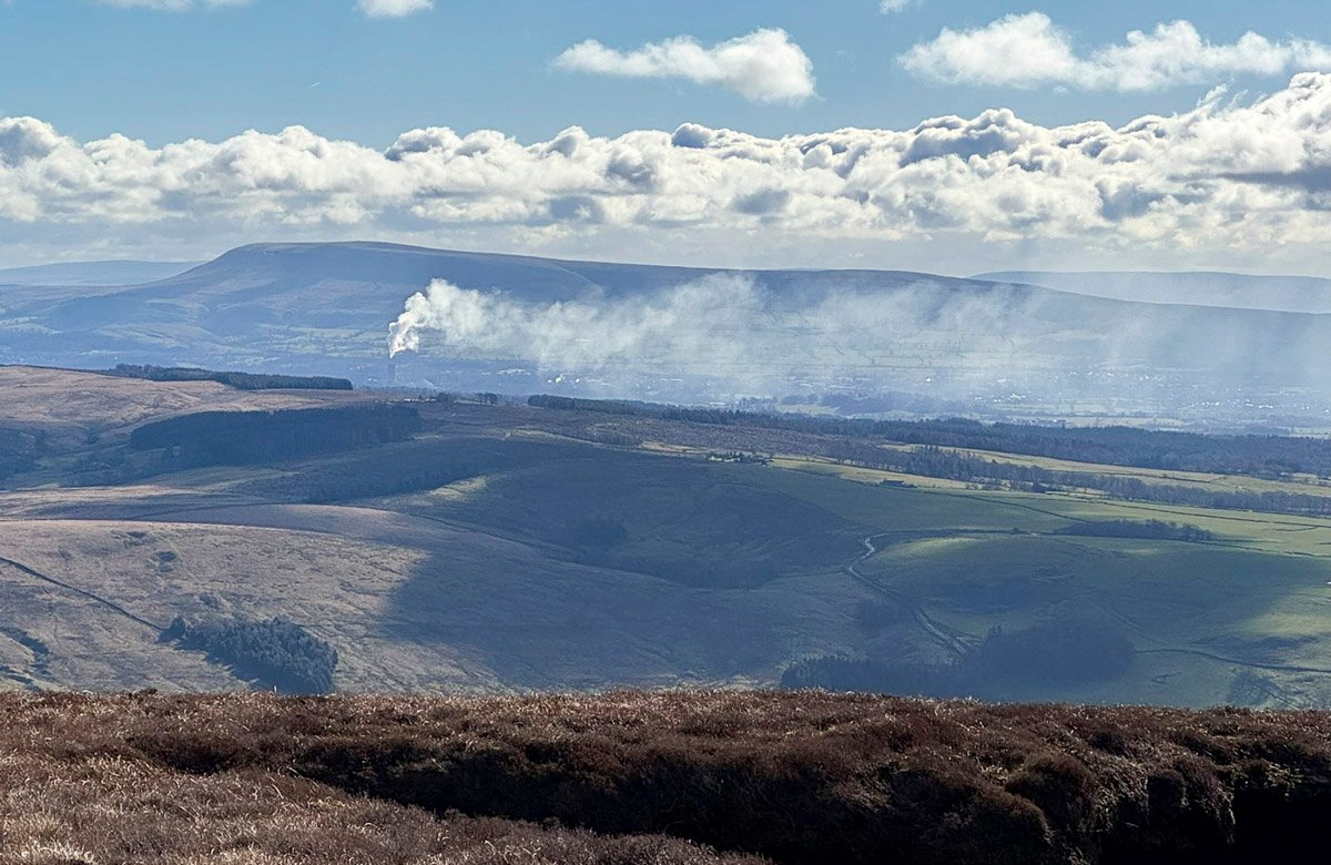
Pendle Hill is an outlier, but not an outcast, exerting a commanding presence far beyond its modest altitude. The hill forms part of the Forest of Bowland National Landscape, yet is entirely separate; a discrete, solitary whaleback distanced from the interconnected upland core of the mother fells.
To the world at large, Pendle Hill is recognised as a place of superstition, inextricably bound to the infamous witch trials, whose surrounding mythology is afforded credence by the brooding landscape. However, such public perception is a mere fragment of the whole, for the essence of Pendle is wide-ranging, combining multiple significant associations, engaging social history, striking geology and a plethora of stimulating ascent routes.
Pendle is a landscape in which human history and the hill itself have become unusually entangled.
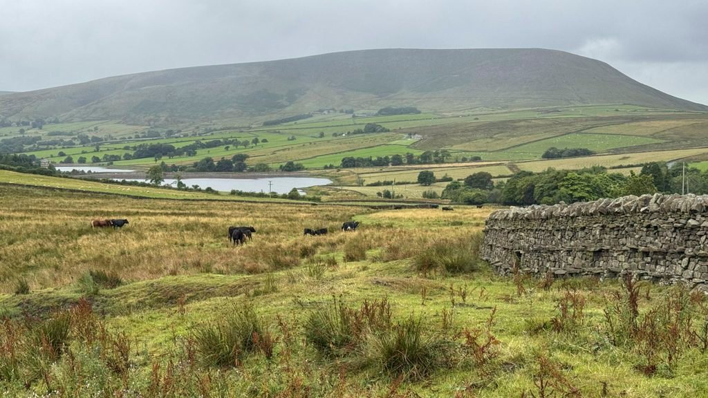
Even the name is complicated. Pendle Hill actually means hill, hill, hill, a tautological excess, not created by an unimaginative absence of adjectives, but developed over the centuries by combining three different linguistic versions of the word hill. The Celtic Pen became Pen-hyll during Anglo-Saxon times, then in modern English that was corrupted to Pendle and hill was added to it, perhaps because everyone had forgotten what the original name meant!
Pendle Hill exhibits considerable visual character; its distinctive profile almost omnipresent throughout the north. Unlike the amorphous mass of the bulk of Bowland, Pendle thrusts its extraordinarily abrupt northern terminus (known as Big End) into the panoramas from many hills and vales. This imposing scarp slope is the result of specific geology and the attrition of glacial erosion. The summit plateau is composed of resistant gritstone, which overlays softer shales, with these layers sitting upon a bedrock of Carboniferous limestone. While Pendle exhibits the same layer cake geological sequence as neighbouring Bowland, it reveals it rather more distinctly.
Pendle Hill endured for millions of years before man arrived to take a foothold on its slopes. And then suddenly in the seventeenth century the hill was propelled into the spotlight by three disparate, landmark events; The Pendle Witch Trials; scientific experiments that spawned Boyle’s Law; and the creation of the Quaker movement. That’s quite a claim to fame for a lowly Lancashire height.
At 1827ft (557m) Pendle Hill doesn’t qualify as a mountain by any of the traditional measures, although as seen rising above the broad Ribble Valley, one might argue that the ferocity of its “Big End” warrants mountain status. High road passes do climb opposing flanks, but fail to diminish the grandeur. Pendle Hill is an impressive exhibit.
The map below can be moved around or zoomed in and out to change the scale:
These roads sprout access paths, although the villages that surround the hill are also popular starting points. And lovely villages they are too, as a local song declares, “Old Pendle – with Barley and Downham content at thy feet”.
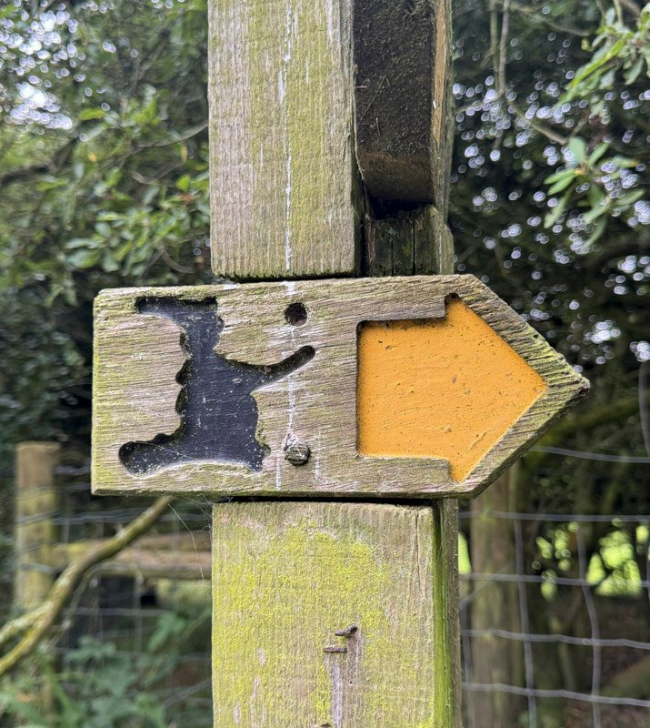
Those departing from Barley will encounter their first sight of a witch, this one riding a broomstick on the pub sign of the Pendle Inn. Of course, Pendle Hill itself was never the courtroom theatre for the witch trials, although it certainly witnessed the activities of those accused of witchcraft as they went about their daily lives, dealing in folk remedies and spells, here on these lower slopes of the Hill.
It was the year 1612 and King James was obsessed by the concept of witches, believing himself to have been a victim of their evil plotting. He was resolved to hunt them down and, in the midst of public hysteria and monumental folly, arose the Pendle Witch Trials. In an arena where everyone protected themselves by blaming others, few of those accused stood any chance of acquittal. All were damned by association.
The ascent from Barley is the busiest of all, especially when swelled by the processions joining from the high road, abandoning their cars along its flanks, which saves some initial walking distance over the lowland fields. It is estimated that three million people live within thirty miles of Pendle Hill and the hill itself attracts around 300,000 visitors each year. Such pressure of footfall was resulting in considerable erosion, however, in recent years some 9km of paths have been improved or created and Pendle is now equipped to cope.
Pendle Hill is a benign mass, although being so popular accidents do occur. Rossendale and Pendle Mountain Rescue Team cover an area of 350sq miles of varied terrain, and their most usual purpose is to assist the ambulance service in remote areas. The team were called out 77 times in 2025, with a dozen of those being to rescue walkers injured or lost on Pendle Hill.
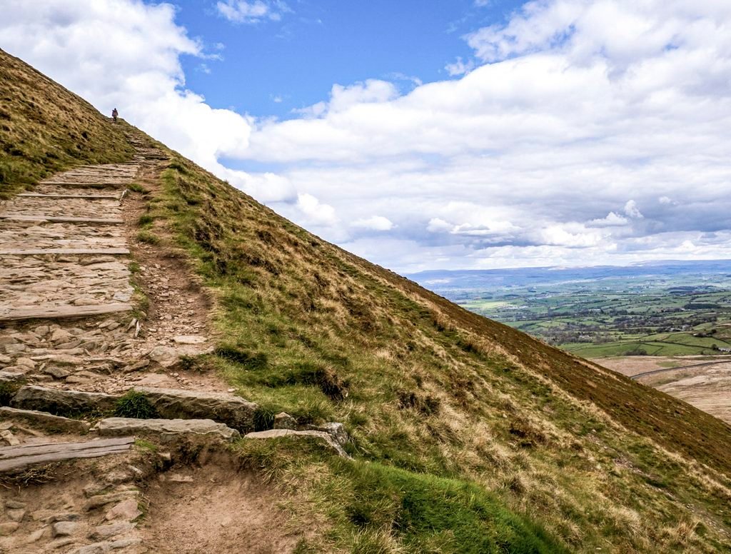
The Barley walk is best executed as a circuit, descending to Ogden Clough. This is the principal watercourse on Pendle and is vigorously incised in its lower reaches, the torrent being harnessed to create two reservoirs above the village of Barley, which serve the local Nelson area.
Downham is a picture postcard village preserved by the landed Assheton estate, who prohibit television aerials and street furniture in order to maintain the serene 16th century aspect of rural England. As with Barley, there are a variety of path choices to enable circular routes. The direct route meets that from Barley at the crest of the Big End, where a new wind shelter and seat has been constructed into the restored drystone wall.
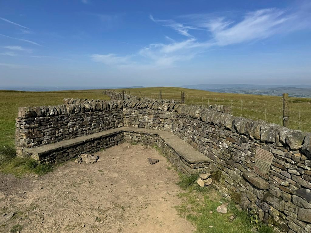
At this shelter a plaque commemorates the summit experience in 1652 of George Fox, moved by the Lord to climb the hill, from whose lofty summit he was shown the places where a “Great People could be gathered”; meaning supporters who would join him in spreading his beliefs, marking this moment as the beginning of the Society of Friends, later known as Quakers.
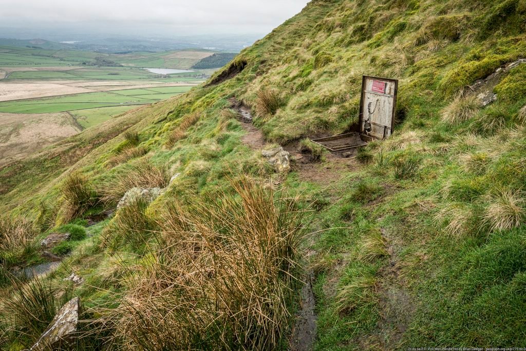
Those who have ascended from Downham may have spotted a curious metal plate shortly before reaching this point. It covers a well, which was where Fox refreshed himself following his spiritual vision, before descending to Downham to stay at the village inn. The story goes that the Landlord was so inspired by Fox’s fervour as to become one of the faith’s first “Great People”.
Quakerism quickly spread and soon travelled across to North America to become a stronghold, and Pendle Hill was adopted as the name of a major Quaker study centre in Pennsylvania. The literature they produce is known as the Pendle Hill Pamphlets.
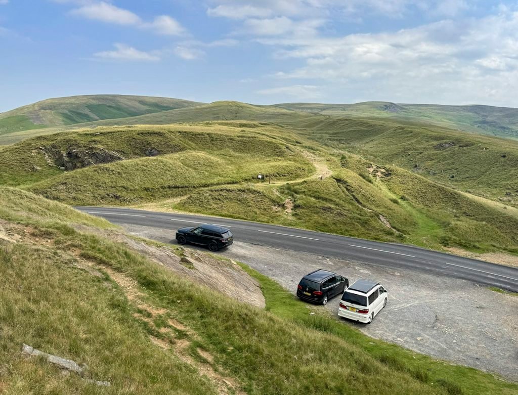
The third main approach to Pendle Hill is from the westerly road pass at the Nick of Pendle, which is a dramatic notch in the ridge at 994ft (303m). From here, without the steep slopes of the Big End and with just 900ft to climb, the ascent is predominantly a moorland ramble, although if taken as a circular excursion, it is widely regarded as the most rewarding route on Pendle.
The Nick was formed by glacial meltwater as it spilled over from one side to the other and vividly demonstrates just how deep the valley glaciers were. As you depart the rough laybys that serve as car parks, down to the left will be seen the Pendle Ski Club, a plastic matting dry ski slope, run by volunteers and proud to have been the early training centre for the Alpine Skier Dave Ryder, who represented Great Britain in three Olympic Games.
The easy going introduces a flavour of the moorland expanse in prospect, with the deep ravine of Ashenden Clough in view, again to the left. A short rise brings us to the intriguingly named Apronful Hill, which derives from a scattered Bronze Age cairn close by the path – the Devil’s Apronful – which is something of a recurring event in northern folklore, as there are three others in neighbouring Yorkshire, where the Devil seemingly dumped the contents of his stone-filled apron intended for various malevolent reasons.
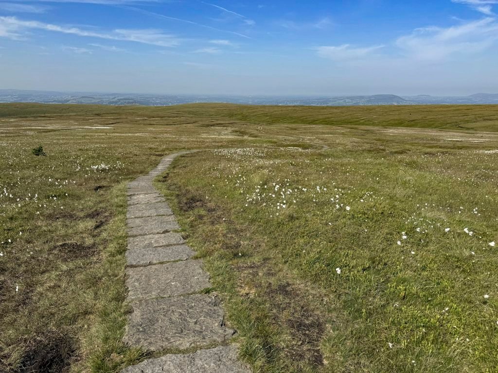
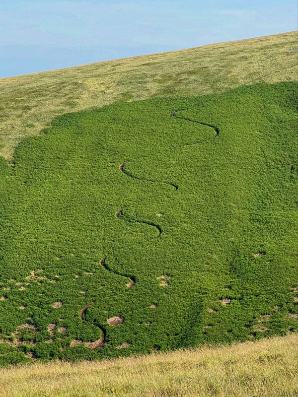
The moorland intensity mounts as the upper reaches of Ogden Clough are attained and then followed. Where the stream fades to a trickle, it is crossed, and a new flagstone path strikes across the moor to the summit. This new path is designed to protect the delicate peatland landscape, which itself has seen much recent restoration and regeneration. All this and more was the result of the Pendle Hill Landscape Project, begun in 2018 and funded by the National Lottery, as a four-year endeavour involving fifteen broad-ranging objectives from tourism infrastructure, archaeology and social history, to the repair of drystone walls and hedgerows.
The summit itself was a focus for an art installation that may easily be missed, as few people on the top of a mountain gaze at their feet. Surrounding the triangulation pillar on its circular paved patio are twelve stone sculptures embedded into the earth.
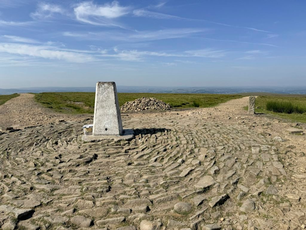
If you are blessed with a clear day the views are spectacular. To the south is the heartland of Lancashire’s former domination of the cotton mill industry, although the towns and villages are afforded some scenic attraction through the hills that rise above these communities.
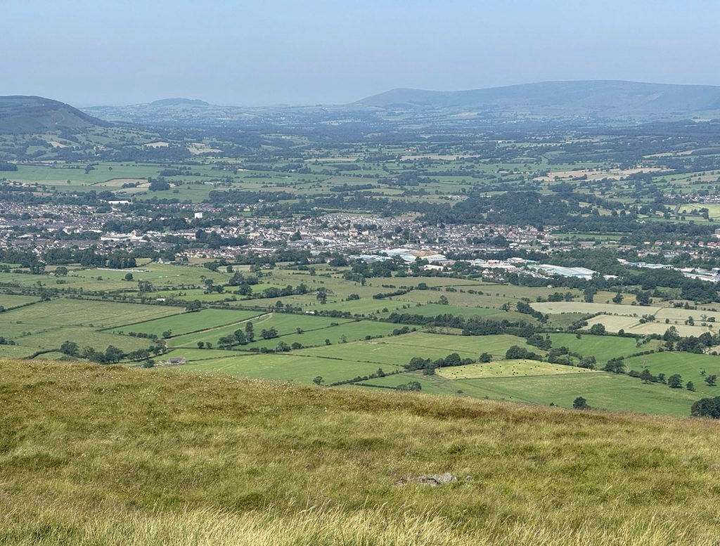
The townies may cast their eyes west to spot Blackpool Tower, although the ardent hillwalker will examine the main mass of the Bowland Fells, which cluster to the northwest across the Ribble Valley, whose otherwise sylvan beauty is interrupted by the surprisingly industrial outskirts of Clitheroe. Attention will then turn to the Yorkshire Dales, where the mountains of Ingleborough and Penyghent display remarkably similar profiles to each other and indeed to Pendle Hill. The underlying geology of all three is fundamentally the same.
And, while you are on the summit, perhaps deserted and bitter on a winter’s day – or balmy and heaving with humanity on a summer weekend – consider this location’s crucial role as the third major revelation in Pendle’s seventeenth century importance. In contrast to the absurdities of witch trials, this was an age of major advancements in science, a study at that time referred to rather more elegantly as natural philosophy.
The glaringly conspicuous Pendle Hill provided an outdoor laboratory for experiments by astronomer and mathematician Richard Towneley, whose family estate was Towneley Hall in nearby Burnley. In the company of his family physician Dr Henry Power, they ascended the hill to develop existing theories on atmospheric pressure, using a mercury barometer, itself a relatively recently invented instrument. They discovered a precise inverse proportion between air pressure and volume. The renowned scientist Richard Boyle learned of these experiments, carried out his own investigations and published them, to be credited with Boyle’s Law, although to Boyle’s own credit he referred to it as “Mr Towneley’s Hypothesis”.
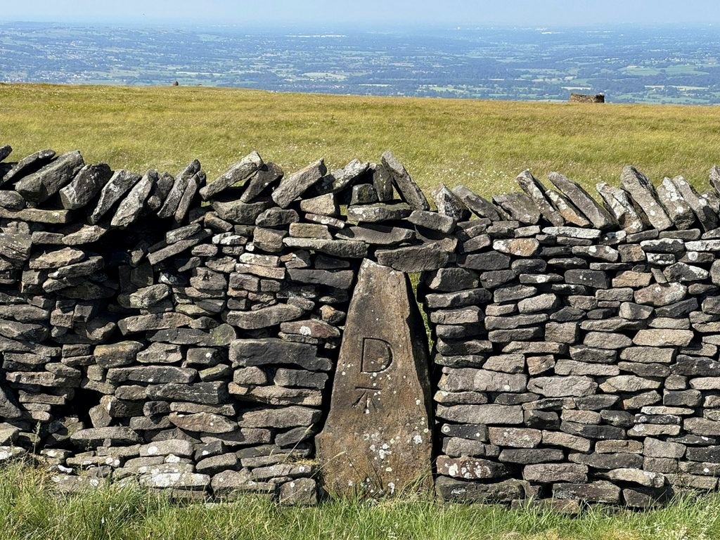
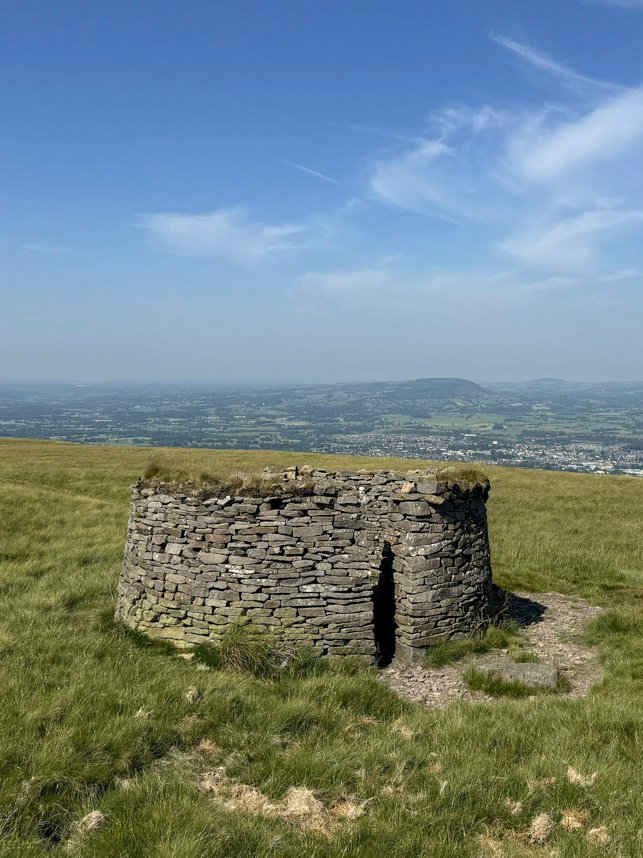
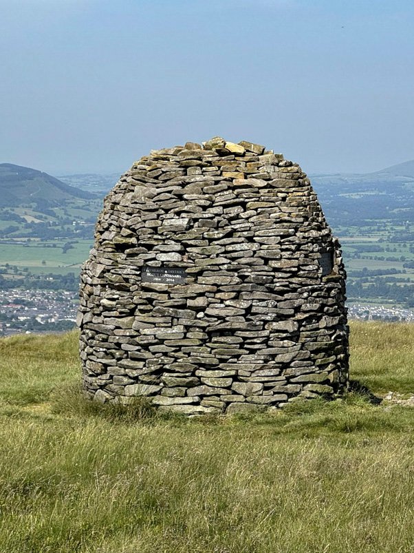
To further immerse oneself in the moorland landscape, a fine descent can be contrived by circumnavigating the summit plateau, above Downham Moor. This route encounters three interesting stone curiosities; an Ordnance Survey Benchmark within a drystone wall; an isolated weather shelter and a shapely beehive cairn dedicated to the Scouting movement.
Wherever you wander on Pendle Hill there is a sense of being amidst a quarantined upland, insulated from the surroundings like a giant glass snow globe. This has forged a deep connection to the local communities for whom Pendle is an immutable presence. It is rare to discover a landscape with such a rich diversity of cultural consequence, historical influence and visual impact.
As George Fox remarked, “Pendle is a very great hill”. I think you will agree.