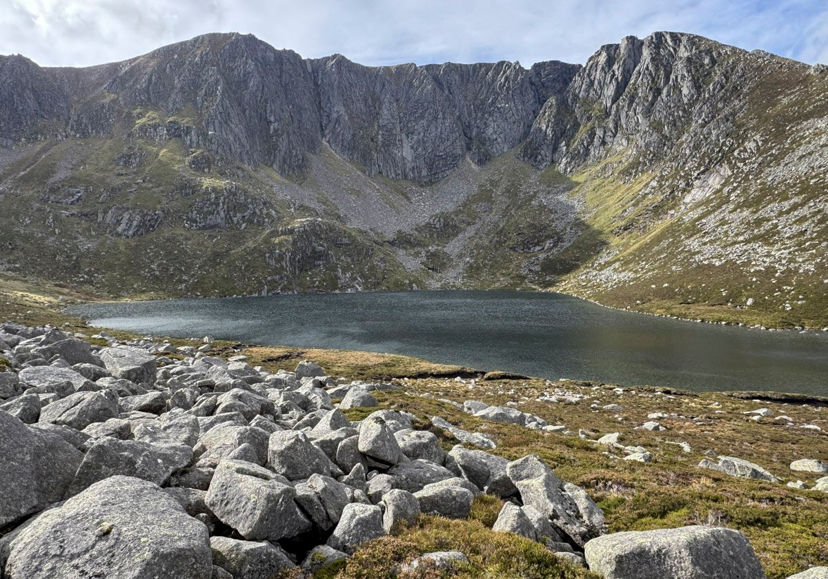
Lochnagar is not only a noble mountain; it is nobility itself, an aristocratic eminence that defines the highland landscape of Deeside.
Nearly fifty years before the mountain became a sporting playground of the Royal Family, Lochnagar had already captured the boyhood soul of Lord Byron, who as a club-footed fifteen-year-old in 1803 determinedly arrived at Invercauld in search of a guide to lead him up the mountain. A few years later, whilst still a teenager, he composed the famous verse that concludes…
England ! thy beauties are tame and domestic
To one who has roved on the mountains afar:
Oh for the crags that are wild and majestic !
The steep frowning glories of dark Loch na Garr !
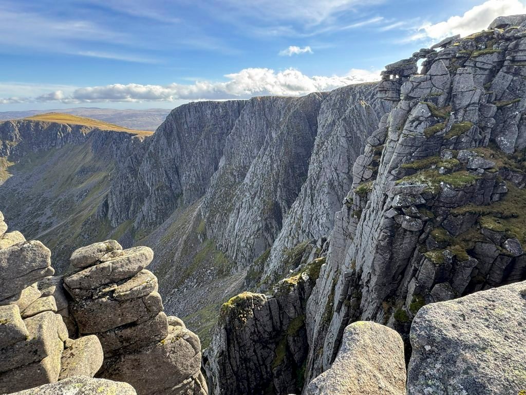
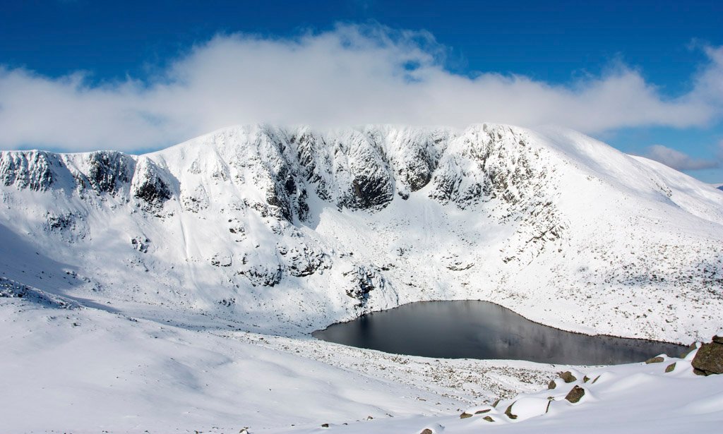
Lochnagar is both romantic and forbidding, the frowning glories expressing the deep, brooding north-east corrie backed by a mile-long headwall that is renowned as one of Scotland’s finest winter climbing arenas.
The first fully documented ascent came in 1810 and was effectively a scientific expedition to measure the mountain’s height. This was undertaken by Rev. George Keith, wielding a barometer, whose estimation of 3800ft was commendably close to the reality of 3792ft (1156m). His party ascended from Glen Muick by way of the Ladder, which is the most frequented route in modern times.
Nevertheless, as the highest of five Munros that populate the extensive White Mounth plateau, together with four well-established starting points, Lochnagar is a complex mountain with eleven tops above 3000ft, something that presents far more than its customary public face.
In addition, Lochnagar is an etymological jungle. The name originally referred solely to the loch occupying the north-east corrie and the mountain bore the Gaelic name of Beinn nan Cìochan, meaning Mountain of the Paps. The subsidiary tops of Meikle Pap and Little Pap still bear that title, although they are too insignificant to be credited with the naming of the whole massif, especially when the twin high points are distinctive pimples recognisable from afar – Carn Cac Beag (the true summit) and Carn Cac Mor.
These names raise a snigger as Cac is popularly claimed to mean faeces, although learned circles dispute the OS map’s two summit dung piles as linguistically incorrect Gaelic and the highest point is more correctly Ca Carn, which curiously has no meaning at all! Most relevant, however, is that Lord Byron was calling the mountain Loch na Garr at the beginning of the 1800s, so mountain and loch have been as one for well over two hundred years at least.
The map below can be moved around or zoomed in and out to change the scale
Glen Muick
There are two main routes of ascent from the road end at Spittal of Glenmuick and their combination provides the classic circuit of Lochnagar. Anticlockwise is usually preferred to gain the best views of the crags while the morning sun illuminates them. A starting altitude of 1300ft (400m) along with good paths ensures Britain’s 20th highest mountain is a straightforward walk in favourable weather.
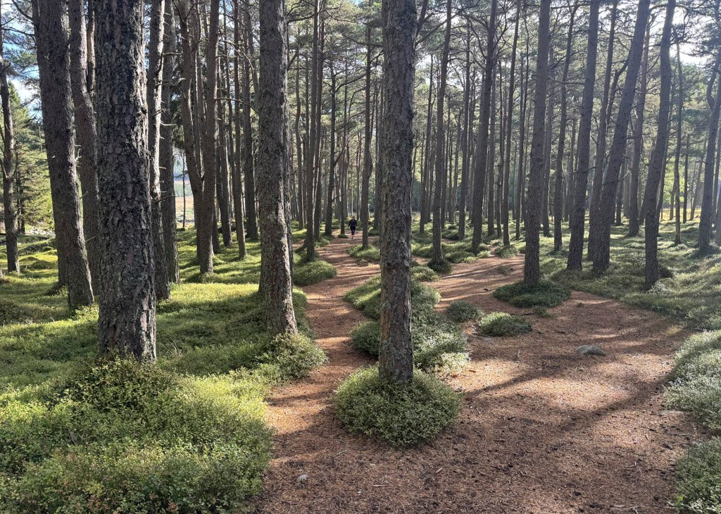
The shortest route is called the Queen’s Path, as it was constructed in 1849 at the request of Queen Victoria to lead directly from Altnaguibhsaich Lodge, which the royals used as a retreat, sheltered by the pine trees that lend their name to the burn of the fir trees, which flows down to it. Victoria loved the “rustic simplicity” of staying there.
The initial climb is not unduly taxing, although not especially exciting either until the Meikle Pap col is reached. Here the ascent comes alive, revealing the impressive views into the major corrie, although to maximise the scene, a little extra effort is required by diverting to attain the summit of Meikle Pap.
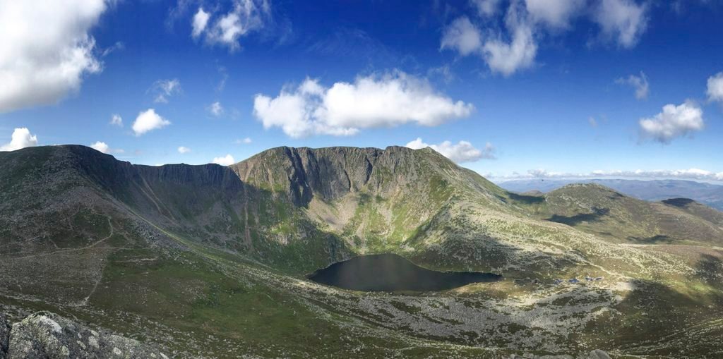
The only steep part of this ascent follows, in the form of the Ladder, again so-named for over two hundred years. Here the path makes use of level boulders to negotiate the sharp rise to the summit plateau of Cuidhe Crom, whose name means crooked snow wreath from a particular snow patch that forms during the spring snow melt.
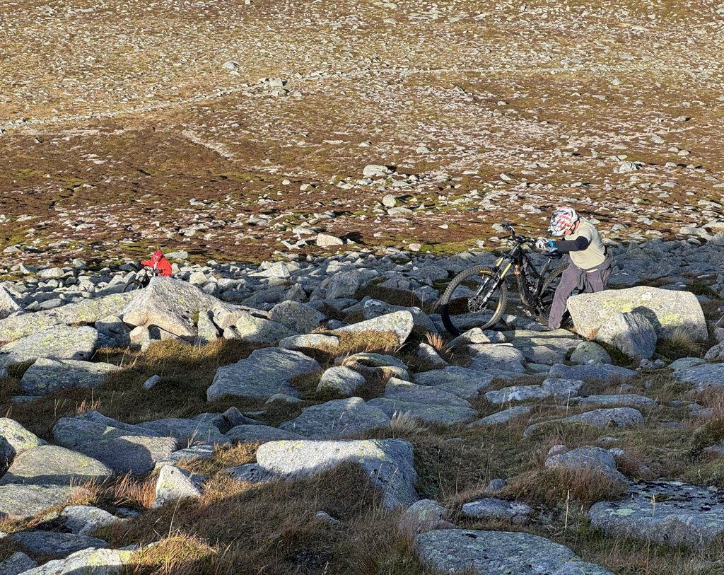
The main path does not adhere closely to the rim of the corrie, but marches across the open plateau accompanied by a plethora of cairns. However, the heart of Lochnagar lies in these mighty crags and the heart of the mountaineer will be drawn to a cliff edge circumnavigation of this monumental spectacle.
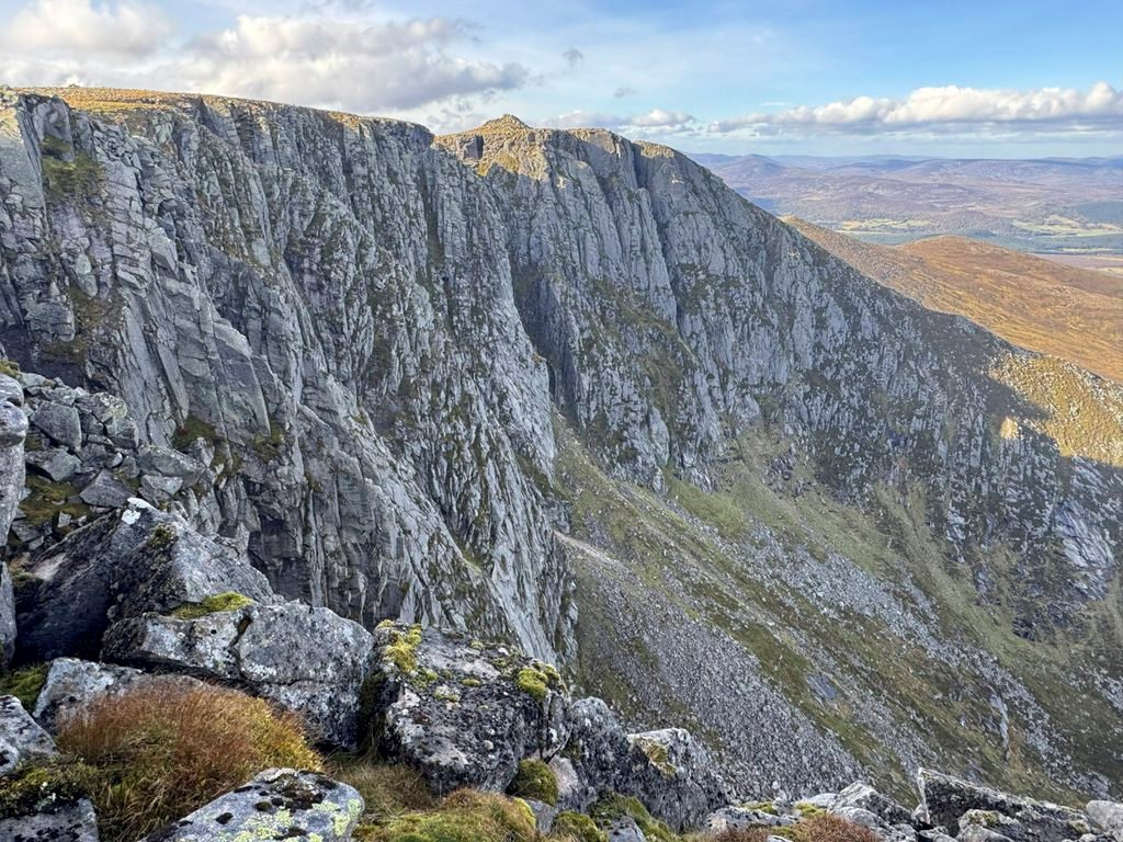
The alternative ascent from Glen Muick, usually reserved for descent, is that which follows the shore of Loch Muick to Glas-allt-Shiel and thence climbing alongside the stream to its headwaters close to the summit.
Loch Muick lies in a textbook glacial trough, the loch diving to a dramatic 256ft (78m) deep, which contrasts with a delightful shoreline of birch woods. These are replaced by a dense shelterbelt of pines at Glas-allt-Shiel, a substantial granite lodge enlarged for Queen Victoria several years after Prince Albert’s death, as she could no longer bear to stay overnight at Altnaguibhsaich Lodge. The former storehouse at the back is a mountain bothy.
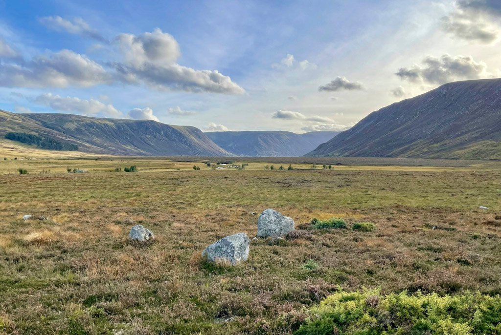
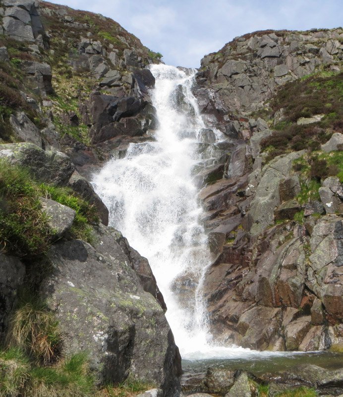
The path above is the shiel is well-engineered and leads past the 160ft (50m) tumultuous cascade of the Glas Allt Falls. Higher up the stream diverges, the southerly tributary also having a royal connection as it was named Coire an Daimh Mhoile by Prince Albert, ever the energetic hunter, the translation meaning corrie of the hummel stags, being the place where he shot two stags without horns.
Lochnagar from the north and west
There are two routes of ascent from the north, one from Balmoral and the other from Invercauld Bridge, the latter route being followed by Lord Byron on his early climb, and then by Queen Victoria on her first ascent of the mountain in 1848. This is a long walk at a gentle angle, initially making use of estate tracks before ascending to Carn an t-Sagairt Beag and the summit plateau. As you make this climb think of Queen Victoria’s first ascent, partly on horseback of course, with an excitable Prince Albert repeatedly charging off to stalk deer and shoot at ptarmigan. However, the summit experience was one of thick mist, although the Queen was quickly determined to repeat the ascent in clearer weather, which she achieved on more than one occasion in her subsequent stays at Balmoral. There were also many failures where the royal party retreated due to unfavourable conditions.
A more exciting variation to the Invercauld path is to head up to Sandy Loch, into the fine corrie of Loch nan Eun and ascend via the easy scramble directly up the ridge to The Stuic. As a bonus, whilst at the loch shore, riches potentially await as this was, two hundred years ago, a renowned location for finding the ornamental quartz Cairngorm Stone.
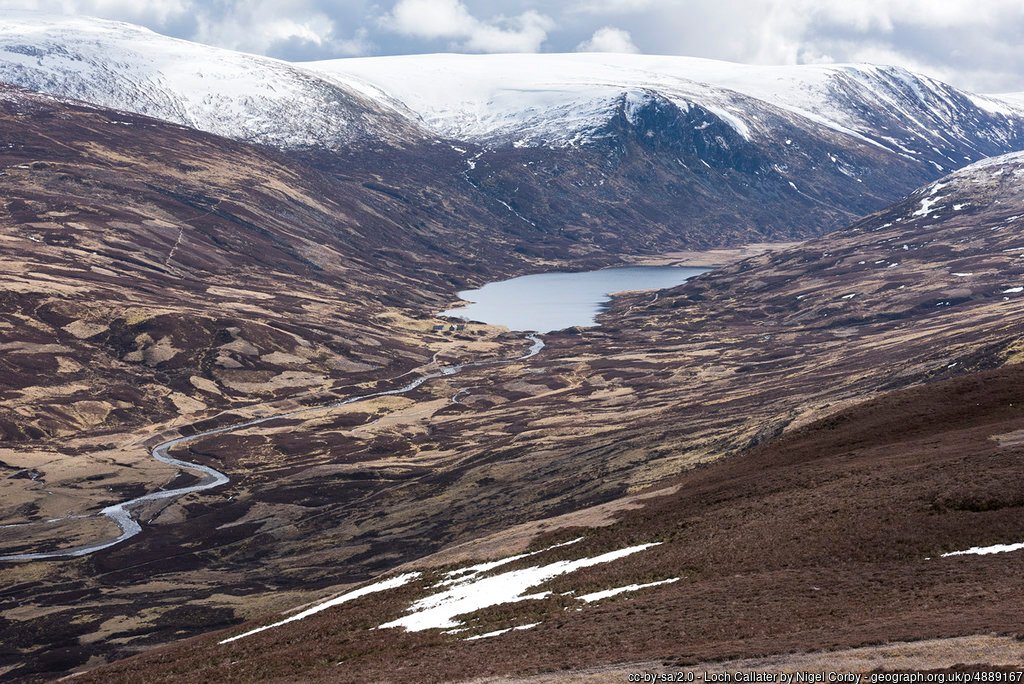
The top of The Stuic is also visited by the longest approach, which comes in from Loch Callater to the west. Again, estate tracks provide a rapid entry into the hills before passing the bothy at the foot of the loch. It then climbs relatively leisurely into the hills to meet the path from Invercauld at Carn an t-Sagairt Beag.
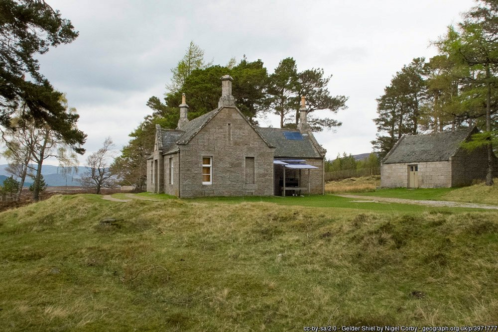
There is certainly a sense of occasion with the Balmoral approach, leading from the entry gates of the castle grounds and through woodland which exhibits a profusion of commemorative royal cairns. The walker emerges into Glen Gelder, estate tracks speeding the passage to Gelder Shiel. The building was commissioned in 1865 by Queen Victoria to be a place of rest and refreshment on her outings. The former stable at the rear is now a mountain bothy, originally very basic but much improved in recent years.
The main crags of Lochnagar are in view for much of the long approach and when the track ends most walkers skirt Craig Liath to the Munro of Meall Coire na Saobhaidhe. However, there is the option to head directly to the Lochnagar corrie, an impressive place that sees few visitors apart from climbers.
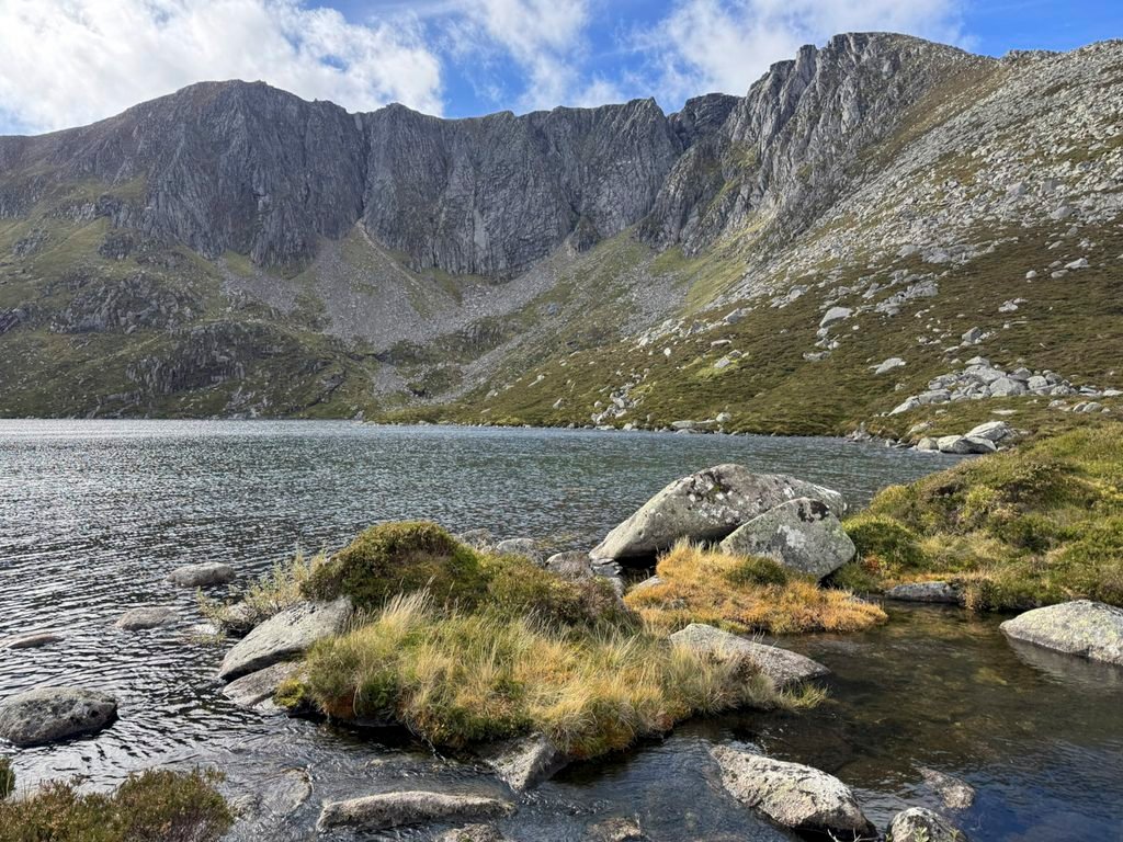
Lochnagar – The Loch
The loch is most speedily accessed by dropping down into the corrie from the Meikle Pap col, although few do. There is a minor path of sorts that heads from the col to the Mountain Rescue box beneath the crags, although for those interested in the West Ridge, dropping down to the outflow of the loch looks fairly straightforward but most certainly isn’t. This is a pathless expanse strewn with huge boulders and deep heather, concealing ankle-twisting cavities and it yields only to the determined walker that is accustomed to off-piste boulder hopping and heather bashing. By contrast, the outflow is easily crossable, which brings some comfort after the ordeal of reaching it.
Byron was naturally the first to praise the loch, describing it as “one of the most sublime and picturesque among the ‘Caledonian Alps’ ”. Later, according to the Royal Collection, the enthusiastic Prince Albert compared the corrie to the crater of Vesuvius. Alex McConnochie in his 1891 work, Lochnagar, recorded “The aspect of the precipice viewed from the base of its talus near the lake is singular and most imposing, the rock being fissured by perpendicular chasms, and having a vast accumulation of enormous blocks near the base…. there, sheltered from the sun, the snow lingers long into the summer, and frost finds its congenial home”. It is indeed a stirring place to be.
In more recent times, many children have read these opening lines to Prince Charles’ book “Not all that long ago, when children were smaller and people had especially hairy knees, there lived an Old Man of Lochnagar. He had made his house in a cave by the Loch of Lochnagar and it was a surprisingly comfortable cave”. Perhaps the Prince knew, as did the climbers, of the howff that can sleep two beneath one of the enormous boulders. If you wish to find it, the howff is not under the crags but above the small lochans by the outflow at grid ref. NO 252854.
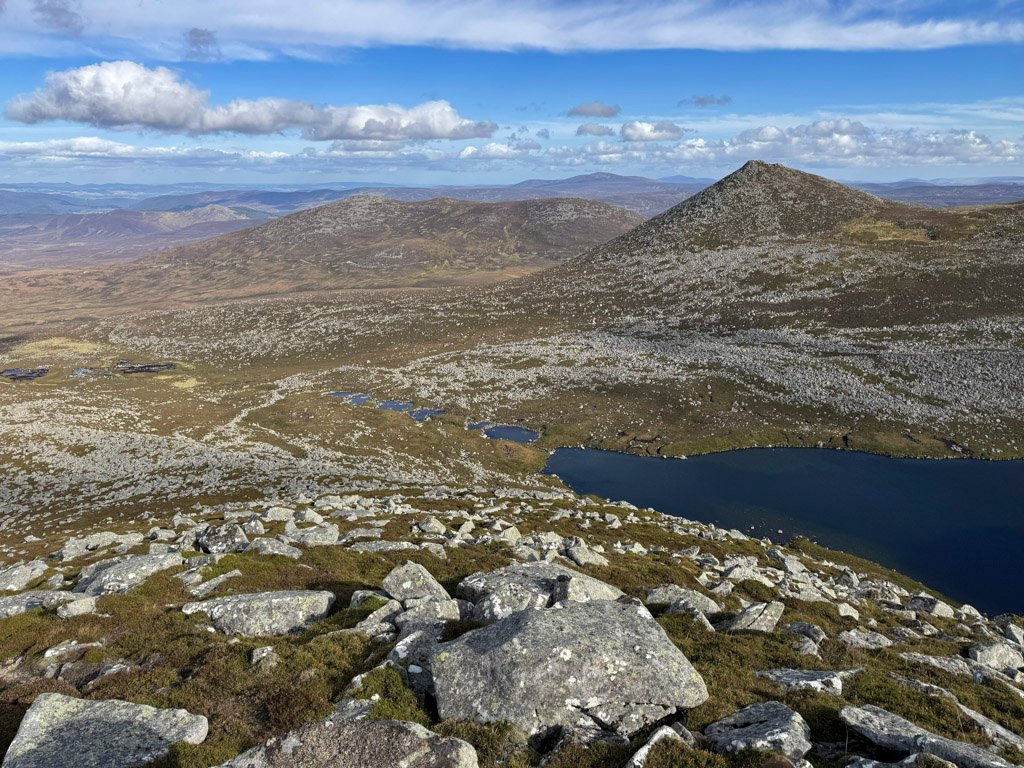
The loch itself became a key site in research projects and monitoring networks, and became one of the most studied freshwater bodies in Europe, having undergone 25 years of multi-disciplinary scientific study. The loch is fed not by streams but by runoff, mostly from melting winter snow. In 1851, early in the period of royal ownership, the loch was heavily stocked with trout, at one time the water surface reportedly boiling with the frenzy of their activity. Trout exist in the loch to this day, although the numbers have been drastically reduced due to atmospheric pollution and acidification of the waters.
Walkers can attain the summit from the corrie by way of the West Ridge whose ascent is mostly pathless, which is odd for such an obvious line. It commences as rough terrain but becomes more grassy towards the top. Alternatively, two rather less comfortable scree gullies beckon for those that desire to get amongst the crags. Red Spout is the wide eastern gully and Black Spout, the narrower, deeper western gully.
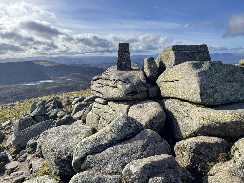
The Summit
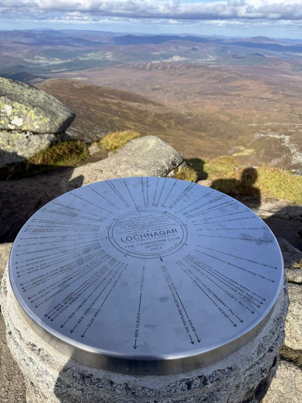
The highest point of the mountain is not directly above the crags, but set slightly to the west and formed of a small tor surmounted by an OS trig pillar (1956) and a view indicator (1924). The indicator has a fascinating story. It was the first of many designed by James A. Parker and erected by the Cairngorm Club. Originally Ben Macdui was scheduled for the inaugural indicator but Parker happened to be on Lochnagar on an especially clear day and it sort of jumped the queue.
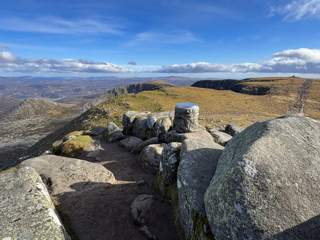
These indicators were designed for longevity, being composed of a heavily glazed, 4-inch-deep slab of Doulton Stoneware1. This one lasted for a century; a stainless-steel replacement was not installed until 2024, when it was mounted on top of the original to avoid the risk of damage during removal. The indicator shows distances and directions to the main hills visible at the summit in clear weather, the most remote of these being the Cheviot Hills in England 108 miles (174 km) to the south.
Immediately on hand is the vast White Mounth, a high plateau wilderness, distanced from the principal Cairngorm range, yet inherently of the same family. Lochnagar commands its own separate kingdom from its cousins across the Dee, although in every aspect it is their equal.
Footnote:
1.The King’s permission was sought and granted for the erection of the indicator and the unveiling ceremony was attended by 140 people. The Cairngorm Club report at the time stated “The top course of the pedestal consists of three dressed white granite blocks, each weighing 84 lbs., and bound together by iron cramps. These, along with sand and cement, had to be taken up (on horseback from Loch Callater) as well as a bag of mason’s tools, buckets for carrying water, a shovel, a handbarrow, and sacks, and a tarpaulin to be spread over the completed work in order to protect it from night frosts while the cement was setting. Finally, there was the precious indicator slab itself, weighing 40 lbs., which, it was arranged, should be carried up by a party of young volunteers from the Glasallt Shiel.”
Worthy Rating: 77
Aesthetic – 24
Complexity – 14
Views – 16
Route Satisfaction – 14
Special Qualities – 9