The Northwest Fells are arguably the most complex and integrated concentration of wonderfulness in the Lake District, a cluster of summits that combine to create a fellwalkers’ utopia, making the task of singling out Worthies particularly onerous. The natural divide of Whinlatter Pass does concentrate the quality to the south, and many would declare those fells north of Whinlatter to be comparatively dull and boggy anyway, although I must single out Sale Fell, with its bowling green turf, as being amongst my favourite smaller hills in Lakeland.
Likewise, Newlands Pass splits the area admirably and, of the two halves, the Newlands Fells throw out superb ridges to the north, though are comparatively bland otherwise, leaving the Grasmoor group to tip the scale for overall engagement. As several of the summits are customarily linked together on walks, to further split these (most notably at Coledale Hause) would foul up many walkers’ route plans.
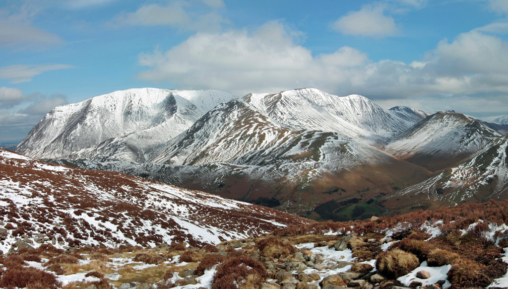
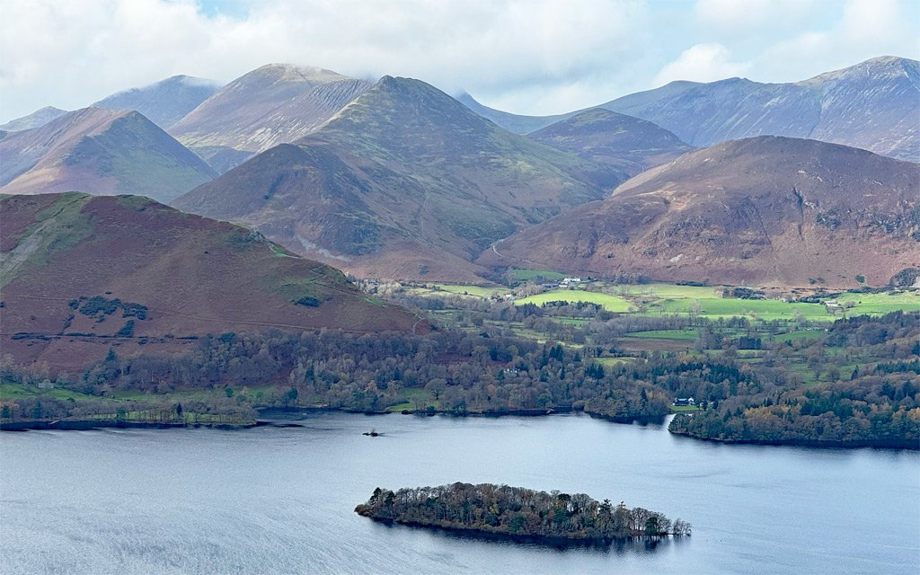
Photo: CC License https://www.flickr.com/photos/mountainwanderer/5009104615/
Grasmoor
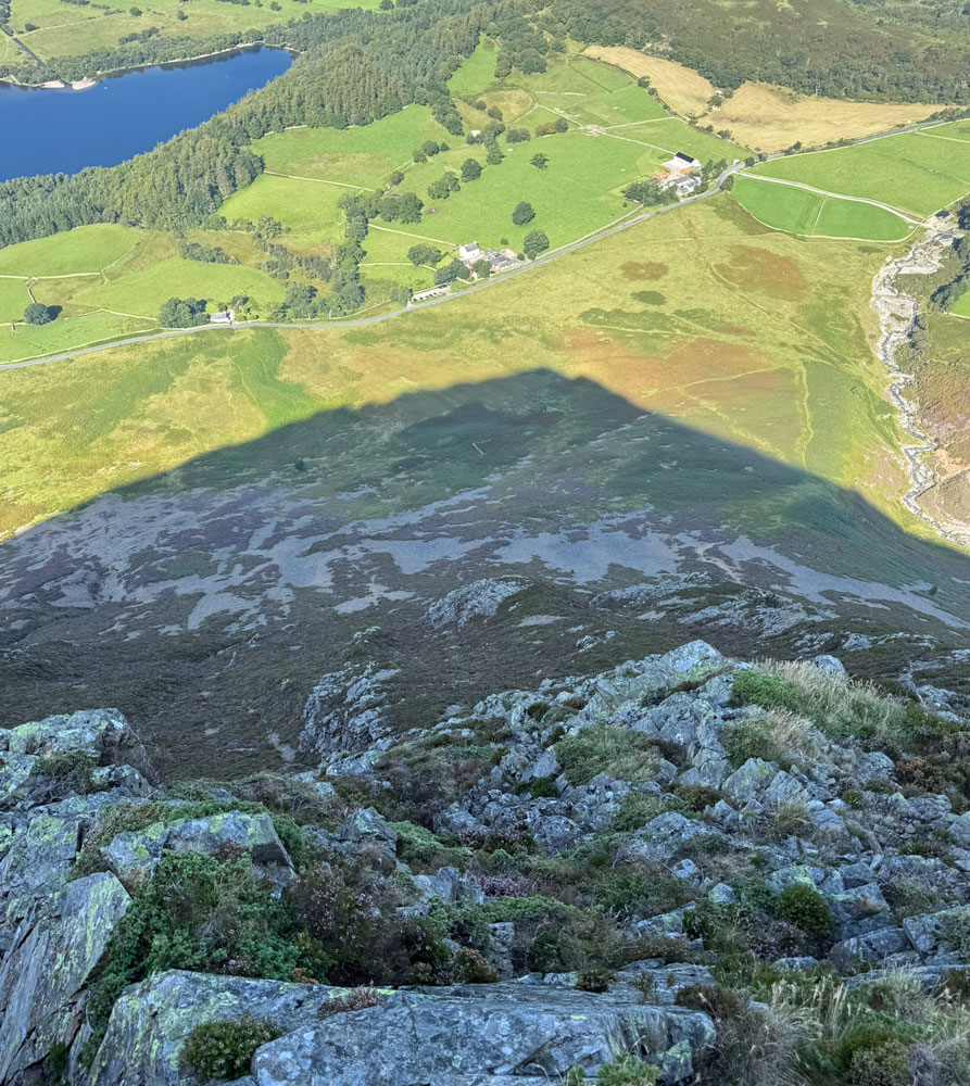
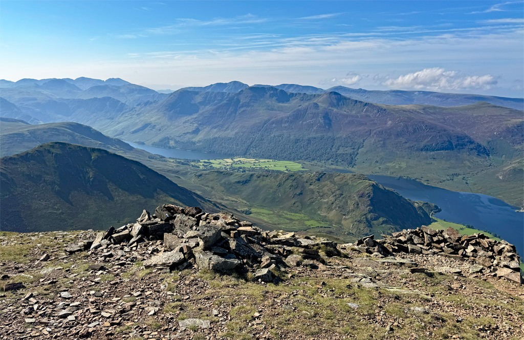
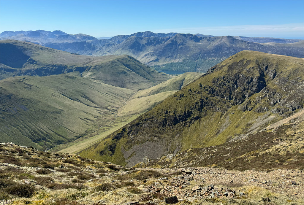
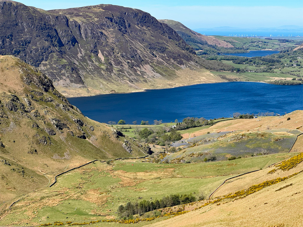
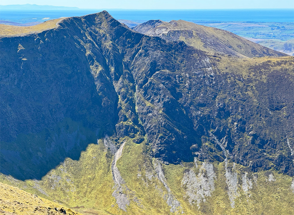
As the highest mountain at 2794ft (852m), Grasmoor is nevertheless slightly aloof from the main pack. From the east, it appears as no more than a lumbering, grassy mound peering over the crest of the impressive façade of Crag Hill (Eel Crag). However, approach from the north and west along the Buttermere road and what confronts the motorist is perhaps the most magisterial vision in Lakeland; the looming bulk of Grasmoor End, aptly likened by Harry Griffin to the North Wall of the Eiger, albeit a a pint-sized version.
The map below can be moved, or zoomed in and out to change the scale
Grasmoor will often be tagged on to a round of the Coledale Horseshoe, simply because it is the highest summit and what a pity that is, for the best of the mountain is overlooked. The only redeeming feature of a visit from the east is to ensure the walker follows the northern rim between Coledale Hause and the summit, to enjoy the spectacular views of Dove Crags, and across to Gasgale Crags. Otherwise, while the summit plateau is unusual, being imbued with a wide-open sense of freedom, the crossing over Wandope Moss to Crag Hill is far less thrilling.
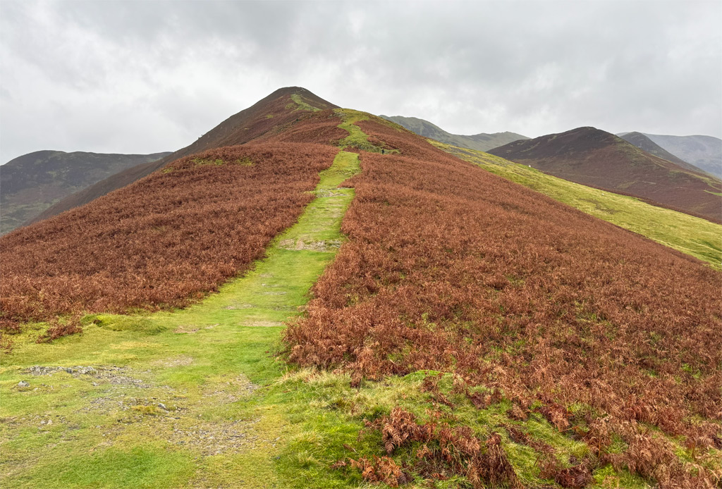
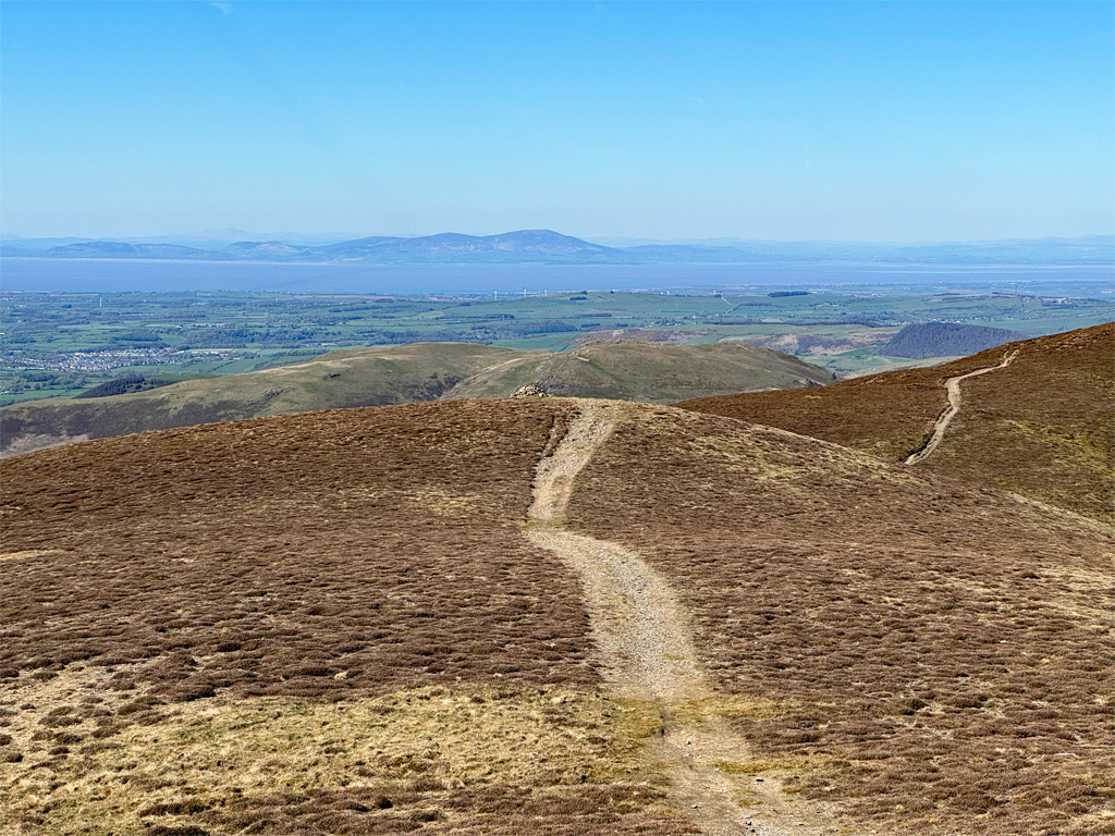
Make your ascent from Lanthwaite Green and you will experience an entirely different mountain. There are five routes to choose from, those most commonly walked being via Lad Hows and Gasgale Gill. Lad Hows takes a fine line, although currently suffers from some path erosion in its upper reaches. The deep, vigorous Gasgale Gill is a wild and intimate route to Coledale Hause, reached by crossing the sturdy bridge over Liza Beck, then heading upstream, with one or two minor hands-on moments.
The other bank of Gasgale Gill can be followed half way, before launching up the hillside to reach the Dove Crag arete. Described by Wainwright as an unorthodox route, and remaining mostly pathless to this day, it provides an exhilarating and mostly grassy scramble beside the compelling hollow beneath Dove Crags. A tarn would be expected in such a high-level corrie, yet none exists, nor in fact are there any tarns within the Grasmoor Fells. Regarding the ascent, there is just one rock slab to negotiate, although if it’s damp and you slip off the first step, the slab can be avoided to the right.
Adjacent to Lad Hows is a now rarely used ascent via Red Gill, which is uncompromising and unpleasant. In the past it was normally used as a descent, the prodigious scree run providing rapid progress, although the best of this has now long gone.
Finally, there is an elephant in the room – the obvious, manifestly ambitious route, that we might call the ‘Eiger Direct’ of Grasmoor, which ascends the imposing face head on from Lanthwaite Green. Wainwright ruminated over this climb for some time and, when he eventually plucked up the courage, saw no evidence of any previous passage. He called it the northwest arete. An unpromising start involves a scree slope, although this now bears a path that climbs obliquely rather than directly. Above, broken rocks are attained and negotiated by a slim path that removes all trepidation from route finding. The position is exciting, although never fearsome. It’s a really enjoyable, steep ascent and leads to a breezy eyrie from which to survey the paper tiger that has been overcome. Nonetheless, real dangers are abundant on this face and there are scrambler’s routes up the crag, although no substantial rock climbs; the Skiddaw Slates being too friable for reliable footing.
Eel Crag/ Crag Hill
Crag Hill is the generally accepted name these days and it has always featured on OS maps (although Wandope was printed as Wanlope until 1974). However, generations of walkers previously referred to the mountain as Eel Crag, deriving from the cliffs that face Coledale Hause, and this was applied to the whole. I am one of those of have failed to adapt.
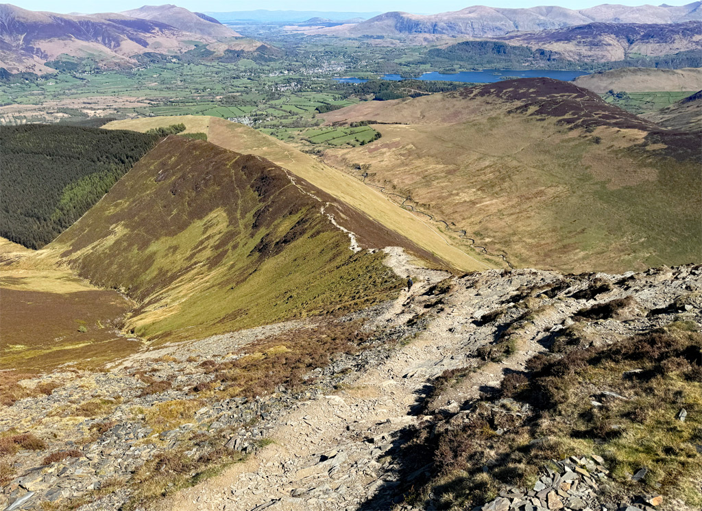
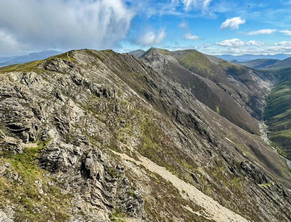
In many ways it is Eel Crag rather than Grasmoor that is the focus of the group, being the summit from which the major ridges radiate. To the south the customary ascent from Buttermere arrives by way of Whiteless Pike and Wandope. From the west the excellent ridge, crossing Causey Pike, Scar Crags and Sail forms an equally natural route. Eel Crag itself is really just the apex of these ridges, rather than being an individual mountain.
The usual route from Coledale Hause is nothing special, although it is far better than it used to be before major path work was undertaken in 2005. Previously the path had become a deep gully, through attracting most of the water run off, and the material collected was being washed down into Crummock Water, adversely affecting the ecology. Nevertheless, a better alternative to this path is to ascend directly up the edge of the actual crag of Eel Crag. Despite appearances, there is no major rock work involved with this climb.
For a get-away-from-it-all ascent of Eel Crag, start from Buttermere and walk by way of Sail Beck, which is particularly gorgeous in autumn hues. This deep valley is dominated by the steep slopes plummeting from the Wandope ridge, and was formerly employed as a through route from Rigg Beck to Buttermere, crossing Sail Pass. Sail Pass itself is surprisingly lofty, at 2025ft; that’s not far off the height of Causey Pike.
Alternatively, an especially secluded climb can be made from Sail Beck to Wandope, ascending by way of Addacomb Beck, the highest of three pronounced re-entrant valleys feeding Sail Beck. The highlight of this is coming into close quarters with Addacomb Hole, another glacial cirque, again with no tarn, although it did originally boast one. The tarn eventually breached the moraine dam that enclosed it and subsequently drained away. Even if you do not ascend this way, make sure to stick close to the edge around the summit vicinities of Wandope to peer into this fascinating hollow. It is interesting to note that the crags below the summit of Eel Crag, overlooking Addacomb Hole, are called Scar Crags, as are the crags on nearby Scar Crags (not surprisingly). The former is likely to be so named because the ridge running from Sail to Eel Crag is also known as The Scar. Not confusing in the slightest!
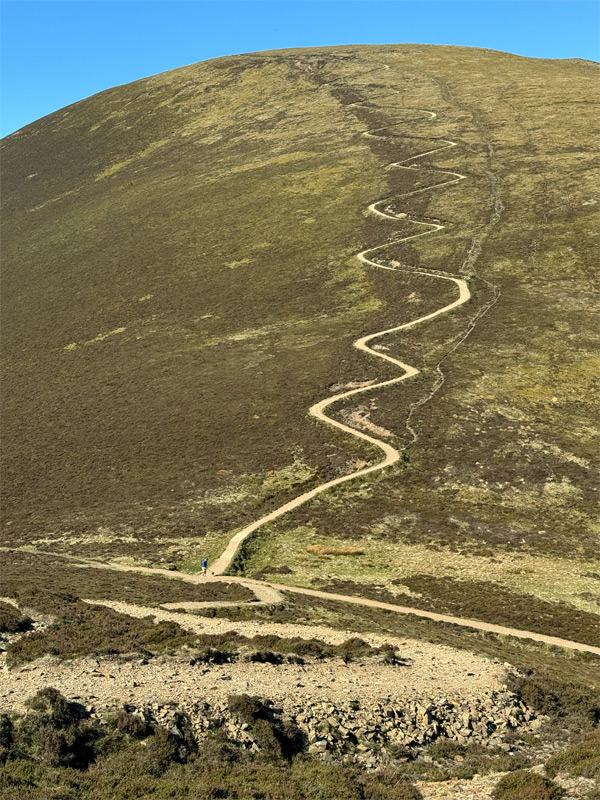
The Sail Path
This path climbs either side of Sail Pass and is undoubtedly the most discussed in Lakeland, following its construction in 2010. Some regard it as any eyesore and others regularly post “Have you climbed the best path in the Lake District?” on social media. In truth, this path was a dreadful mess, the hillside becoming increasing eroded by an ever-widening path. Natural England were especially concerned, as these fells are part of the Buttermere Site of Special Scientific Interest and the Lake District High Fells Special Area of Conservation, and such scars are not in keeping with protecting the landscape.
Fix the Fells is the National Trust led body that works with other organisations to maintain the paths in the Lake District. They considered the possibilities for repair and were presented with numerous difficulties. For such a steep gradient, a pitched path would usually be constructed, however no suitable local stone (to ensure blending in) was available. The alternative of an aggregate path requires that the angle remains under fifteen degrees to maintain stability, and therefore zig-zags were necessary. In the event, dainty serpentine curves were employed and it is perhaps these that render the modern path so distinctive.
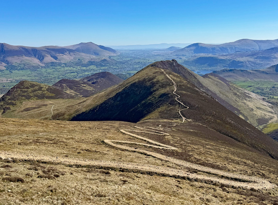
Nevertheless, on an otherwise grassy slope, zig-zags would likely be ignored by those in descent, who would soon create more direct shortcuts. Therefore, to discourage this, the path bed was raised by two feet and ditches placed either side. In the event, some walkers are still cutting corners and scars are forming once again.
Furthermore, criticisms are voiced that the path is rather stark. In reality, it is far less stark than when it was a ravaged fellside of churned up rubble, and in fact the aggregate used was all local material, although incessant attrition of boot soles does hinder the surface from fading. However, when actually on the path it does not appear quite so bright. So, to their credit, Fix the Fells carried out a commendable and durable path repair considering the substantial complications.
And there’s more…
Returning to Sail Beck, but before leaving, there is a fine little ridge that forms the eastern side of the valley. This is topped by Knott Rigg and Ard Crags. These fells are usually climbed from the Newlands side, although do also provide convenient access to Sail Pass.
For those making a circuit of the fells from Crummock Water, then a romp over Rannerdale Knotts is highly recommended. Rannerdale itself has long been renowned for its sumptuous bluebell display, although social media has learned of this and appears to believe it to be the only bluebell field in the Lake District worth visiting, so these days it does become oversubscribed.
Also, not to be overlooked, are honorary mentions for the two outliers to the north of Sail Pass, Barrow and Outerside, both delightfully combined from Braithwaite, and often included in the Coledale Horseshoe walk, if doubling back from the top of Causey Pike.
And so, to the Coledale Horseshoe; the de rigueur outing on the Grasmoor Fells. Walt Unsworth lauded the walk as ‘arguably the best combination of linked ridges in the Lake District’. The outer fells of the ring are Causey Pike and Grizedale Pike, and within lie Scar Crags, Sail, Eel Crag and Hopegill Head. Grasmoor and Whiteside do not belong to Coledale, although both can be added. This is a comprehensive round.
Coledale itself is a deep and formerly heavily mined valley for lead, zinc and barytes, which affects its attractiveness, although offers a useful retreat in case of bad weather or darkness. Force Crag Mine, at the head of the valley, was the last working mine in the Lake District, eking it out until 1991. The mine was identified as one of the worst polluting in Britain and in 2014 a groundbreaking scheme was put in place to purify the rainwater that runs through it.
Grizedale Pike is a popular fell in its own right and the customary Sleet How ascent from Braithwaite is well-blazoned. However, the approaches from Whinlatter to the north are worthy of attention; the quiet and pleasing north and northeast ridges, that emerge from the forest, make for a very enjoyable short day.
The fell is actually named after the little-frequented Grizedale Gill that rises below the summit and flows northeast into the forest. The rocky summit is nicely airy, and is a place that is gazed upon with such wonder from afar, forming an integral part of the iconic view of the Northwestern Fells, from the A66 road as it approaches Keswick.
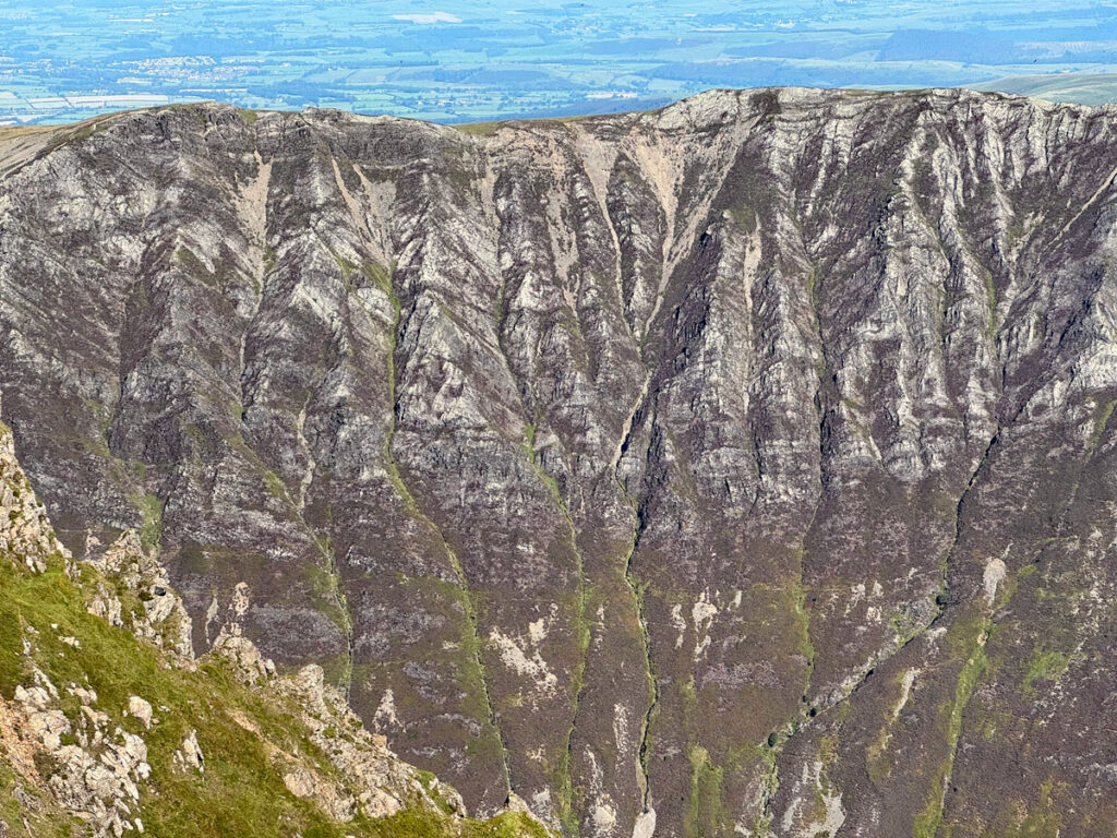
There is a direct path from the summit to Coledale Hause, for short cuts, but the continuation to Hopegill Head is insistent; circling the rim of Hobcarton Crag is too good to miss. This crag is the finest feature of the mountain, almost perpetually in shadow and undisturbed by summer climbers due to the unstable Skiddaw Slates, it has nevertheless attracted the attention of the rare Red Alpine Catchfly, being the only known habitat in England. It is a plant known for tolerating mineral rich soils and perhaps this could be reason it survives here and nowhere else in the wild.
Hopegill Head also has a second name, Hobcarton Pike being, in common with Eel Crag, due to its dominant rock face. However, the summit does stand at the head of Hope Gill, which is a known, though rarely used means of ascent, the better option being to climb the splendid ridge of Swinside and Ladyside Pike.
The greatest glory of Hopegill Head is its connecting ridge to Whiteside, one of the finest miles in Lakeland, traversing a heavenly ridge; sharp enough to excite but broad enough for comfort.
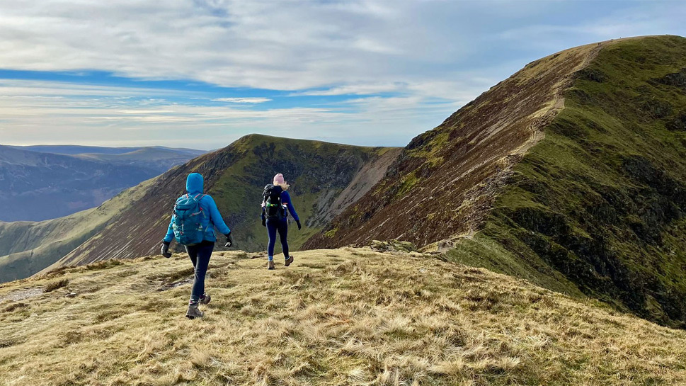
There are numerous permutations to explore the Grasmoor Fells and, whilst most summits can be included on an extended version of the perennially favoured Coledale Horseshoe, there are corners of high quality that would be omitted. These hills are amongst the very finest of the Lakeland heights and deserve detailed exploration of the unified whole, an exercise which richly rewards the holistic fellwalking pilgrim.
Grasmoor Fells Worthy: Grasmoor, Eel Crag, Grizedale Pike, Sail, Wandope, Hopegill Head, Whiteside, Scar Crags, Whiteless Pike, Causey Pike.
Honourable Mentions: Ard Crags, Knott Rigg, Outerside, Barrow (and not forgetting Sale Fell!).
Worthy Rating: 82.5
Aesthetic – 25.5
Complexity – 16
Views – 17
Route Satisfaction – 16
Special Qualities – 8