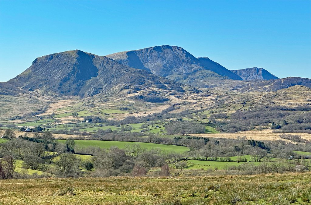
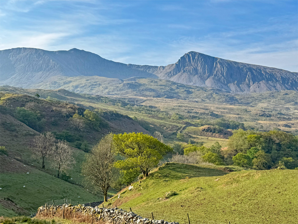
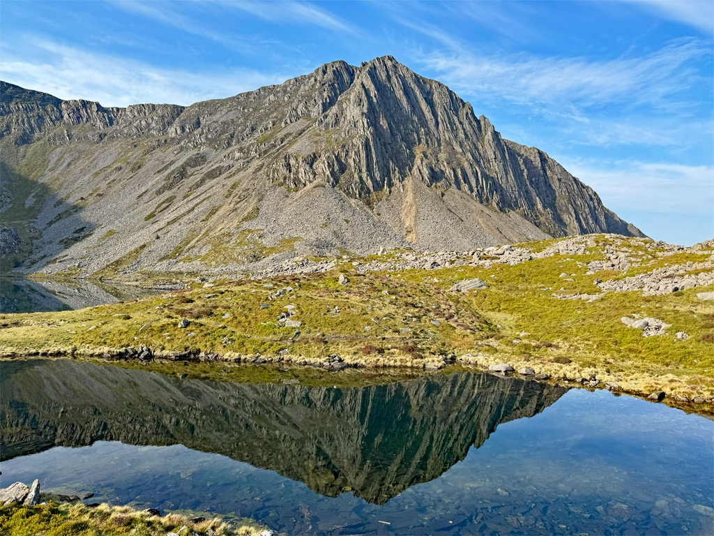
Cader Idris is not the name of a single mountain, but of a mountain range, which was once thought to be amongst the highest in Britain, a remarkable assertion considering that its neighbour Aran Fawddwy is taller, although neither even reaches three thousand feet in altitude. The misconception derives from the powerful, independent presence of the Cader Idris massif, rising boldly to monopolise the skyline.
The public perception of height and significance led to guides being available from the mid-1700s to escort tourists to the summit. By the mid-1800s, there were on average fifty ponies stabled in Dolgellau, taking the ‘Pony Path’ up the mountain, which remains the most popular ascent today, minus the ponies of course.
For centuries, the accepted spelling was Cader Idris, and it was marked as such on Ordnance Survey maps until the 1970s. By the 1980s, Cadair became more widely adopted, and in 2016 the Welsh language Commissioner declared Cadair to be the correct Welsh word. Nevertheless, the Snowdonia National Park Association retains Cader, choosing to recognise and respect the local, historic version. As I grew up calling it Cader, this feature for the most part keeps with tradition.
Cadair means chair. Few mountains in Wales escape folklore, especially one as important as Cadair Idris, the name meaning the chair of Idris, a mythical giant. There is much stuff of legend surrounding the mountain, should you care to research it.
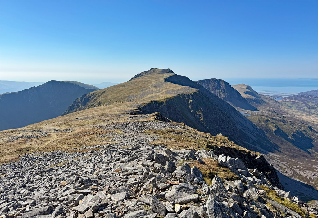
Cader has four principal summits, the highest being Penygadair ‘top of the chair’, which has always generally retained this spelling. The massif rises to 2929ft (893m), so is actually well short of 3,000ft, although a prominence of 608m assists in enhancing its stature. Furthermore, there are ascent possibilities from every direction, which deliver enviable complexity.
In essence, Cader Idris is a self-contained mountain realm.
The map below can be moved and the scale changed by zooming in or out
Ascents
Those early tourists approached the mountain via a historic packhorse route established between Dolgellau and Llanifhangel-y-pennant, which brought goods to Dolgellau market. This path crossed a high shoulder of the mountain, and it was therefore convenient for the tourist route to utilise this and merely ascend the broad slopes from the shoulder to the main summit. However, as is so often the case, the most popular route is not the finest, as whilst the views are admirable, they are restricted in extent until the higher reaches.
Approaching from Llanfihangel-y-pennant to join the Pony Path is the longest customary ascent of the mountain. There is a more direct alternative via Mynydd Pencoed, which is mostly pathless and a taxing ascent in its lower reaches, so it is perhaps best left for the descent if making a round trip.
Another ascent that joins the Pony Path in its upper half is that followed by the Cambrian Way. This approaches from the much-photographed beauty spot of the Cregennan Lakes, crossing Craig Las, although the grassy ridge has its origins much further west for those seeking a longer, wilderness walk.
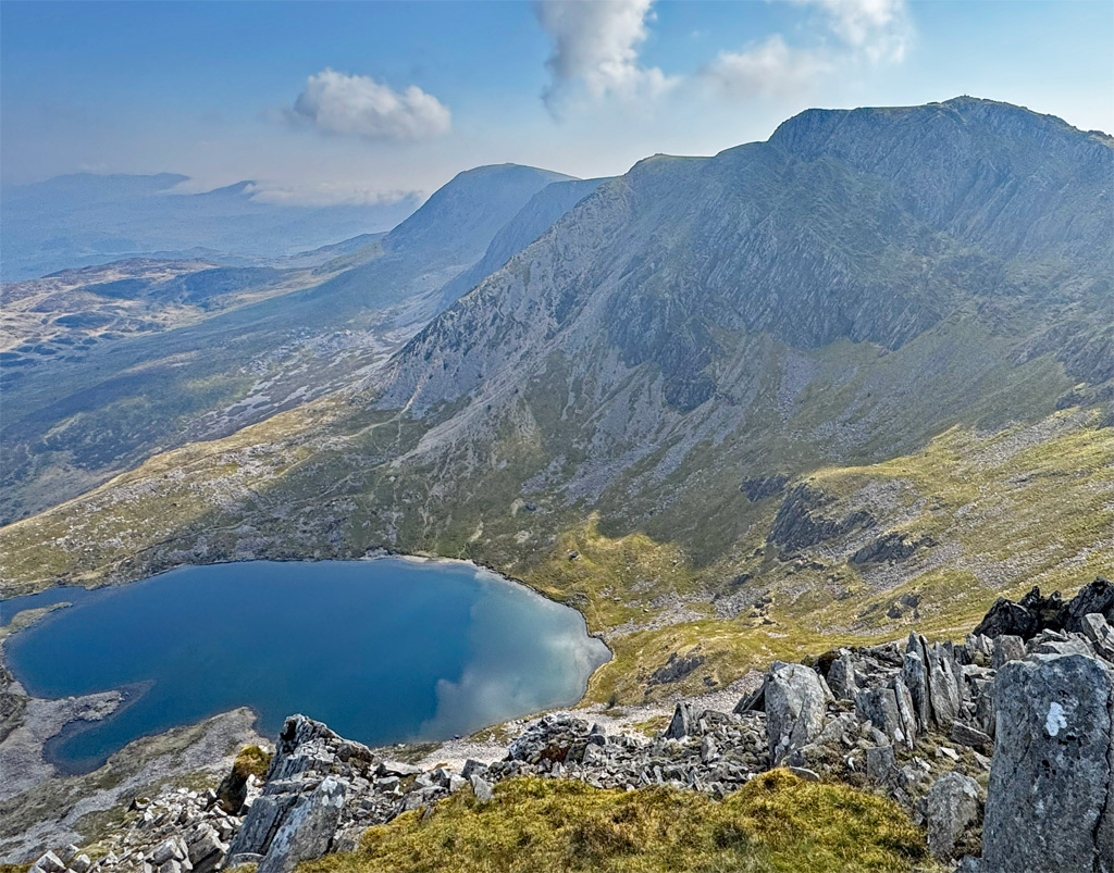
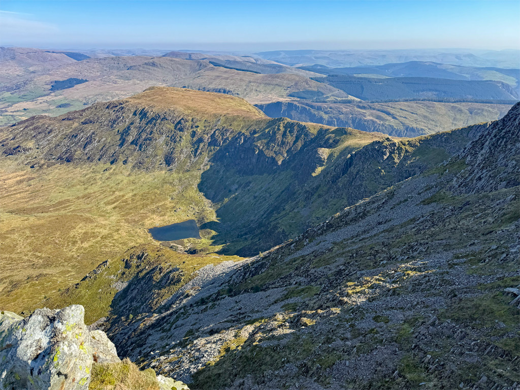
The Pony path itself begins from the dedicated car park at Ty Nant. The first half to the pass is mostly pitched and a very amenable walk. For a quieter and more impressive alternative to the ‘tourist’ route, the Fox’s Path also commences from Ty Nant and probes deep into a formidable cwm, home to Llyn y Gadair. There are two ways to reach the lake. Either follow the initial stages of the Pony Path before striking off into the corrie or, slightly more circuitously, follow the courtesy path marked by white posts running from the campsite to the Gwernant Hotel. Cross the road here and begin a devious ascent via Llyn Gafr. Perhaps this cunning route is why the path was named Llywbr Madyn, which is Welsh for Fox.
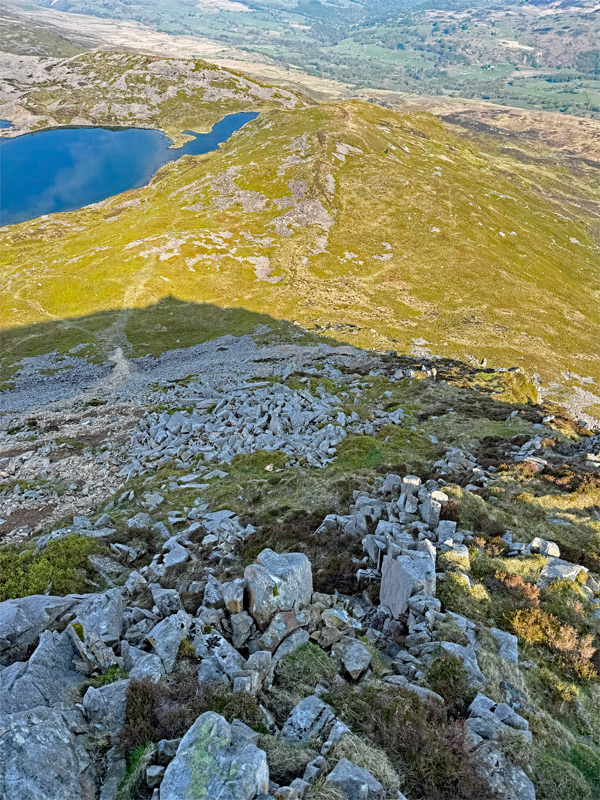
Once at the deep hollow of Llyn y Gadair, one becomes enveloped by the mountain. It’s a glorious place. On the crags to the west, the distinctive notched ridge of Cyfrwy Arete is a fine climb for scramblers, although most will turn east, to the left of the lake, and ascend via the rather less appealing scree slope ahead. Fear not, this notorious route can be mostly avoided. Instead of attacking it head on, drift diagonally leftwards almost around the obvious bounding ridge, where there is only a small quantity of scree to be climbed before heading up the steep crest on rocks and heather. The summit plateau is gained with comparative comfort.
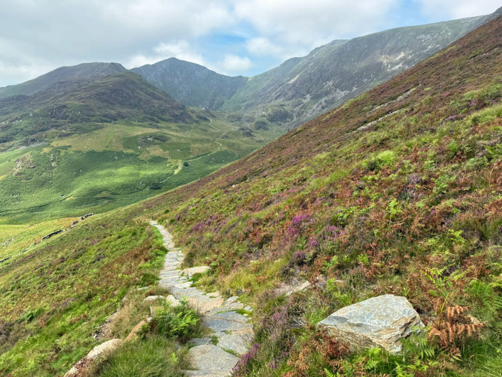
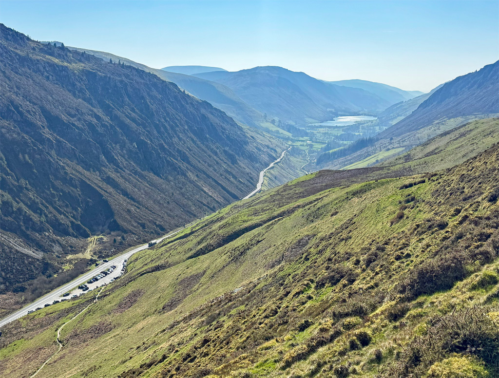
From the east side of Cader Idris, the Minffordd path is the second most popular ascent and probably the finest. Of all the routes, it feels most continuously involved with the mountain. There is again a dedicated Eryri National Park car park here. This is close to the old Minffordd Hotel, which began in the 1500s as a drover’s inn, being later developed for tourists in the 19th century as a more scenic alternative to the Pony Path.
The popularity of the Minffordd Path was rooted in the romantic attraction of Llyn Cau, described by the poet Gillian Clarke as “like a secret cupped in hands”. Painters of the sublime conjured Arthurian mists and aggrandised the scene, but the majesty of Llyn Cau is undeniable. The path actually does not bother with grazing the lake shore, although you must divert to it for the good of your soul. Even better is to circumnavigate the lake.
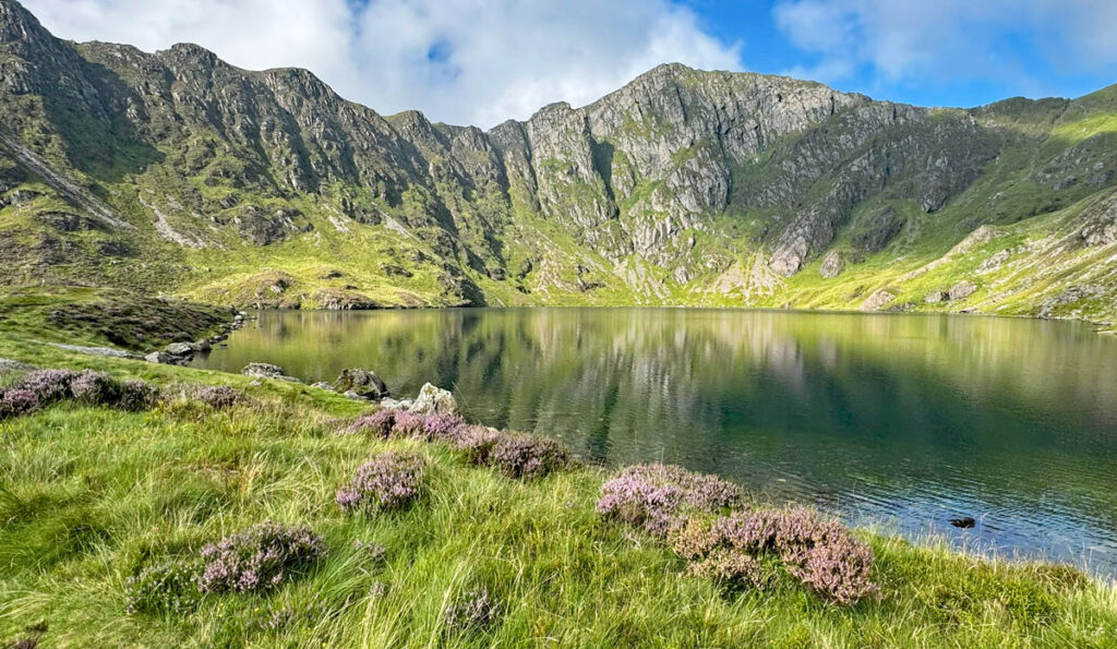
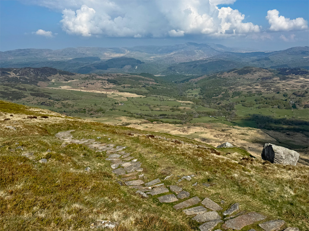
The Minffordd Path is one of the shorter ascents and therefore one of the steeper ones; however, being popular, it is well-constructed, certainly as far as the lake. A direct ascent to the col above the lake can be made but involves scree and steep, potentially wet, grass, although would form the shortest ascent of the mountain.
If there was a criticism of the Minffordd Path, it would be that the climb up the southerly bounding ridge above Llyn Cau towards Craig Cwm Amarch stubbornly avoids the crest, staying well back and missing out on the finest views. Nevertheless, it’s inspiring once on top, looking across to the true summit, although attaining this does involve a fair drop and a rambling re-ascent.
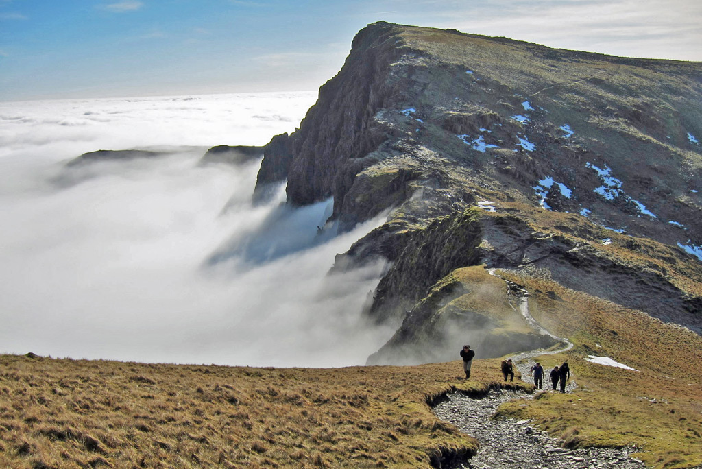
Rather than return by the Minffordd Path, many walkers choose to make a horseshoe outing, wandering gently towards Mynydd Moel before dropping down south-east, following the fenceline. There is a short cut slanting down from the minor top before Mynydd Moel if desired. The path becomes increasingly steep and unpleasantly rough; however, work is presently underway to pitch the route, so it may be much better soon. After the steep section, the path has already been completed and swings west to descend more kindly to rejoin the lower portion of the Minffordd Path.
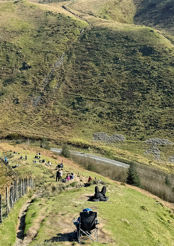
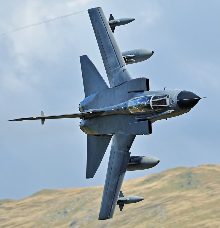
Finally, there is another tempting route to the summit, much of its appeal arising from a high starting point at the top of the Bwlch Llyn Bach. The ridge is also utilised as the continuation of the Cambrian Way. Here there is a large car park, which is usually full, although not with walkers’ cars, but with plane spotters! In recent years, the training flights of military aircraft from RAF Valley on Anglesey around what is known as the Mach Loop have become a major spectator pastime. The lower slopes of the ridge above the bwlch are usually populated by deckchairs, tripods, and many slumbering enthusiasts poised to leap into action at the first sighting. This viewing station is known as Cad West.
The walk itself is pleasant, if a little boggy in places. There are a couple of steeper climbs, initially to Gau Graig and then subsequently rising to Mynydd Moel. On this latter ascent, stick to the edge rather than the eroded path, to be rewarded by grass under your boots and fine views into the cwm of Llyn Aran.
The ridge can be combined with the Minffordd Path as a longer circuit. Parts of the old A487 road linking the bwlch to the Minffordd Hotel are now a path, although two sections of walking on the modern road are still required, and it can be thunderingly busy, which detracts from the enjoyment a little.
The Summit
The actual top of the mountain, Penygadair, is a minor eruption on a generally rambling expanse, although the steep drop to the east is a danger in misty weather. There’s a triangulation pillar, as befits such an independent mountain, the trig being one of the first primary pillars to be built in 1936. It fell into disrepair and was replaced in 1985, although forty years later, it is once again fighting a losing battle against the elements.
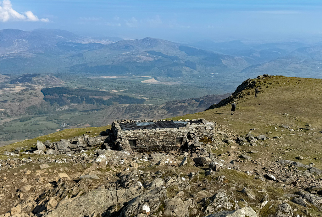
An unexpected sight just below the summit is a hut, originally built in the 1830s to serve refreshments to the tourists. Naturally that too fell into disrepair after the golden age, but was restored by the National Park Authority, who deliberately did not make it comfortable enough to invite overnight stays.
Local guide Robert Edwards made over 1,800 ascents of Cader Idris in the late 18th and early 19th centuries, and even at the age of ninety was still making three ascents each week. Edwards was an eccentric character, described as “a little man, given over to drink when he could get it, and rather too free in his use of the expletives of language”.
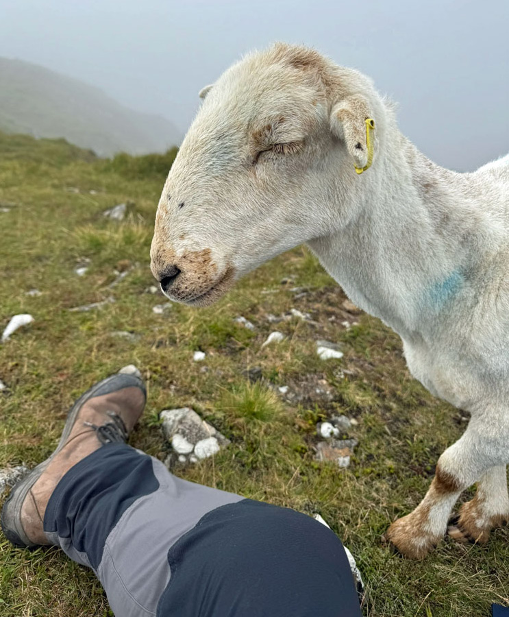
It’s often bustling on the summit, although with extensive space, there is usually somewhere to escape for contemplation. Just watch out for the present-day characters in the form of woolly muggers, who have become somewhat precocious through being fed by ill-advised tourists!
Worthy Rating: 85
Aesthetic – 27
Complexity – 17
Views – 17
Route Satisfaction – 15
Special Qualities – 9