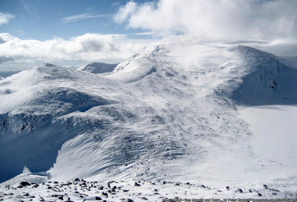
The nobility of Ben Macdui derives from its gentle superiority within the vast upland plateau of the Cairngorms, Britain’s highest concentrated landmass; a vast dome of pink granite dissected and carved by glaciation. The mountain’s significance lies in its location at the heart of this wilderness whose scale, isolation and grandeur are difficult to comprehend until experienced.
The Cairngorms is a subarctic wilderness where the temperature can fall below freezing during any month of the year. The highest windspeed in the UK was recorded on the plateau and the country’s worst mountain tragedy occurred here. Nonetheless, in clement conditions, the expansive plateau is benign, accommodating and conducive to extended walks – which is just as well, for distances in the Cairngorms can be considerable.
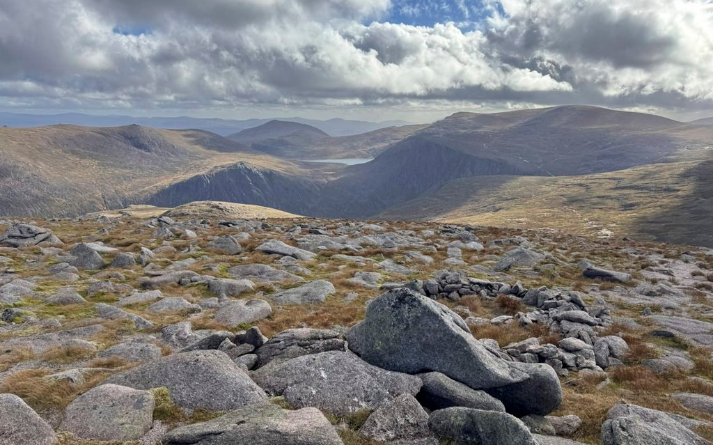
In days of old the principal ascent of Ben Macdui commenced from the Linn of Dee, an 18-mile round trip even by the shortest route. It was partly this requirement to venture into elusive, lofty mountain country, which fuelled the perception that Macdui was in fact the highest mountain in Britain. Of course, everyone knew of Ben Nevis, as its enormous bulk starkly presented the mountain’s proportions without discretion.
There was no secret about the scale of Nevis, whereas Macdui was shielded by its compatriots, only to be discovered after a lengthy approach. A contemporary article from Blackwood’s Edinburgh Magazine in 1848 records “Surrounded by his peers, he stands apart from the every-day world in mysterious grandeur.”
The matter of altitude was not fully resolved until the Ordnance Survey published details in 1864. There were many claims from previous surveys that put the height of Macdui at as much as 4390ft and Ben Nevis as 17ft lower and this was widely accepted, although the indefatigable Reverend George Skene Keith had spent many days during 1810 climbing the Cairngorm mountains with his mercury barometer to measure heights, recording remarkably accurate results. Macdui he estimated to be almost exactly 4,300ft, exceptionally close to its current figure of 4296ft. During the same year, he despatched his son to measure Ben Nevis, who returned with the result of 4350ft.
Many refused to accept Skene Keith’s outcome and among the Macdui adherents was the owner of the mountain, James Duff, the 4th Earl of Fife, who in 1815 lodged plans to build a towering sepulchral pyramid 100ft high with a cast iron balustrade. Thankfully it was never constructed and what a folly it would have been, because modern surveying pronounces Macdui to be 115ft shorter!
Whilst for this Cairngorms Worthy we are considering Ben Macdui as the centre point, its summit is merely the uppermost contour of a lengthy plateau, which never drops below 3600ft, and with numerous ascent routes available incorporating several other tops, from Cairn Gorm to Derry Cairngorm, it would be churlish not to include them.
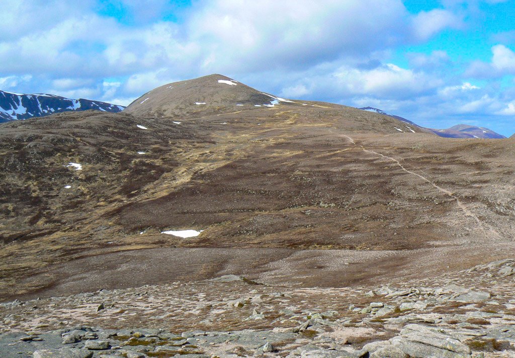
There are a handful of individual plateaux within the Cairngorms, although the writer Nan Shepherd in her exquisite book The Living Mountain declares the range to be a unified whole – “The plateau is the true summit of these mountains; they must be seen as a single mountain, and the individual summits… though sundered from one another by fissures and deep descents, are no more than eddies on the plateau surface”.
Interestingly, the range is not named after its highest mountain, although as Ben Macdui was originally called Ben Muich Dhui, that title is rather more cumbersome, although walking the Muich Dhuies does nevertheless sound rather appealing. Cairn Gorm, perhaps being the shapelier, more prominent and accessible summit gave its name to the range, and even when the precise altitudes were finally settled, ranking Cairn Gorm as only the 4th highest, the name Cairngorms was sufficiently established to remain unchallenged.
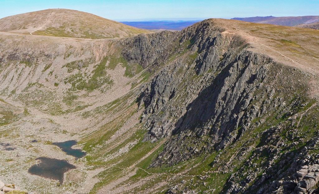
The creation of the road beyond Glenmore Lodge through the development of skiing on Cairngorm in the 1960s, led to the focus of ascents shifting to this high-altitude spring board. A direct assault on Ben Macdui from here involves just a five-mile walk each way with only 2400ft of ascent. It’s a swift, steady ascent with nothing remarkable until above 1000m, where the plateau asserts its sweeping magnitude, and the commanding presence of the mighty corries of Braeriach beguile from across the great rift of the Lairig Ghru.
Whilst there is merit in taking this linear approach in one direction, the outing is appreciably improved if coupled with a walk around the rim of the corries on the Cairngorm Plateau. There are multiple options to reach the plateau from the Ski Centre, including the celebrated Fiacaill Ridge; a short, exciting scramble on one of the few aretes in the Cairngorms.
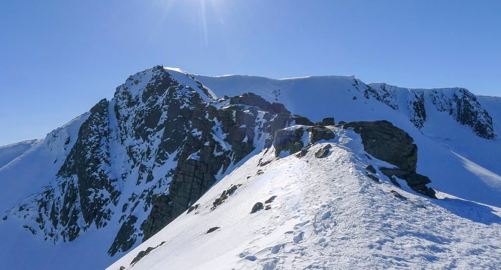
The southerly approach from The Linn of Dee remains popular and also offers several variations, including options that climb out of the mighty Lairig Ghru; above the Pools of Dee, steeply beside March Burn or – for those coming from Derry Lodge – by the exceptionally relentless slope from Allt Clach nan Taillear, which rises 2300ft in one mile. The ridge of Sron Riach is the most direct from the south, or for additional Munros, there are Derry Cairngorm; a rare shapely peak amongst the range; and Carn a’ Mhaim, which is even more unusual due to its exhilaratingly slender summit ridge.
However, the standard path climbs through Glen Derry from Derry Lodge1. Two bothies are passed on this route. The remoteness of the Cairngorm mountains has fostered a large number of bothies, more than any other mountainous area of the Highlands. Some are not particularly remote, such as the first to be encountered – Bob Scott’s Memorial Hut in Glen Lui, run by a group of ‘Friends’ as a registered charity2. Otherwise, most are maintained by the Mountain Bothies Association, including the Hutchison Memorial Hut – affectionately known as the Hutchie – supremely located in Coire Etchachan.
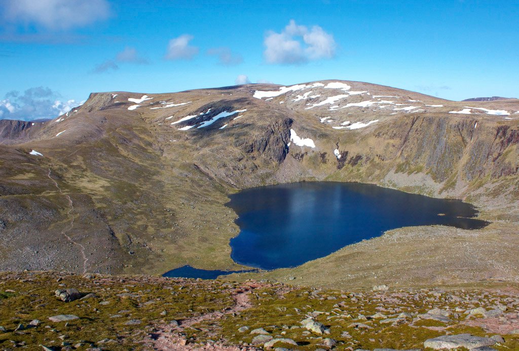
Above the Hutchie is Loch Etchachan, which is the largest Scottish loch over 3000ft above sea level. Beyond it is the highlight of this ascent – peering down into the dramatic Coire Sputan Dearg, which cradles its own high lochan.
Queen Victoria made this ascent of Ben Macdui via Glen Derry in 1859, mostly by pony and recorded delight in her diary – ”such magnificent wild rocks, precipices and corries. It had a sublime and solemn effect; so wild, so solitary – no one but ourselves and our little party there”.
The Summit
Queen Victoria experienced cloud to obscure her ascent but fortunately this cleared on top allowing the monarch to appreciate the grandeur of the scene. Many years later, during the first continuous winter round of the Munros, Martin Moran was confronted by a snarling whiteout on the enormous plateau. Counting his steps towards the summit, he discovered that it wasn’t where he expected it to be. He was forced to conduct a block search of the surrounding 100m squares until the cairn was eventually discovered.
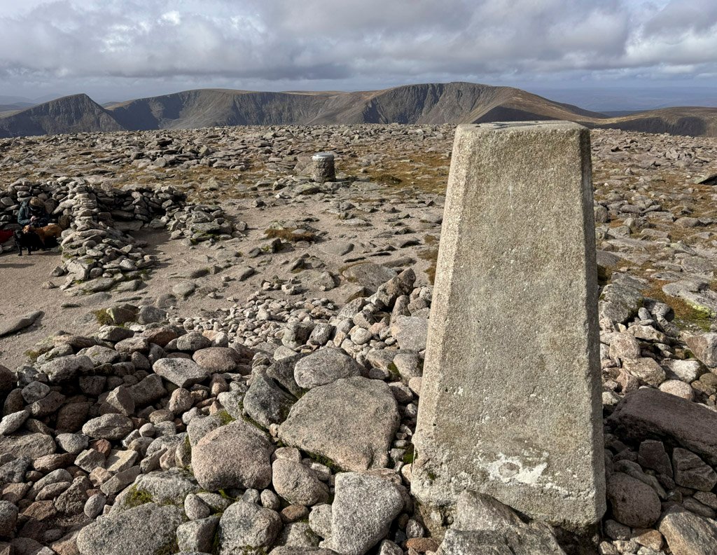
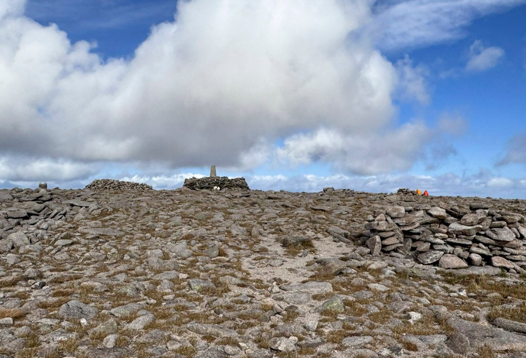
The present cairn is substantial and topped by an OS trig pillar, although the original summit cairn was even more substantial, standing some 22ft tall. It was constructed around 1847 in a “Tower of Babel style”, four stories high and has been attributed to the Earl of Fife – the very same man who had conceived even grander plans over thirty years previously.
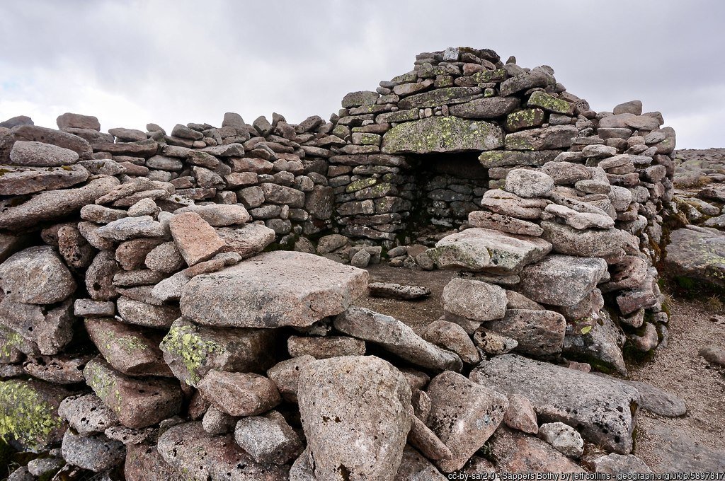
A building contemporary with the original cairn lies just east of the top, although it is now mostly ruinous. It is known as the Sappers Bothy, and was built by the Royal Engineers who were stationed on the summit for eleven weeks during the summer of 1847, under General Colby of the Ordnance Survey, to carry out trigonometrical measurements of the surrounding country. In 1897, for Queen Victoria’s Diamond Jubilee, the Cairngorm Club planned a celebration, two members carrying fireworks to store in the bothy. Unfortunately, due to “abominably disloyal weather” no one else made it up there!
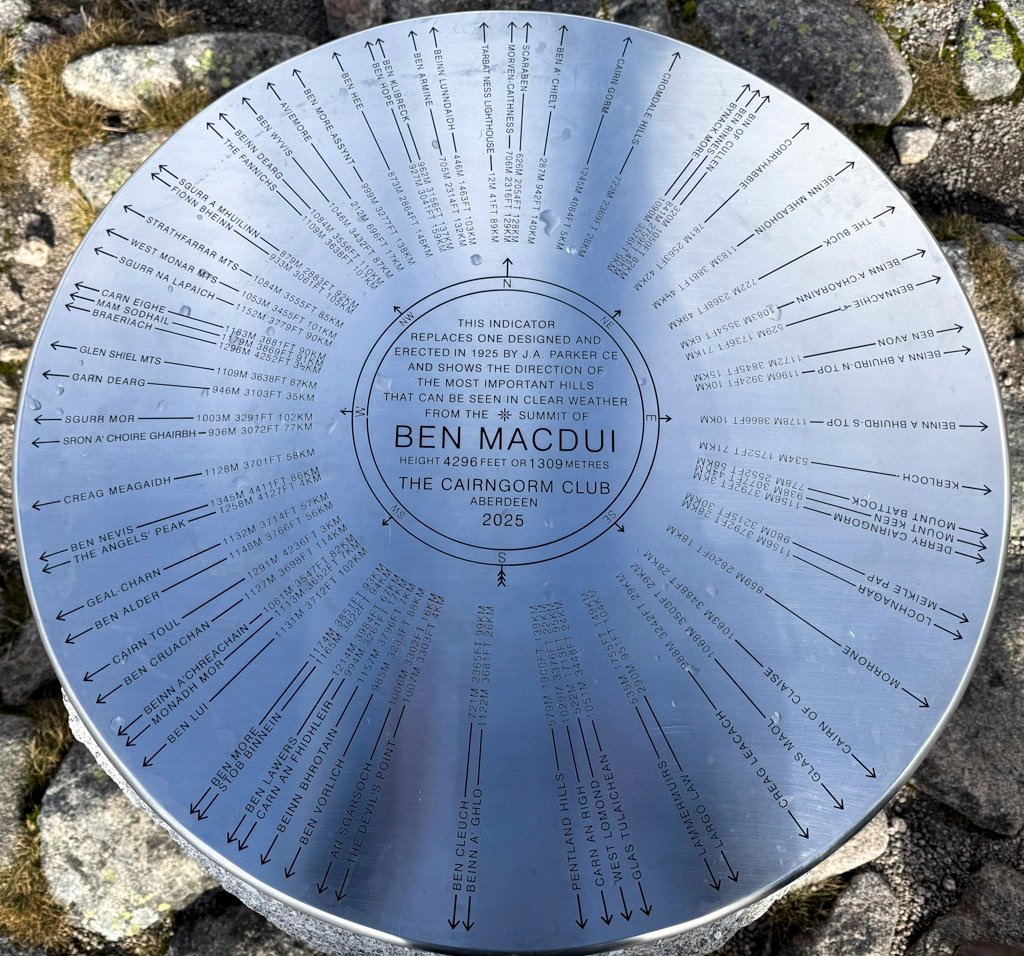
Also among the summit furniture is a view indicator, which was carefully located so that the former summit cairn obstructed as little of the panorama as possible. The indicator was erected in 1925 by the Cairngorm Club in memory of its first president, Alexander Copeland, and was designed by James A. Parker. Following the success of the erection of an indicator the previous year on Lochnagar, this structure was identical, the indicator plaque being composed of Doulton Stoneware.
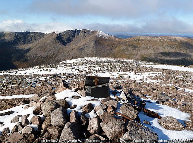
While the vista is extensive, the plateau truncates the lower half of many mountains, so to maximise the view, stroll westwards toward the edge of the plateau, from where it plunges 2300ft (700m) into the Lairig Ghru. A little way to the north from here, a small memorial plaque may be spotted, commemorating a RAF Avro plane that crashed in 1942 on a training mission. The plane’s two engines remain on the ground. This was not the only aircraft tragedy on Macdui, as in 2001, two US F-15 fighter jets smashed into the summit, close to the main path that arrives from the north. All the wreckage was quickly cleared for investigation.
The summit of Ben Macdui is certainly a place of much consequence deserving of its altitude status, with its wide variety of structures and historical detail, although some of this is not widely known. To the north east of the summit, at an altitude of 1270m is a tiny lochan that is probably the highest natural body of water in Britain. It feeds Loch Avon.
Macdui actually has two summits, although few visit the lower North Top as the main path bypasses it. This was originally the highest designated Munro Top, until its deletion from the list. Nonetheless, on the ground the top is real and in misty conditions it can provide an additional navigational trial for those stumbling blindly across the plateau relying on gaining height as a means to attain the summit.
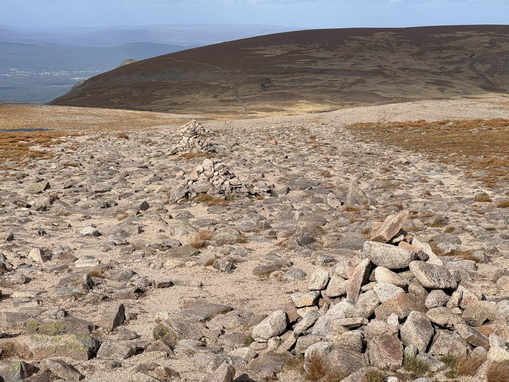
We will now head north to traverse the plateau towards Cairn Gorm, almost four miles distant. The stone path makes a protracted, gradual descent to the lowest point, marked by Lochan Buidhe, which itself is renowned as the highest named lochan in the country, standing at 3690ft (1125m), and on its banks there was formerly a small shelter known as the Curran Bothy. It was built in 1963 as one of a number of high-level shelters. Sadly, it became the focus of Britain’s worst mountain tragedy in 1971 when a party of school children and their instructors failed to find it in a blizzard. Five children and one young instructor perished after being forced to bivouac for two nights by the Feith Buidhe, just below the lochan.
The Curran and other huts were subsequently demolished as the authorities decided that if they did not exist, such a party would retreat earlier rather than pressing on in the hope of finding shelter.
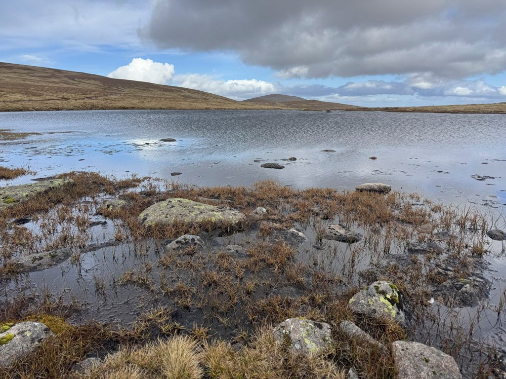
The Feith Buidhe also drains into Loch Avon (pron. A’an), whose wild and remote setting has been described as being “like a fragment of the Alps imported and set down in Scotland”. This is the savage heart of the Cairngorms. Ben Macdui can be climbed from here for those who have trekked over Cairngorm and made the prodigious descent beneath the hanging bowl of Coire Raibert. It is certainly worth it, if only to experience the powerful silence surrounding Loch Avon.
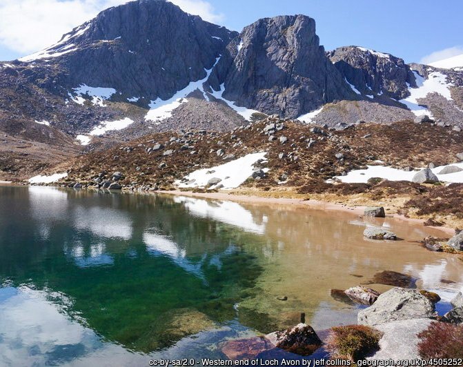
Above the head of the loch stands Shelter Stone Crag, a bold, austere and majestic granite magnet for climbers in both summer and winter. And below the crag is the Shelter Stone itself, a mammoth rock over 40ft wide and 20ft high, which is lodged in such a way as to have created the most famous natural bivouac in the Highlands. Even as far back as 1794 the shelter was famous, described as having sufficient space to accommodate eighteen armed men – not perhaps a description we might use in modern times! In reality the floor space is little more than 10ft by 10ft, so more than six sleeping within becomes a squeeze.
Cairngorm
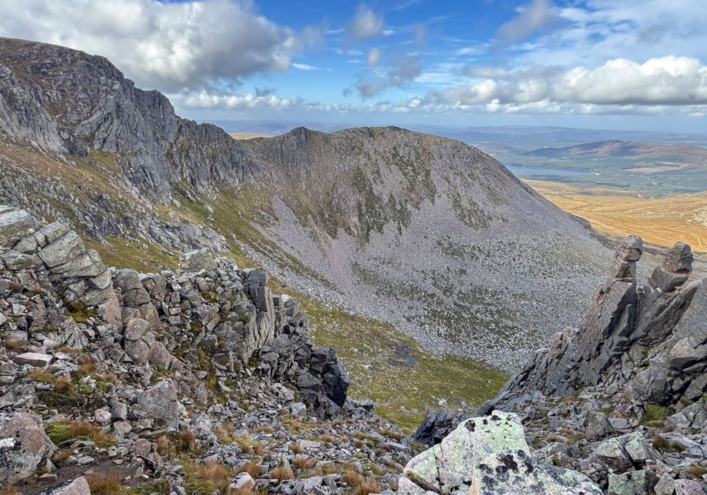
Returning to Lochan Buidhe and the tundra of the plateau, Cairn Lochan rises above. However, this is merely a Munro Top so the main path to Cairngorm avoids it and slants across its shoulder, although to enjoy the complete prospect of the northern crags and corries, Cairn Lochan ought to be climbed. Likewise, Stob Coire an t-Sneachda is just a top, but this perambulation of the rim is not about bagging; it’s about the awesome sight of the corries from above.
Cairngorm itself is not much higher than the neighbouring tops, yet it does exert a domineering presence, and the approach from Cairn Lochan is infinitely better than to climb it from the ski area, as you will discover should you descend that way.
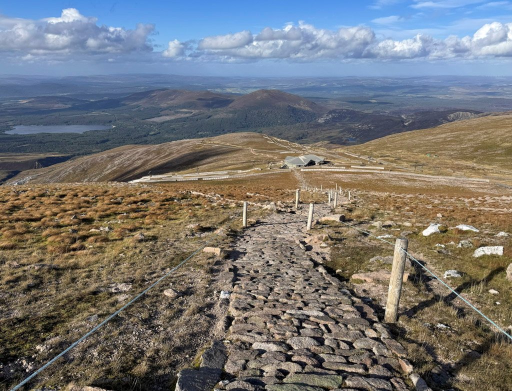
Cairngorm summit is an excellent viewpoint. There are many mountains to observe, although it is perhaps the aerial perspective over Loch Morlich and the woods of Rothiemurchus that emphasise the commanding position. While few dedicated hillwalkers climb Cairngorm as a sole objective, many other people do, although since the chairlift was replaced by a funicular railway, access from the Ptarmigan Restaurant at its terminus was restricted to protect the environment. However, a three-month trial in autumn 2026, permitted visitors to break free and walk to the summit carrying GPS, to monitor their movement and ensure they adhered to the permitted path.
Close to the summit cairn is an automatic weather station built by the Physics Department of Heriot-Watt University, which has been operating since 1977, recording wind speed, direction and temperature in the UK’s most severe climate.
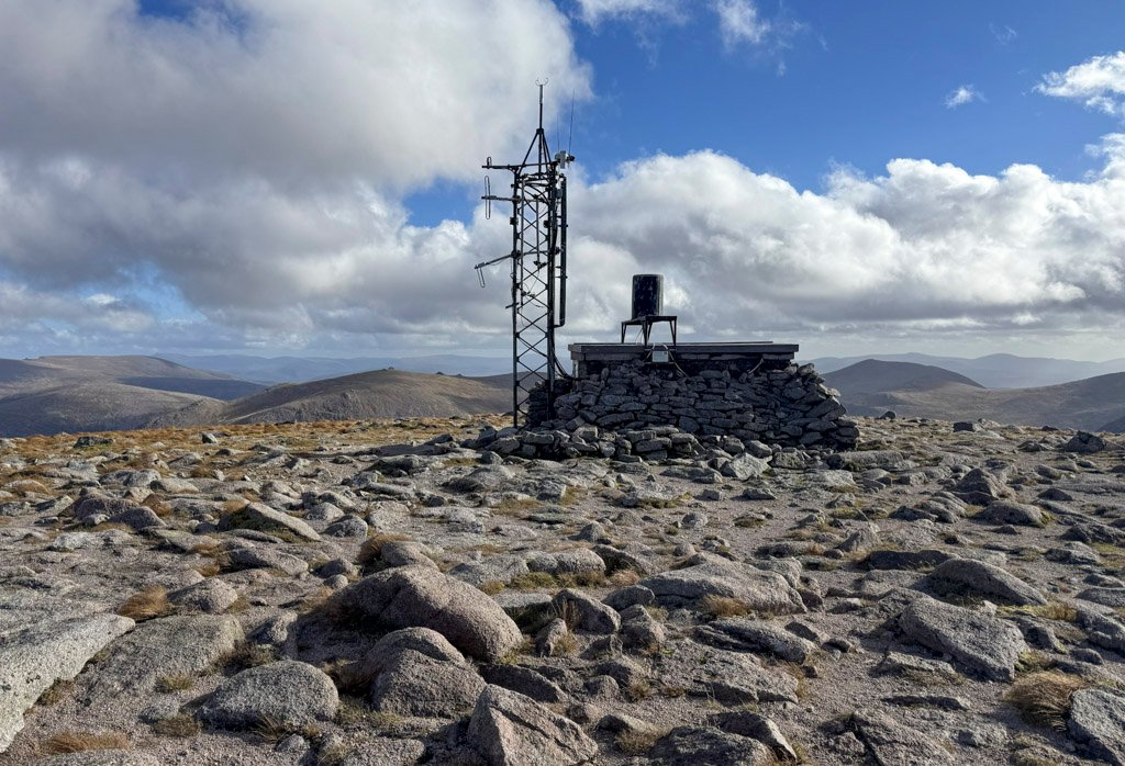
The Cairngorms have been associated with several claims to Britain’s highest recorded wind speed. The official Met Office record is a gust of 173 mph, recorded at the summit on 20 March 1986. The summit weather station data also claims the record with a windspeed of 176 mph observed in 1993. Indeed, even higher figures have been reported elsewhere, including 194 mph at Cairngorm in 2008 and 197 mph at RAF Saxa Vord in Shetland in 1992. However, neither of those claims has been substantiated sufficiently to replace the recognised 1986 record. Unfortunately at such velocities the equipment has a tendency to break!
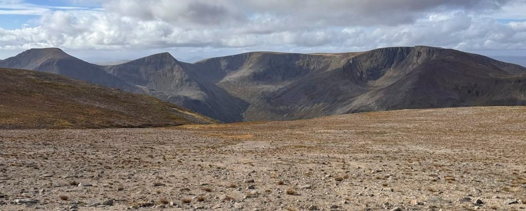
The Ben Macdui/Cairngorm plateau may be one of the most simple to reach, but it has shown itself to be highly dangerous in less than perfect conditions. Ben Macdui is the highest mountain of the district and therefore an irresistible attraction. Many climb it for the lure of its altitude alone, but the mountain is far more substantial and worthy. The combination of human endeavour and heritage builds a tangible atmosphere of lore; the location provides a window to the wonders of the greater range; and the thrill of crawling like a tiny ant across the vast elephant’s back of the plateau is a unique and quintessential mountain experience.
Footnotes
- Derry Lodge is the largest of the buildings in this part of Glen Lui and popularly thought to have been a shooting lodge, although it also served as a gamekeeper’s residence, as did nearby Luibeg Cottage, whose outbuilding also accommodated occasional ghillies or passing walkers (for a small fee). Although basic, Derry Lodge was considered suitable to host Queen Victoria for tea on her descent from Ben Macdui in 1859 – although her luncheon had been taken on the summit cairn “in a piercing cold wind”, so this would have been luxurious! In 1942 the lodge was requisitioned for military training and from 1951-67 became a club hut for the Cairngorm Club. This ceased when new landowners increased the rent and it became uneconomic to continue. The lodge is now owned by the National Trust for Scotland who proposed plans for a hostel but these have not materialised.
- Bob Scott was the last long-time Gamekeeper at Luibeg and his bothy became the memorial hut. The present hut is the third incarnation; the first burned down and was rebuilt downstream, only to subsequently burn down again. Fingers are crossed for the present bothy – third time lucky…
Worthy Rating: 75
Aesthetic – 21
Complexity – 16
Views – 16
Route Satisfaction – 14
Special Qualities – 8