
Rising above the River Wharfe at one of its most idyllic stretches is a glorious heather moor, complemented by a multitude of prominent gritstone outcrops. This is Simon’s Seat; a moor of distinctly independent character to the majority of the Yorkshire Dales National Park.
The Dales is predominantly renowned as limestone country, yet as the borders of the park hesitate at the transition to the coarse Pennine gritstone landscapes, a pocket of this transformation is retained. This is the Yorkshire Dales, but not as we know it.

Although popularly known as Simon’s Seat, strictly the hill is Barden Fell, and the Seat is its particularly distinguished summit outcrop. Barden Fell is part of the wider Barden Moor, and although Simon’s Seat is not the highest point, it is a focus of especially concentrated interest.
The moor has long been the private sporting estate of the Dukes of Devonshire, and yet the public are permitted to ‘trespass’ into this former ducal enclave, to witness the frequent call of the red grouse. Long a place of disputed access, permissive paths were not established until 1968, with the legacy that the Bolton Abbey Estate retains the right to close the moor for up to 30 days a year. In practice, this is primarily exercised at times of fire risk rather than during the grouse shooting season. Official access paths normally remain open, although to protect the ground-nesting birds, no dogs are permitted all-year round.
The map below can be moved around and zoomed in or out to change the scale
Simon Who?
Simon’s Seat has been known as such since at least 1771 and was at that time attributed as a personal or proprietorial name, in keeping with the neighbouring outcrops bearing the titles of Lord’s Seat, Lady’s Bower and Earl Seat. Nevertheless, there is no credible evidence of a former landowner with that name, nor a well-respected local that warranted such an honour. However, folklore soon took a hold, involving druids and most bizarrely the story of a shepherd finding an abandoned baby who was named Simon Amangham – simply because his fellow shepherds agreed to collectively raise the boy “amang’em”. Curiously, the Bolton Abbey Estate supports the alternative – an association with Simon Magus and the Druids. Mountain Worthies remains unconvinced.

The geological transition from Carboniferous limestone to gritstones is especially complex in this area, with the celebrated presence of the conical Cracoe Reef Knolls juxtaposed against the rising bleak moors, and the limestone gorge of Troller’s Gill abutting the foot of Simon’s Seat. This translates into a distinctive landscape beautifully described by John Ruskin as “noble moorlands.. purple with heath, and broken into scars and glens,” contrasting magnificently with the cultivated landscape below.
Bolton Abbey itself was then and remains today a sublime ruin of “sweet peace and tender decay”, the priory and its picturesque environs presently attracting 450,000 visitors a year. From the early 1800s, the 6th Duke of Devonshire began laying out pathways to lure tourists, both to the riverside and into the wilder country of the moor above.

Piercing the hill is Posforth Gill, whose tumbling waterfalls were ideal country for the duke to create a romantic visitor perambulation; the upper ravine later acquiring the name “Valley of Desolation” following catastrophic storm damage in 18261. This only heightened the allure. Even more romantically, the Ordnance Survey labelled it the Vale of Desolation on their early maps and marked the named seats strategically placed to take delight in the vistas.
There has been substantial replanting in the valley in recent years, most notably in 1980, when an avenue of one hundred oak trees was established as a grand procession at the entrance to the valley. In 1998 – 2000 a scheme of planting was undertaken, deliberately designed to illustrate the sequence of woodland types that originally colonised the valley. The grand plan of the estate is to recreate the picturesque scene before the storm.
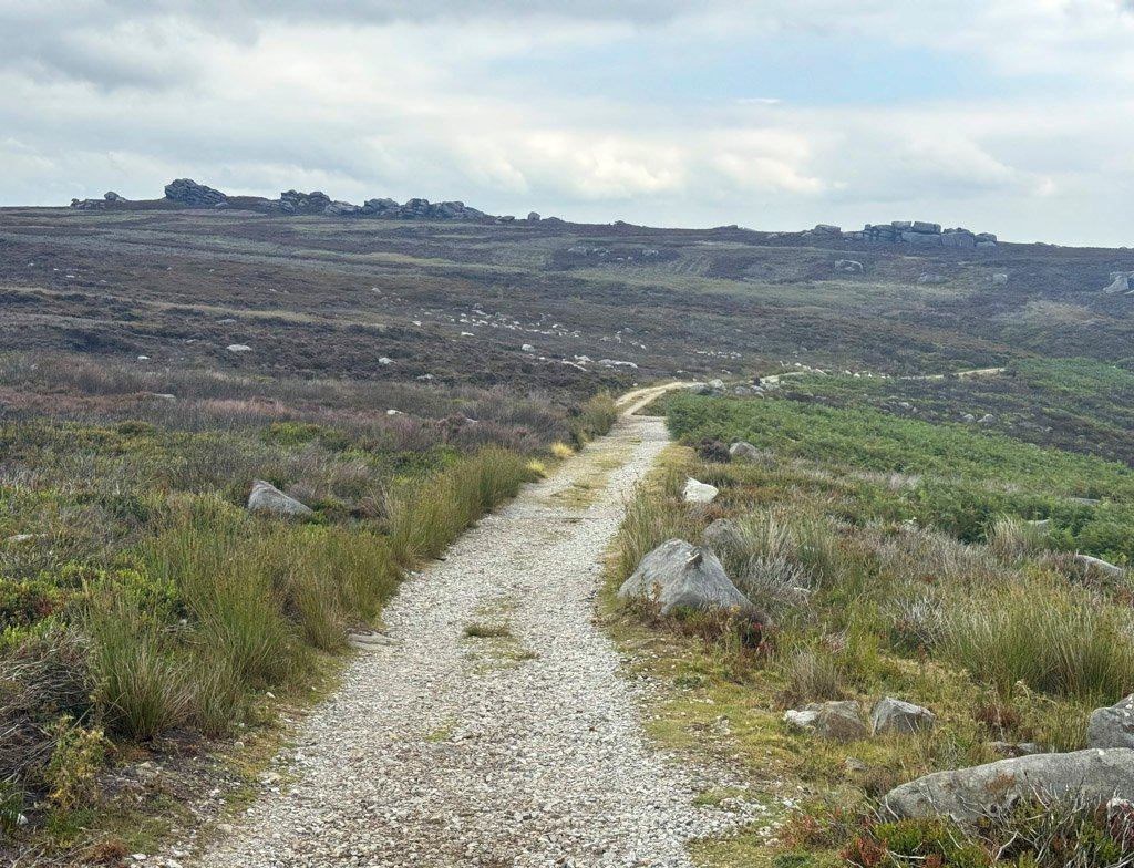
The Valley of Desolation remains the most documented ascent route, although Simon’s Seat offers approaches from every quarter, with six routes of ascent from Wharfedale alone. Various combinations can be devised and a riverside ramble beside the Wharfe is also a popular component, with the ancient oakwoods around the narrow cataract of The Strid being particularly acclaimed.
Circular walks in excess of ten miles are easily achievable if the wider Barden Fell moorland is included. That’s not bad at all for a hill that doesn’t even reach 1600ft.
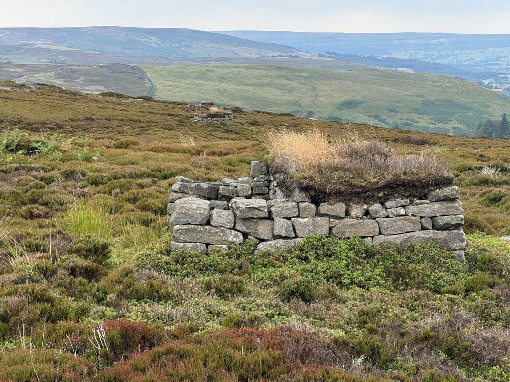
Estate tracks from Bolton Abbey provide convenient access to the moor, if somewhat tempering the atmosphere of wilderness. This is primarily a managed, working landscape, preserved by the gamekeepers for grouse. The Bolton Abbey Estate covers 30,000 acres and almost half of this is upland moor. Grouse butts abound and are ingeniously supplemented with stands created by removing selected capstones from the extensive drystone wall that spans the moor.
Importantly, the heather moor is a designated SSSI and environmental protection of its blanket bog is imperative2. In 2018, 30 tons of reclaimed flagstones from the floors of Lancashire mills were transported to Barden Fell by helicopter by the Yorkshire Dales National Park Authority.
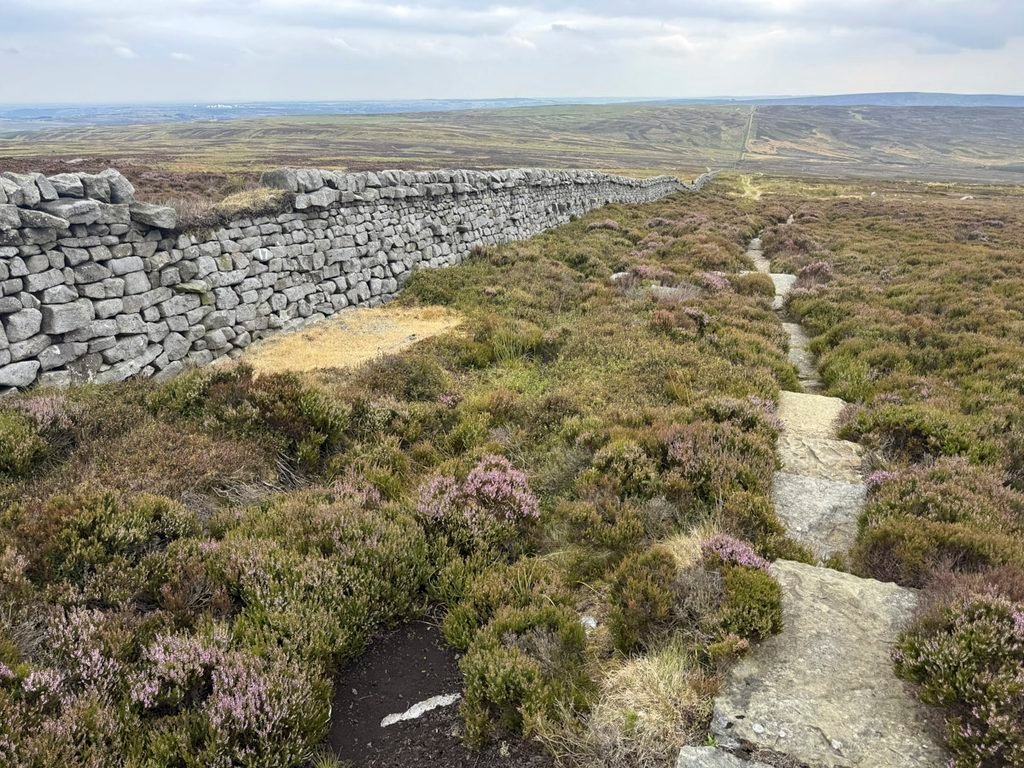
The subsequent construction of the flagged path is pleasingly discreet, meandering around the natural obstacles and often obscured from general view by the depth of surrounding heather cover. Rarely has such a path designed for erosion control and for ecological conservation blended in so tolerably, with the added benefit for the walker of also being far more palatable than battling with bog and impenetrable heather.
The moor also received attention for its mineral resources in days past. Peat was dug here for local use, as was coal, and the former workings of both may be stumbled upon. There are also shakeholes on the moor, including the Great Shack and Dry Tarn marked on large scale maps. Some of these were formed by mining activity, although others appear to be sinkholes (or dolines), Karst features that are typical of limestone country. Except of course this is gritstone; however, limestone does underlie the grits and may have caused it to collapse3.

The eye is predominantly attracted by the entertaining rocky outcrops that define Barden Fell, most of these concentrated in the vicinity of the summit, Simon’s Seat. All have names and many of them offer sport for climbers with Simon’s Seat and Lord’s Seat providing the majority of the routes. Most of the tops are also attainable for active walkers and provide splendid vantage points for viewing the moors4.
The walk around Barden Fell is fulfilling but the summit experience is the irrefutable highlight of the occasion; crowned by Simon’s Seat, the finest and most consequential of the outcrops. Standing on this invigorating and historic emplacement, one feels like the duke surveying his domain.
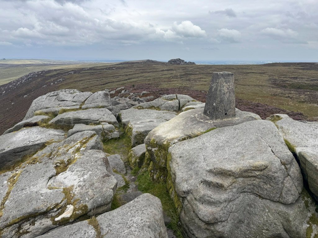
The prospect of Wharfedale and the Yorkshire Dales stretching beyond is momentous. And yet we stand at the very edge of the national park, our boots gripping the rough gritstone of a geological watershed. Simon’s Seat may be a minor height but it has a major story.
Footnotes:
- Some accounts erroneously date the storm to 1836, however, contemporary historic reports confirm 1826.
- The conflict between managing moorlands for sport and conservation is long-running. There is a complex interplay of factors. The Bolton Abbey Estate was previously criticised by Natural England for the “unfavourable and declining” condition of its moors, although in recent years the estate’s increased investment in conservation has reversed this situation to “improving”.
- There are claims the prominent Cracoe Reef Knolls that fringe the western edge of Barden Moor may also rise again beneath Barden Fell as part of the underlying limestone belt, thus increasingly the likelihood of gritstone collapse into limestone chambers. However, I have not discovered any documented evidence of a subterranean reef.
- The Featured photograph at the top of the page shows the stunning view from close to one of the outcrops/cairns known as The Devil’s Apronful. There are several of the same name in Yorkshire and one on Pendle Hill, however, this particular pile of stones, if it is not the discarded contents of the Devil’s apron, it is thought to be a Bronze Age burial cairn.
Worthy Rating: 67.5
Aesthetic – 19.5
Complexity – 13
Views – 15
Route Satisfaction – 13
Special Qualities – 7