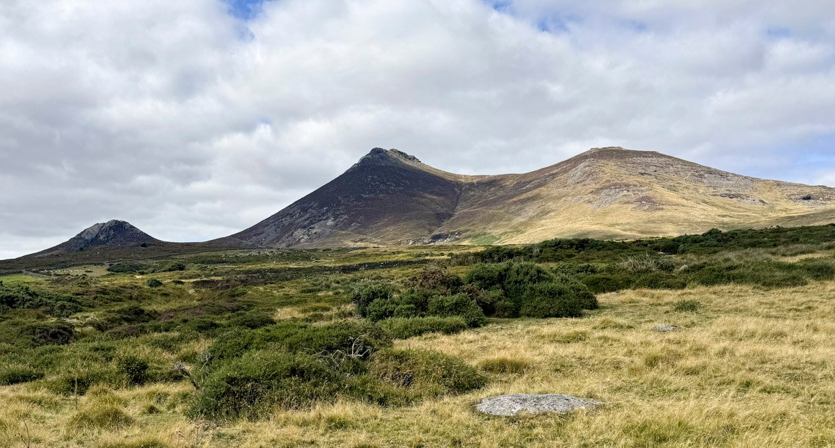
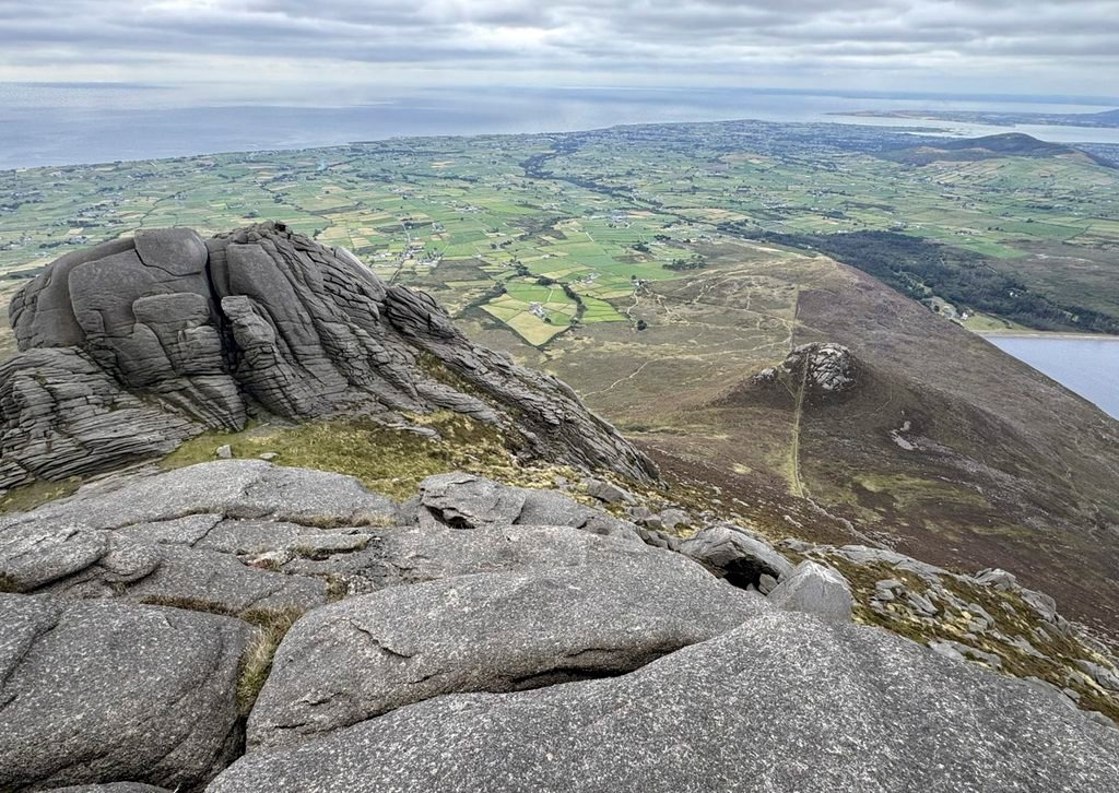
The Mourne Mountains comprise a compact range of immense character; uncompromising granite peaks jostling for attention. Crucially, in the Worthy stakes a select number are artistically distinguished by imposing tors, revealing their resistant bones of bare bedrock in spectacular fashion. These summit tors are a remarkable feature of the Mournes, and the most prodigious collection of tors belongs to Slieve Binnian.
Being an hour from Belfast and under two from Dublin, the Mourne Mountains are attractive to a large number of hillwalkers, especially when considering the available alternatives. Dublin boasts the Wicklow Mountains close by, although they lack the majesty of the Mournes. Belfast has no major mountainous terrain in the vicinity. Therefore, do not expect to be alone. Slieve Donard is the highest mountain and draws the majority of the crowds, but Slieve Binnian is for the discerning walker although, judging from the extra car parks open at weekends, there are plenty of those around too.
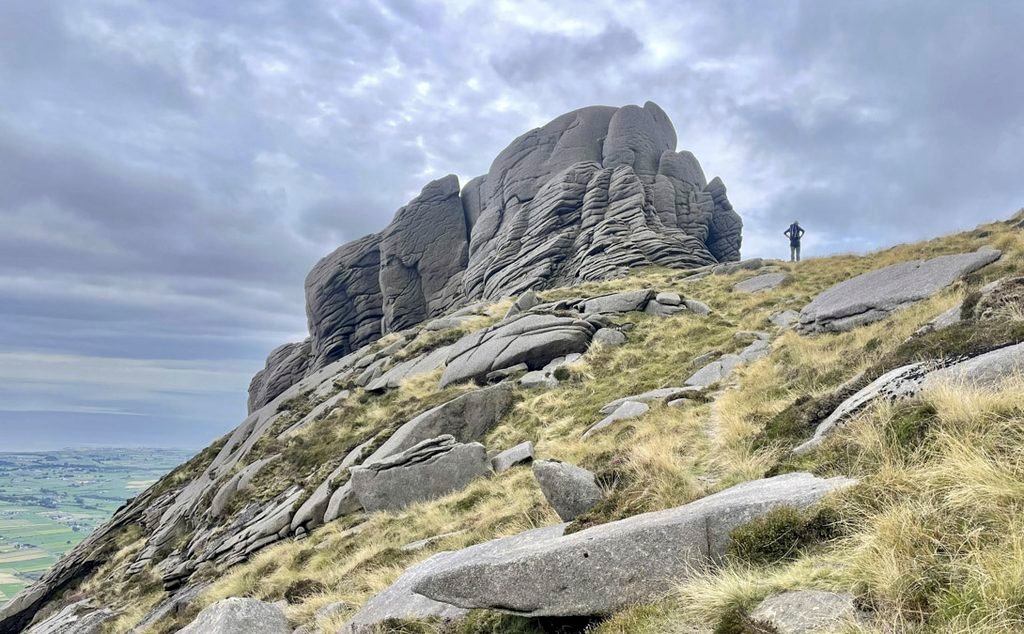
In Irish, our mountain is Sliabh Binneáin, which translates as the “mountain of the small peak(s)”, the name itself presumably chosen to identify the precise characteristics that make the mountain exceptional. The Gaelic name was anglicised to Slieve Bingian, then Bignian and latterly Binnian. Furthermore, Binnian, as it is known for familiarity, is furnished with more tors than any other Mourne height, bristling with around a dozen sizeable rocky eminences that punctuate the skyline spanning the mile-long summit ridge. To follow the path that weaves around them is arguably the finest hillwalking experience in Northern Ireland.
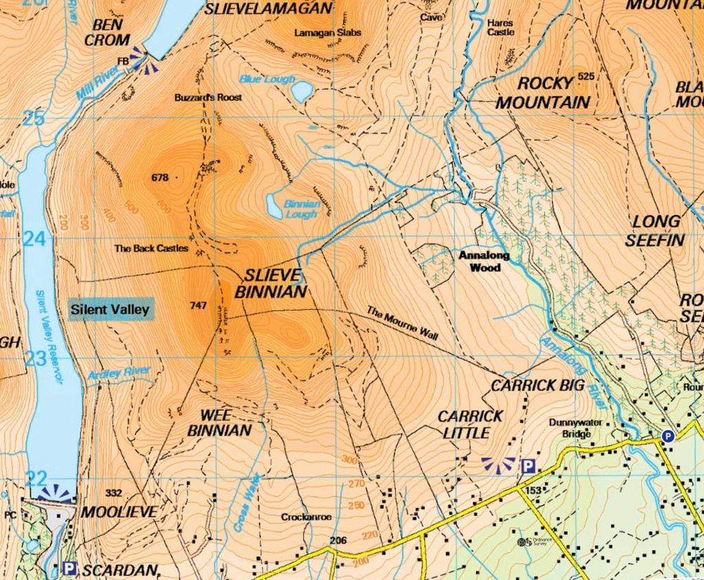
The mountain divides the Annalong Valley to the east and the Silent Valley to the west, with ascents available from both sides and from the col connecting the north ridge to Slieve Lamagan. The most popular route is from the Annalong Valley, commencing from Carrick Little on the wonderfully scenic Head Road.
With the car parks standing at 200m and the summit at 747m and just 3.6km distant, this is not a major climb, although it is toilsomely inclined in places. The initial section is carefree, following a track into the Annalong Valley, inviting a study of the defining visual characteristic of Mourne farmland – the astonishing drystone walls composed of rounded granite boulders that were scattered in wild disarray as a legacy of the ice age. To improve agriculture, the boulders were cleared and fashioned into field boundaries that are locally known as Ditches.
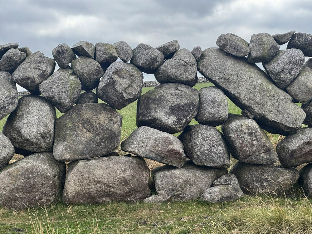
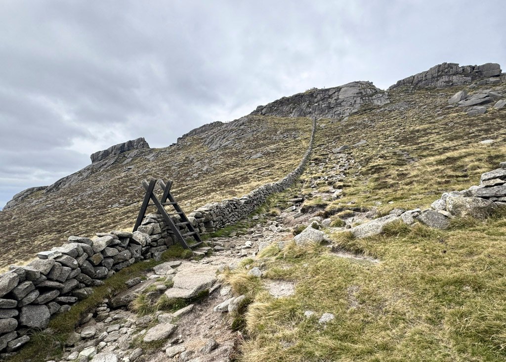
As the path diverges from the valley track, a rather more traditionally regimented wall is encountered, built of quarried granite cut to shape. This is the renowned Mourne Wall, now a “listed” structure, and built to enclose the perimeter of the catchment area for the Silent Valley water scheme. It stretches for 22 miles, crossing 15 summits and is unbroken except when foiled by vertical crags. Its purpose was to exclude animals from contaminating the water supply1.
The path follows the wall closely all the way to the summit, although higher up, rather than following the standard path to the notch as described in many guidebooks, there is more merit in crossing the Mourne Wall and slanting left to the southerly summit tors, thus benefitting from their inclusion in your exploration of the mountain.
Those commencing from the Silent Valley may be tempted by a slightly shorter distance and direct approach, although this involves two subsidiary summits; Mooleve, which is straightforward, and Wee Binian, which involves some reasonably easy scrambling to its summit, although this can be avoided. What is inescapable is the exceptionally steep hillside that rises beyond to Binnian. Nevertheless, the advantage of this route is that it passes all the summit tors, which helps distract the walker from the tiring terrain. It also affords the opportunity to study the environs of the Silent Valley in intimate detail.
The Silent Valley
The Mourne Mountains were a natural place for Belfast to look for a source of water. Initially, it was envisaged to construct two reservoirs in the adjacent valleys of the Rivers Kilkeel and Annalong. Silent Valley was the first project and borehole investigations there suggested that the bedrock lay at most 65ft underground, however, the rock turned out to be massive boulders deposited by the glaciers, and solid bedrock was not confirmed until 212ft down. To build a dam on the unstable boulders would have resulted in subterranean leakage, structurally undermining the dam. To resolve this, a vast trench was dug down to the bedrock and filled with concrete to create a waterproof barrier. The extra work compelled the project to be extended from 6 to 10 years.
The Silent Valley alone was not enough to quench the thirst of Belfast. Nevertheless, the Annalong Dam project was understandably shelved due to the bedrock issues with the construction of the Silent Valley Dam, as it was feared that a similar geological nightmare would ensue. Instead, a plan to harness the Annalong catchment was hatched, using a tunnel to feed Silent Valley.
The resulting Binnian Tunnel is 8ft wide and links the two valleys by burrowing directly beneath the mountain itself. The angle of the tunnel floor is very shallow, dropping just 18ft over 2.5 miles, so the water depth is usually just a few inches. For many decades the tunnel entrances were accessible and many adventurous locals would walk through – the line was so straight that light from opposing ends is seen throughout – and some would surf their inflatable lilos from one end to the other!
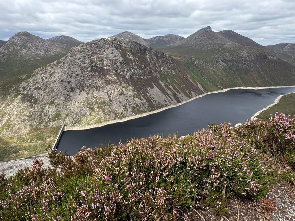
The tunnel link increased the overall catchment area of water available, nonetheless, as the reservoir capacity remained the same, water would frequently be lost during wet periods, through overflowing when the reservoir was full. This resulted in the later Ben Crom scheme, building a higher reservoir that would store supply from the Silent Valley catchment and release it into the main lower reservoir as required.
Silent Valley originally bore a Gaelic name, but that was supplanted by Happy Valley. According to an account in the Down Recorder in 1928, the name originated with Cornish miners brought in to prospect for silver in the 1840s, who were so charmed by the place that they bestowed the name upon it. Others claim it was the cheerful disposition of the miners that earned the name. In any event, it was later replaced by Silent Valley, whose frequently repeated story purports that the valley acquired this name during construction of the reservoir, when blasting and machinery supposedly drove away the birds, resulting in an uncanny silence whenever work ceased. This ecological exodus is an appealing explanation, but is merely a modern folklore myth: the Belfast Naturalists’ Field Club was already referring to the Silent Valley in 1892, more than thirty years before reservoir construction began.
The Summit Ridge
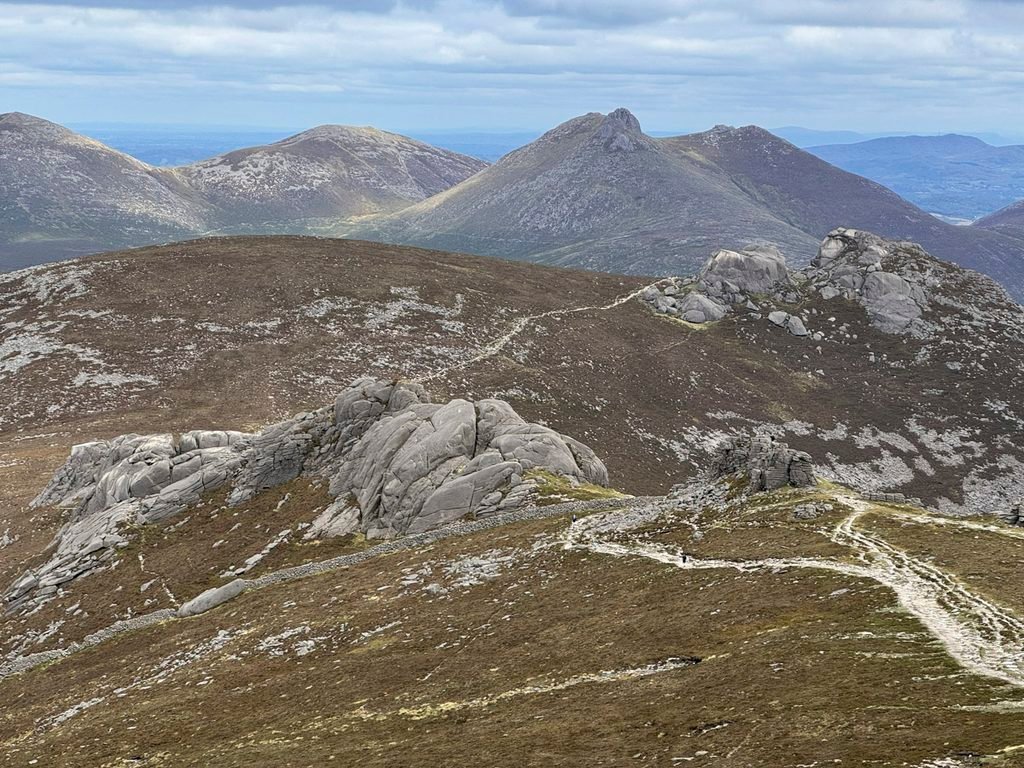
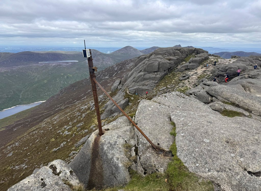
The summit itself is ironically perhaps the least compelling place, with views partially restricted by its own extended formation. However, as we progress north the delights of the unfolding Mourne mountain panorama increasingly impact on the scene. Slieve Donard, despite some criticism that it lacks excitement whilst on its slopes, soars magisterially from this angle; Slieve Bernagh (another Worthy) displays the similarly knobbled profile of our own Binnian; the Mourne reservoirs glitter in the sunlight.
The principal Binnian tors are all steep, although smoothly rounded. But now, as we descend to the level, intervening ground, the smaller, far more blocky tors of the Back Castles present themselves as rocky guardians of the landscape. As we proceed, crossing another wall, the central tors revert to the accustomed slabby nature predominant on Binnian, and directly ahead our eyes are drawn to the most imposing granite eruption on the whole mountain – North Tor.
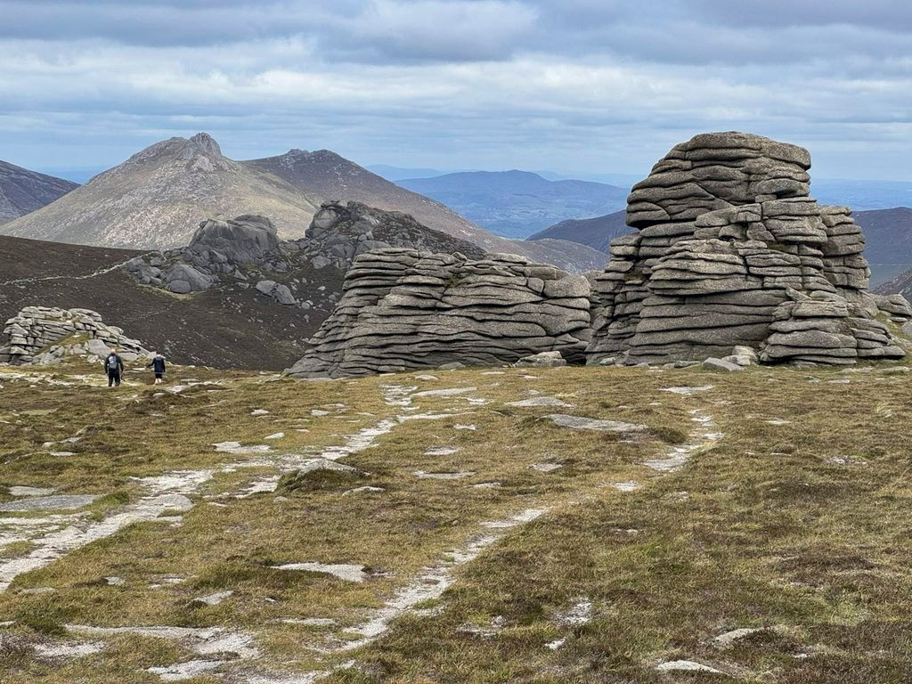
Having walked from the summit to North Tor, the natural route of descent is to drop down to the col separating Binnian from Slieve Lamagan and then turn either left or right to circle back through the low-level valleys to the respective starting points. As can be observed from the newly constructed path, this is a much-trodden route and was suffering badly from erosion. The organisation responsible for undertaking the repair work is the Mourne Heritage Trust who operate independently on behalf of the Mourne AONB (now a National Landscape, although the Northern Irish appear to be hanging on to the original title).
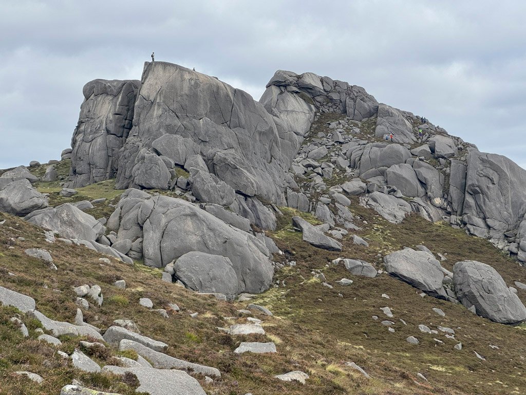
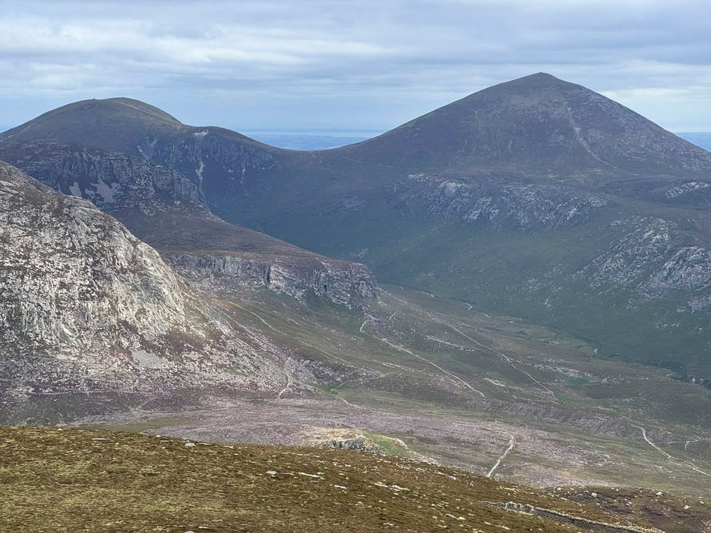
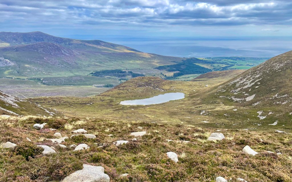
Both valley routes are appealing, the Silent Valley for its reservoirs, whereas the Annalong Valley conversely escaped flooding. It is engrossing to compare the two. If heading back to Carrick Little, Blue Lough is the first point of interest, being a natural lake in a shallow corrie beneath the ravaged face of Slieve Lamagan.
The Curious Case of Percy Bysshe
As the stony path proceeds beyond Blue Lough, it descends beneath an outcrop seen to the left, which bears the intriguing name of Percy Bysshe. There is a cave within it – there are several caves in the area – and some rock climbing routes. Locally, it is apparently known as Scotch Rock, however, the world at large calls the outcrop Percy Bysshe and this is what is printed on the maps. The name is too compelling not to be associated with the poet Percy Bysshe Shelley – but in what context? Shelley did visit Ireland, although I have discovered no evidence that he explored this wild place. In the absence of fact, my personal hypothesis is that the naming of the outcrop came much later, perhaps when climbers were inspecting the crag. Observing that it had suffered shell damage from the US Navy, they invented a pun – the rocks had been heavily shelled → Shelleyed → thus thoroughly Percy Bysshed! Such are the strange wanderings of the weary walker’s mind. Nevertheless, to further strengthen my mischievous proposition, an unexploded American shell was discovered close to Percy Bysshe as recently as 2018.
Full Circle
Beyond Percy Bysshe the path levels out and becomes even more substantial, having served the numerous former granite quarries in the valley. Mourne granite was highly valued as a building stone from the early 1800s and a considerable industry developed to supply the growing industrial cities such as Belfast and Liverpool with material. It is claimed that up to five ships every week departed from Annalong Harbour bound for Liverpool with a cargo of ‘setts’ (paving stones), leading to the Mourne folk traditionally claiming to have “paved Lancashire”.
The stones beneath your feet make for rough going, with the path remaining above the valley floor. Shortly before once again meeting the Mourne Wall glance down to the river, as this is where the Binnian Tunnel commences its passage to the Silent Valley.
This is one final reminder that throughout the savage landscape encountered today, the hand of man has been present, yet the human endeavour of monumental construction exists harmoniously within it. Slieve Binnian has absorbed it all, remaining noble and untainted – and its tors continue to reign supreme.
Footnote:
- The Mourne Wall was a public-health measure that inadvertently created one of the defining features of the Mournes. Not only was an increased volume of water necessary to serve Belfast, but even more important was an uncontaminated one. The rapidly growing city had suffered repeated cholera epidemics during the nineteenth century, while typhoid remained a serious public-health problem as the Mourne scheme was being developed. As regards eradicating disease, the new water supply was a major success.
Worthy Rating: 77
Aesthetic – 24
Complexity – 13
Views – 17
Route Satisfaction – 14
Special Qualities – 9