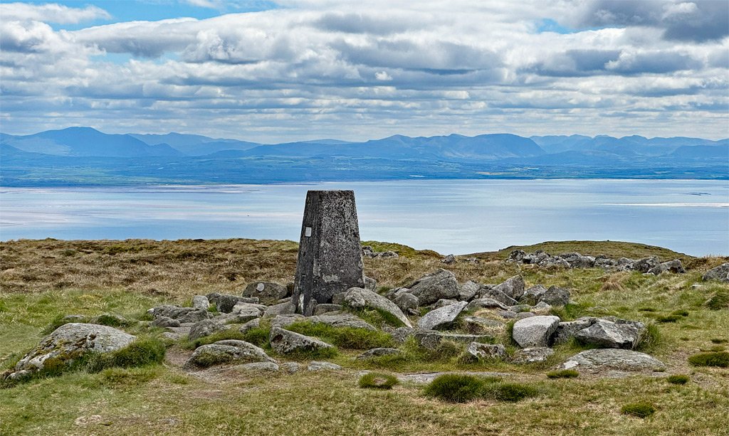
Criffel is no mountain, although at 1867ft (569m) it is not that far off attaining official status. However, precise altitude is irrelevant, because it forms the highest ground for many miles around, with no serious competition coming for twenty-five miles, looking either due north to the Lowther Hills, or southeast, across the Solway Firth, to the northern fells of the Lake District.
A coastal location above the Solway Firth, augments the perceived elevation and lends an air of seclusion. Nonetheless, Criffel is merely the highest of a cluster of rounded hills that occupy this southeastern corner of Dumfries and Galloway. Dense forestry submerges some of these lower hills, further obscuring the landscape, while others break the surface like stranded islands.
There is a dramatic contrast of geology at play here, and the juxtaposition of Criffel, rising starkly above extensive sandflats, marshes and low-lying fields, resulted in the designation of the Nith Estuary National Scenic Area. Whilst the shallows comprise sandstones, Criffel is a granitic pluton – an igneous intrusion that became revealed as the softer rocks around it were weathered away.
The map below can be moved around or zoomed in and out to change the scale
The neighbouring hills are not easily combined with Criffel; any thoughts of exploiting natural links being dissuaded by forestry, and Criffel is therefore normally climbed as the solitary objective. Furthermore, historical tradition has limited those ascents to a simple choice of two paths, which can be combined into a circular outing, although the existence of boggy ground on one of those routes, results in a clear favourite.
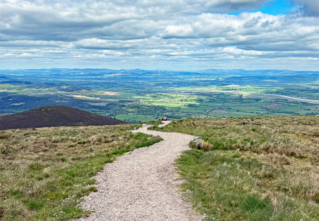
The shortest and driest climb is from Ardwall, making it the more popular route. In addition, a grant of £210,000 from the Scottish Government in 2020, completed the construction of a new footpath, the lower half having been previously upgraded in 2010. Whereas the upper reaches of the Ardwall path were formerly appallingly muddy and braided, now it’s a dry-shod breeze. Although I haven’t mentioned that it remains quite steep, climbing nearly 1700ft in less than two miles. Well, it is almost a mountain.
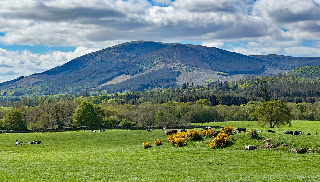
There isn’t much else to say about this path; the first half ascends through forestry, accompanying the Craigrockall Burn, and it’s clear to follow throughout. It’s also remarkably popular.
The woods are managed by the Forestry Commission and were planted originally in the 1950s, the trees now mostly on their second rotation. The predominant species is Sitka spruce, although the current management plan aims to reduce this supremacy. The Forestry Commission are recognising the importance of recreation and wildlife, pursuing a policy to “increase species diversity to enhance landscape value, while maintaining productivity”. This involves reshaping woodland edges to soften the visual impact, and considers wildlife in particular by the planting of trees friendly to red squirrels. These include Norway spruce and Scots pine. Some broadleaved woodland is replacing larch at lower levels, thus maintaining autumn colour.
Don’t be shocked if you encounter pigs in the forest. These are in fact feral, originally having escaped from farms, and this is one of three areas in Scotland where localised populations have become established. Unfortunately, due to fears of disease, the numbers have to be controlled and culling does take place.
For a slightly longer walk, the approach from New Abbey can be considered, and potentially combined with Ardwall, for a circuit of 5.5 miles (9km). The two starting points are linked by walking through the forest above Loch Kindar, which is notable for a natural island containing a ruined church, and two crannogs (artificial islands supported by wooden frameworks). The loch is well-stocked with rainbow trout for private fishing.
For the New Abbey approach, there is a car park at Glen Burn, nearer the hill, although New Abbey itself is worth a visit, being an especially historic village, renowned for Sweetheart Abbey, a ruined Cistercian monastery.
The first half of the path is again through forest, on a well-made track, but once the scene opens up, the path deteriorates and reverts to the nature of most of the hill – boggy. A subsidiary top of Knockendoch is crossed before the gradient eases for the final stretch to Criffel. Note: if descending by this route, do not attempt to head directly between the two summits, as your feet will get wet, so take the main Ardwall path down, until a faint path leads left (north) and traverses around the northern slopes of Criffel to the col between the two tops.
It is interesting to note that both routes are classed as Core paths, recognised by the Scottish Government, to serve as dedicated open access for recreation. However, as can be observed, the actual surface of the path is irrelevant to this status, whether groomed gravel, or monstrously muddy.
And so, to the main event – Criffel’s summit view. This is what lifts an average walk to Worthy level. In fact, the prime views are actually from Dumburn Hill, a few minutes’ walk to the south of the summit, although most people settle for loitering around the oversized cairn and the triangulation pillar. The cairn is known as Douglas’s Cairn, ostensibly a reference to the Earls of Douglas, although its provenance is sketchy.
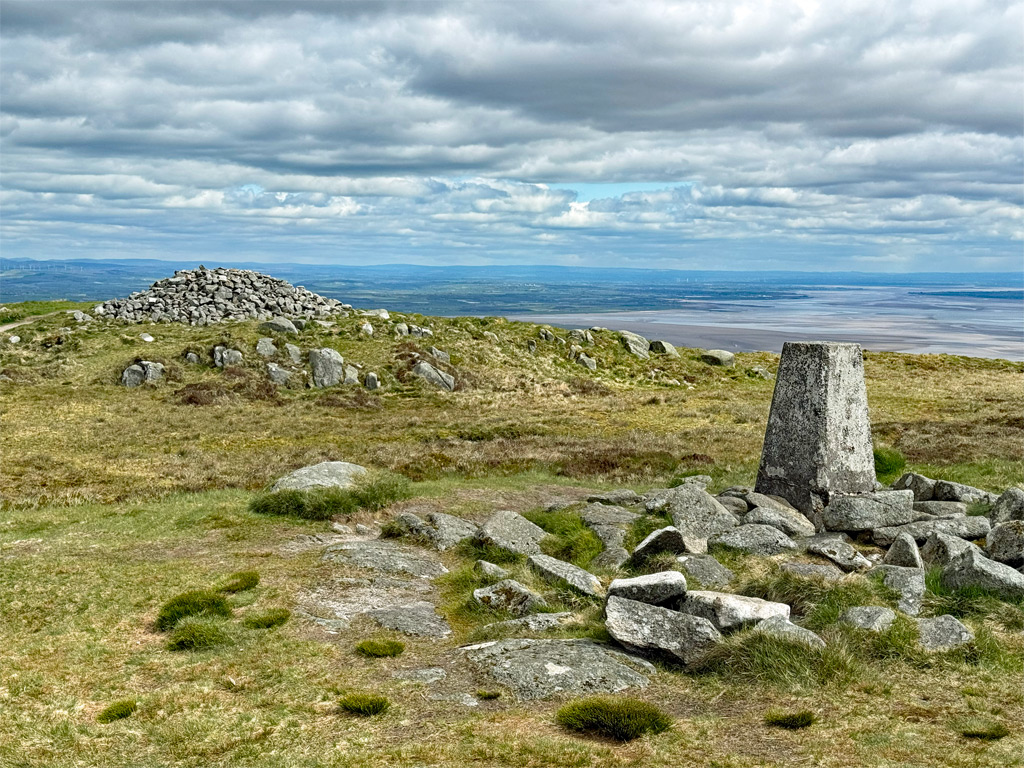
Likewise, the etymology of Criffel is equally unclear, not merely because its spelling has changed throughout the centuries. Certainly, the “fel” evokes the not-too-distant fells of Lakeland, and also on a Norse theme, some sources claim the name means “Raven’s Hill”, although you are more likely to see – or rather hear – skylarks.
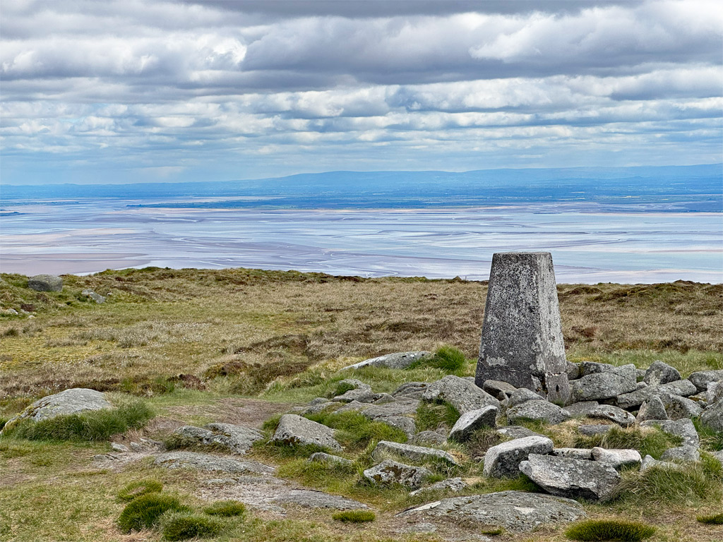
The trig point reflects the topographical importance of the hill, with far-reaching vistas in every direction. For this reason, it was one of the initial Primary triangulation stations, the next nearest Primary neighbour in view being Skiddaw.
And finally, because this hill rises in relative isolation, it posed a danger to aircraft navigation, particularly during wartime training missions, and in 1944, a plane crashed to the northwest of the summit. Thankfully, all the crew survived. The wreckage is still visible, although partially concealed by heather.
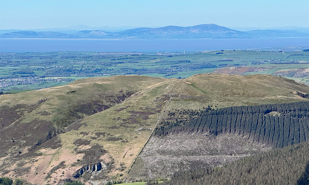
If you are a local, you will already have climbed Criffel. If not, and you happen to be within striking distance of Dumfries, and it’s a clear day, then you will be well rewarded by the diversion. After all, when you are next on those northerly Lake District tops and gaze across the Solway, you’ll now know exactly what you had been looking at for all these years.
Worthy Rating: 67.5
Aesthetic – 22.5
Complexity – 9
Views – 16
Route Satisfaction 13
Special Qualities – 7