Langdale Pikes – Lakeland’s Natural Billboard
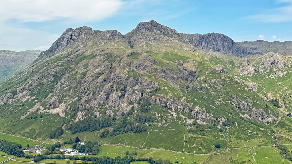
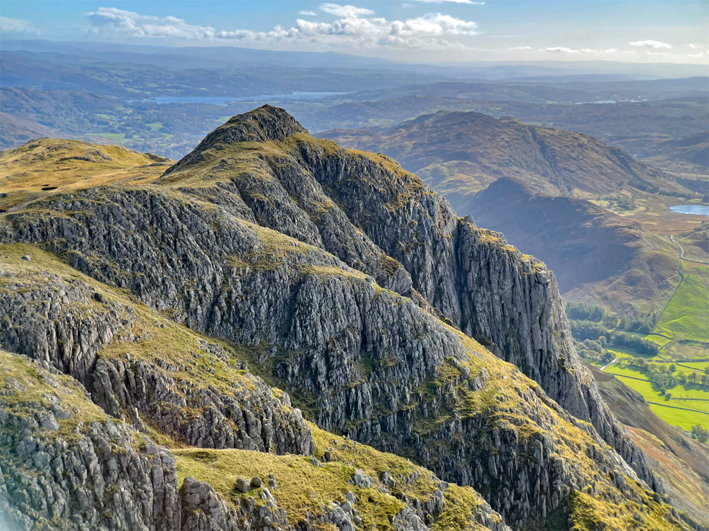
The classically romantic prospect of the Langdale Pikes, when viewed from the glittering shores of Windermere, or the agreeably open common at Elterwater, was the quintessential showcase of Lakeland’s mountain splendour for the Victorian tourist. Today, this bustle of bristling summits surmounting a bulging fellside and etching the skyline with compelling distinction, still possesses enough impact to stop you in your tracks.
Nature has distilled a supreme blend of beauty and grandeur, creating a showpiece of irresistible attraction, where the tourists gaze in wonder and the hillwalker yearns to be a part of the picture, immersed in its celebrity.
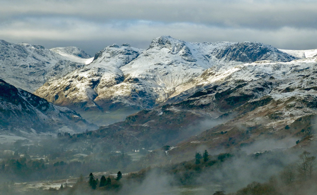
And so, with an ‘aesthetic’ of such calibre why do the Pikes not receive a full ten out of ten? From many angles they do, the composition subtly and pleasingly modified as the viewpoint swings around the compass, until the perspective from the north begins to dominate. Here we enter the shop window rather than observe it from outside and everything changes, for the shop is empty.
It is not that the Pikes are merely a façade, the frontage is not a painted stage set, as the props are real and brimming with interest. However, a step behind the main curtain reveals an astonishing contradiction, for here lies a plateaued expanse of nullity, an extraordinary contrast into what Wainwright described as ‘a high and featureless tableland of interest only to sheep’.
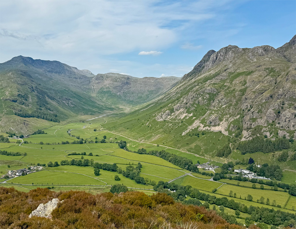
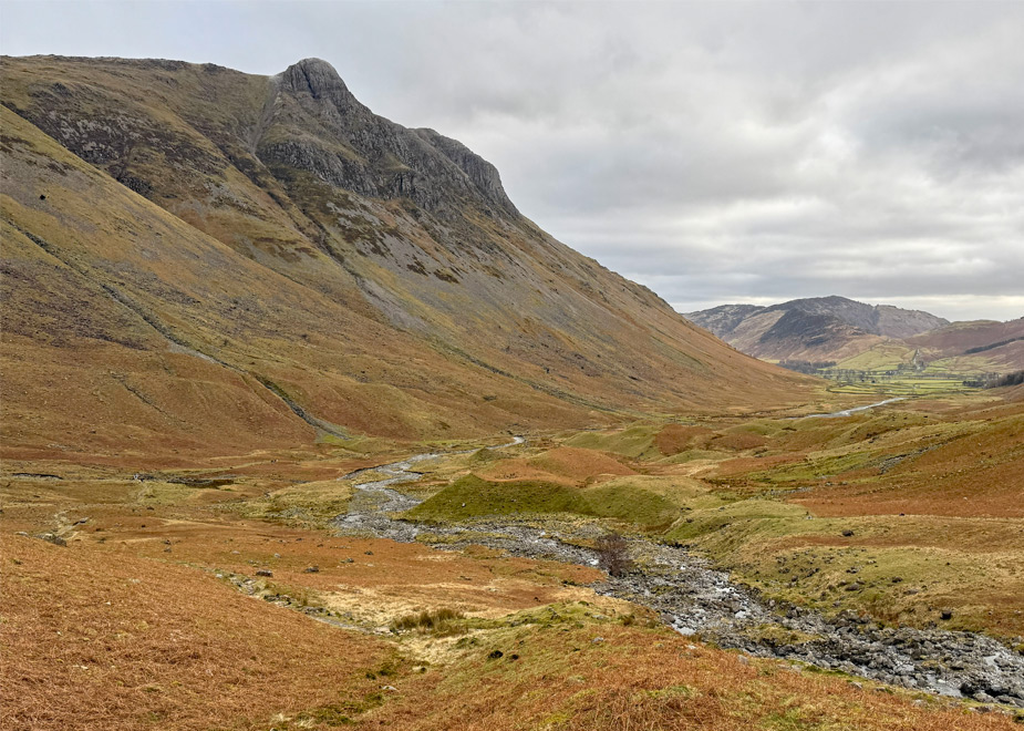
The Langdale Pikes form the southern gateway to the Central Fells and for most people they represent the highlight of that massif, being so different in character to the otherwise undistinguished terrain that constitutes the majority of the range.
There is some debate as to how many summits comprise the ‘pikes’. Several distinct tops populate the vicinity, each with individual appeal, although for the early writers it was the dominant turret of Harrison Stickle and the singular dome of Pike o’ Stickle that were generally considered as the focus. Wainwright’s book ‘Favourite Lakeland Mountains’ lists five pikes, elevating Loft Crag and Pavey Ark to the royal household, along with Thorn Crag, which AW didn’t actually recognise as a separate fell in his guidebooks. As we progress with an analysis of each top, you can decide for yourself.
The map below can be zoomed in or out to alter the scale:
For the purposes of our Langdale Pikes ‘Worthy’, we are drawing a baseline through Great Langdale from Millbeck (New Hotel) to the head of Mickleden, enclosing the summit scarp that sweeps back from Stake Pass to Pavey Ark, whilst generally ignoring the tops to the north. Ascents can be undertaken from Borrowdale or from Grasmere and do augment the complexity of the pikes, however, whilst recognising this aspect, other fells would generally be traversed enroute and so these approaches are excluded from this feature.
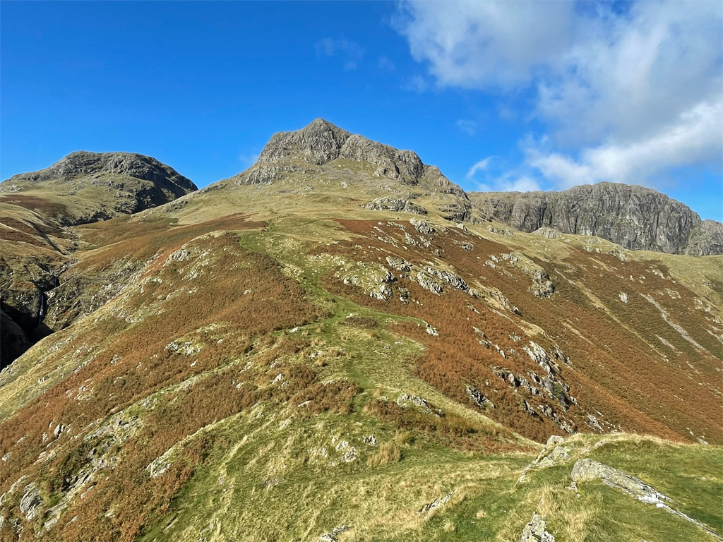
Harrison Stickle is the highest of the pikes at 2413ft (736m) although, whilst altitude is not its selling point, the fell, in common with Pike o’ Stickle, is notable for the uniformly unrelenting southern flanks that tumble for over 2,000ft to the floor of Great Langdale valley. This dramatic aspect, allied to the shapely summits, accounts for the powerful impact the pikes deliver to the observer.
Harrison Stickle likely takes its name from the Harrison family who farmed much of Great Langdale in the 16th and 17th centuries. The Dungeon Ghyll New Hotel, popularly the ‘New DG’, was one of their properties, which they converted to a hotel in 1862 to cater for the increase in tourism. It is from the hotel that the majority of ascent routes commence, each with numerous permutations.
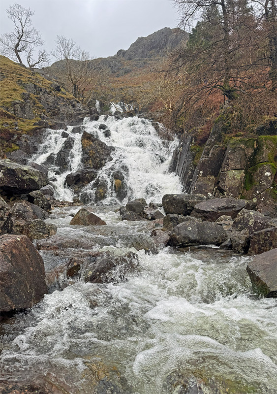
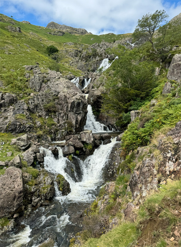
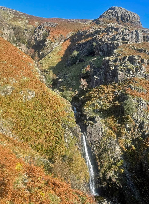
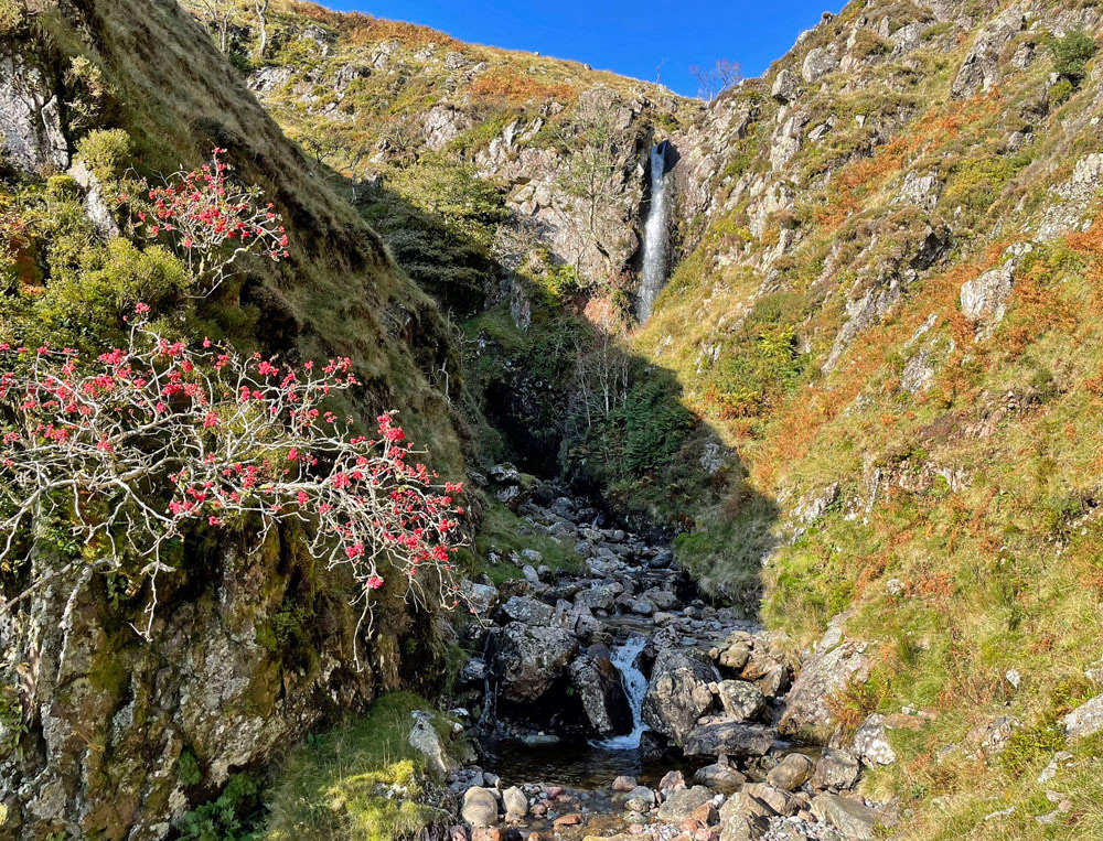
As you leave the commodious (but often not commodious enough) car park at Stickle Barn, there is a sheepfold repurposed from a ruined former medieval fulling mill, where wool was degreased and thickened. Further right is Millbeck Farm which, like the car park, is in the hands of the National Trust and, on the west bank of the beck, is Miller’s Crag. It therefore comes as no surprise that this stream was commonly known as Mill Gill until recent decades when Stickle Ghyll has taken favour.
Waterfalls were a favourite of the Victorians and Stickle Ghyll displays several fine cataracts, which add interest to relieve the steep ascent. The massively constructed path, a necessity due to the sheer volume of traffic, has several variations although the crowds generally adhere closely to the western side of the beck. The eastern side, once a popular ascent, is much quieter.
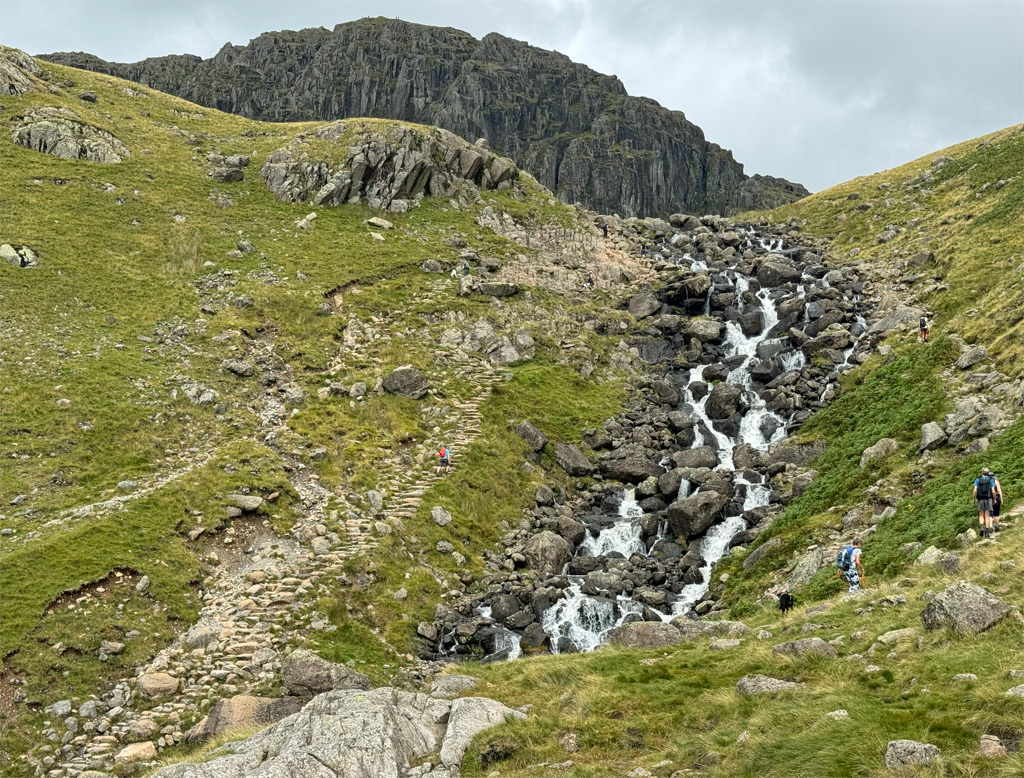
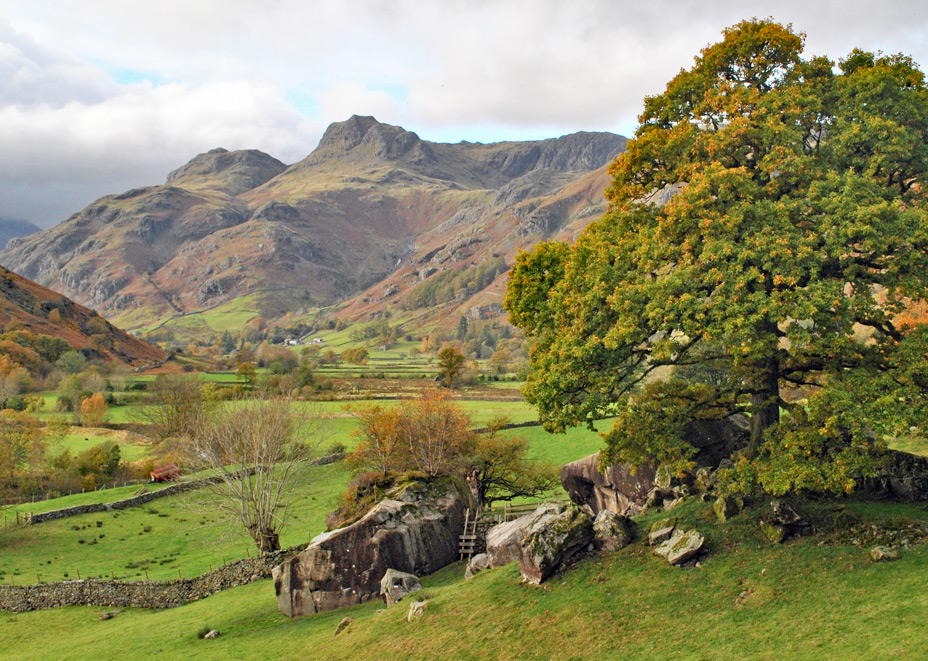
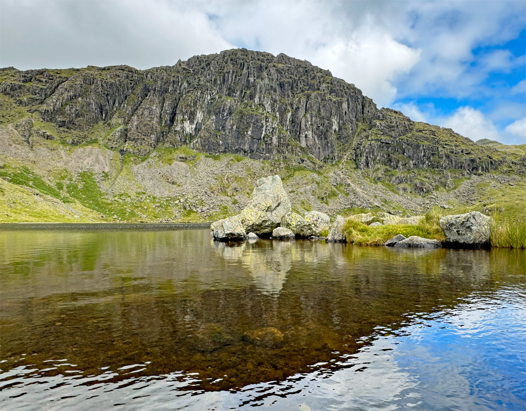
The imposing vision of Pavey Ark framing the sky above Stickle Tarn is unforgettable, the potency remaining powerful no matter how many times it is seen. Personally, I have always considered Pavey Ark to be one of the ‘pikes’ as its presence is integral to the overall, iconic picture. It’s a big crag too, the scale swollen by the apron of steep scree at it foot.
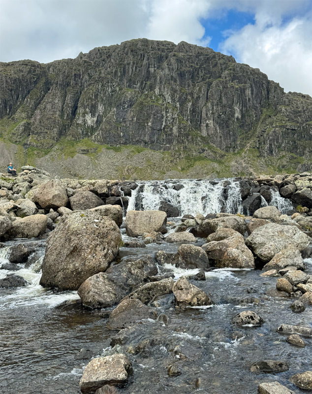
Stickle Tarn is a natural glacial lake that was deepened to around fifty feet and doubled in size by the building of an embankment dam in 1824, to provide a reservoir for the Elterwater Gunpowder Works, boosting the flow in Great Langdale Beck at times when levels were low. Now long disused, the dam began to deteriorate and its owners, the Lake District National Park Authority considered removing the embankment in the 1950’s to remove the cost of future maintenance. In 2015, for similar reasons, Stickle Tarn was put up for sale at an estimated price of just £20,000 to £30,000. Naturally there were many caveats in place, and many public outcries, with the sale eventually abandoned. Nevertheless, other less controversial national park land was successfully sold.
For many visitors Stickle Tarn is their destination, leaving the pikes to the fellwalkers. Some of latter, intent on merely climbing the highest pike, take the path up the slopes to the left of Pavey Ark bound for the summit of Harrison Stickle. Far better, of course is to ascend Pavey Ark as well. A popular route is the North Rake, so-named by Wainwright, which takes a line out of view behind the crag and was described by AW as a ‘remarkable grassy breach’. It remains a striking feature, although heavy footfall has rendered it less pleasant.
Wainwright also suggested Easy Gully as an ascent, although it is very seldom climbed these days, the boulder choked section being somewhat more tricky than the long-legged AW declared it to be. Mostly though, Easy Gully is not climbed because it commences at the same point as the far more renowned and spectacular Jack’s Rake, which slants boldly across the face of the crag.
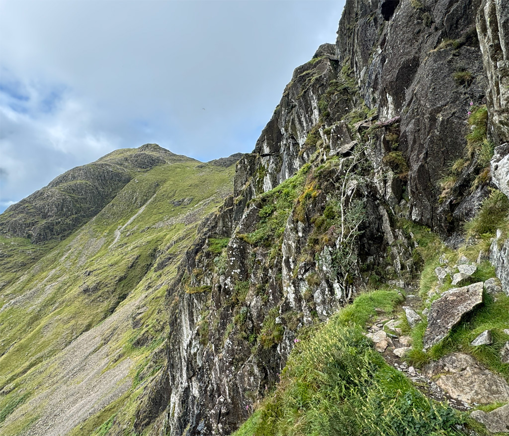
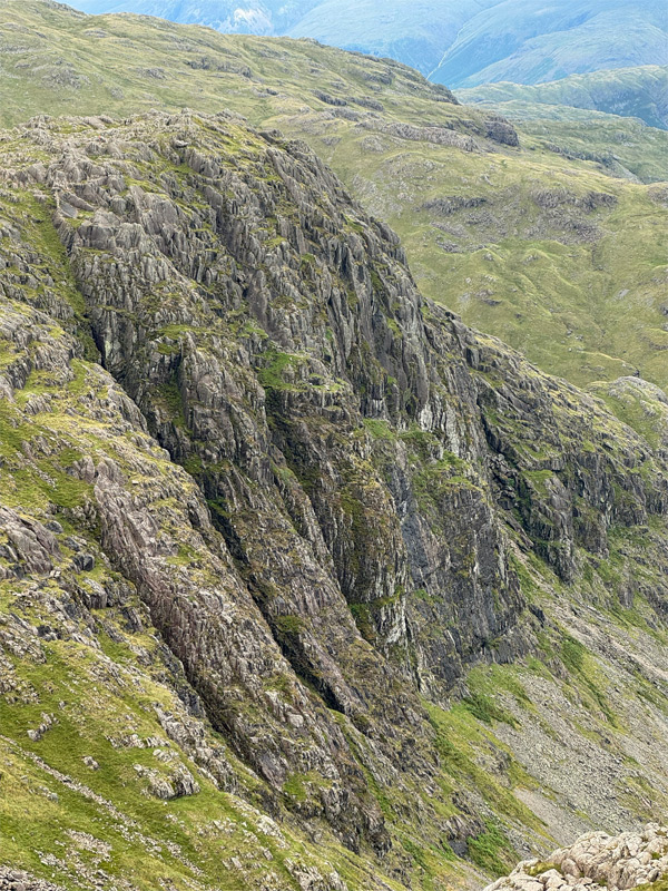
The crag is massive, although well broken and the overall side profile lies well off the vertical. However, it takes the form of precipitous sections interspersed by grassy shelves. The face is riven by several deep gullies and these attracted the early pioneer rock climbers. Much of my early rock climbing escapades in the 1970’s were here too, as Dungeon Ghyll was accessible by bus. By that time there were some seriously bold climbs on the open faces, but I had no money and my equipment was little better than the early pioneers. I blame whoever bought me a copy of Owen Glyn Jones’ 1897 book ‘Rock Climbing in the Lake District’ for Christmas, which naturally drew me into the ‘gully epoch’ and firmly entrenched my route choices to those of the past.
Jack’s Rake was originally classed as a rock climb, although is now a grade 1 scramble, nonetheless it warrants caution, especially in anything other than dry conditions. The rake in its lower half is a shallow groove which shields the climber from undue exposure, although being enclosed can make passage more awkward for those carrying a large rucksack. It also serves as a runnel for draining water. The upper part is more airy, with no definitive route, which may unsettle those of limited confidence. Sometimes it really is better to have no choice! The natural way leads into Great Gully, but soon steps left before this becomes difficult. There then follows a high step onto a slab, which may feel daunting when damp, otherwise you can actually step down and a go a little further to the left before heading up the far side of the slab. Above that all is plain sailing.
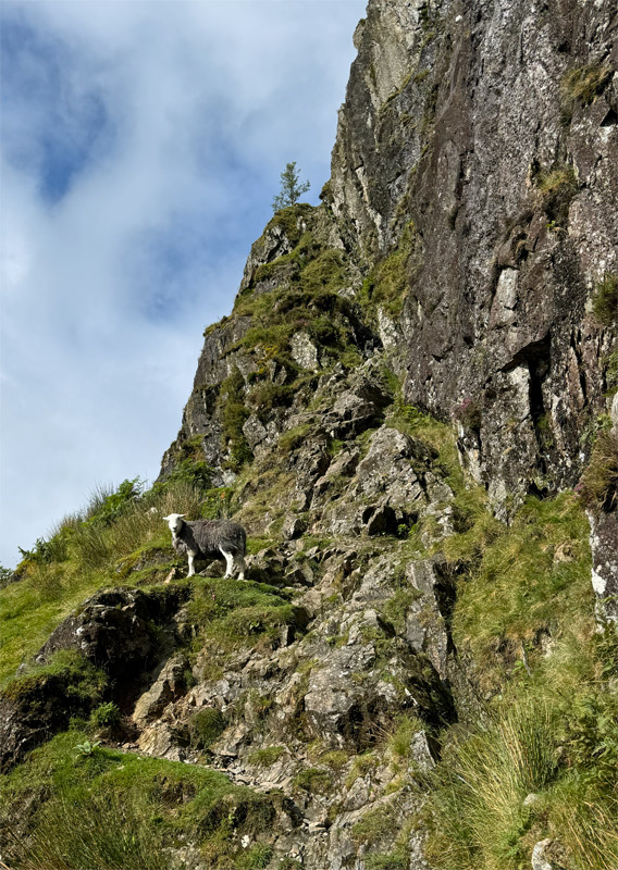
The top of Pavey Ark is a fine, rocky place, yet can’t avoid delivering a slight anticlimax, for there is no pointed peak, merely a gently rising plateau that drifts up to Thunacar Knott, the true summit of the hill. This aspect is not appreciated when ogling the iconic view from afar. One might think of Pavey Ark as the Lake District’s version of a climb to Conan Doyle’s Lost World, complete with cute Herdwick dinosaurs!
Almost everyone having climbed Pavey Ark will wander around to Harrison Stickle, less will do the reverse and there is perhaps some justification for this because, from Harrison Stickle, Pavey is seen for being the crag that is and not really perceived as a separate mountain.
Those who do not climb Harrison Stickle from Stickle Tarn usually follow the time-honoured main ascent known as Mark Gate, which initially follows the stream of Dungeon Ghyll that lends its name to the hotels. The spelling Ghyll as opposed to Gill, is an affectation in these parts and possibly to be laid at the door of William Wordsworth who employed it for his poem ‘The Idle Shepherd Boys’ published in 1798, which describes Dungeon Ghyll Force, one of the many waterfalls in the ravine. The poet’s popularisation of the falls made it a particular draw for the early tourists, for whom a ladder was provided to gain access. The ladder is no longer there and a confrontation of tree roots requires entanglement in order to find this now secretive waterfall.
Dungeon Ghyll can be followed as an intrepid scramble in its lower half, seemingly a world away from the busy Mark Gate path. You will likely be totally alone on one of Lakeland’s busiest fells. There is nothing particularly difficult to negotiate and an exit left at the final waterfall should be made to regain the Mark Gate path. This climbs to Thorn Crag, which does have the craggy aspect of a separate pike when viewed from below, but lacks identity once attained.
The upper ravine of Dungeon Ghyll, bounded by Thorn Crag on its west side, is inaccessible for ordinary mortals. Wainwright enthusiastically described it as a ‘remarkable manifestation of nature’s primeval sculpturing’ and thankfully it can be viewed from the alternative ascent (or descent) via Pike Howe, which takes a narrow trail through scree above the gorge. The very top of Dungeon Ghyll gives way to a boggy hollow called Harrison Combe, which provides the source of the stream. Overall, this a much quieter path than Mark Gate, offering excellent views, particularly from the miniature summit of Pike Howe itself.
And so to the great bastion of Harrison Stickle whose ridge top summit provides two cairns. It is the north, rearmost top that is the highest point, although there is also a cairn on the south top. The contrasting views are equally engaging.
Such is the importance of this mountain that in Wainwright’s Central Fells guide, Harrison Stickle receives the most pages of any hill in the book.
From Harrison Stickle, the true nature of Pavey Ark (left) is revealed, with the antics of those tackling the upper part of Jack’s rake well seen from this vantage point.
The claim for Loft Crag as one of the pikes is, like its neighbour Thorn Crag, in doubt. Loft Crag was not even named on the early Ordnance Survey maps, while strangely, the OS have consistently acknowledged the existence of Thorn Crag. Some guidebook writers too, including WA Poucher in his ‘Lakeland Fells’ book, pretty much ignored it. However, there is substance to Loft Crag, in the form of a small but neat summit cone, a thrilling little perch. Significantly, the fell also takes full possession of one of Lakeland’s finest rockfaces, Gimmer Crag. As climbing developed from the confines of the gullies on Pavey Ark, Gimmer took over as the leading climbing ground in Great Langdale. Even I progressed to tackling the routes there, one of my favourites being the curiously titled Kipling Groove… so-called because it’s ‘ruddy ‘ard’!
Where Harrison Stickle is king, Pike o’ Stickle is the undoubted queen, her distinctive stately crown being one the most recognised sights in the Lake District. It is remarkable how often this dome intrudes into a view, its ubiquity evident even from the ‘wastelands’ to the north. Strictly speaking of course, we should offer more respect and retain the official title, Pike of Stickle as printed on the map. The name may derive simply from being a lower peak of Harrison Stickle or could signify its location as the peak above Stickle Breast. Stickle itself means steep, or a steep place.
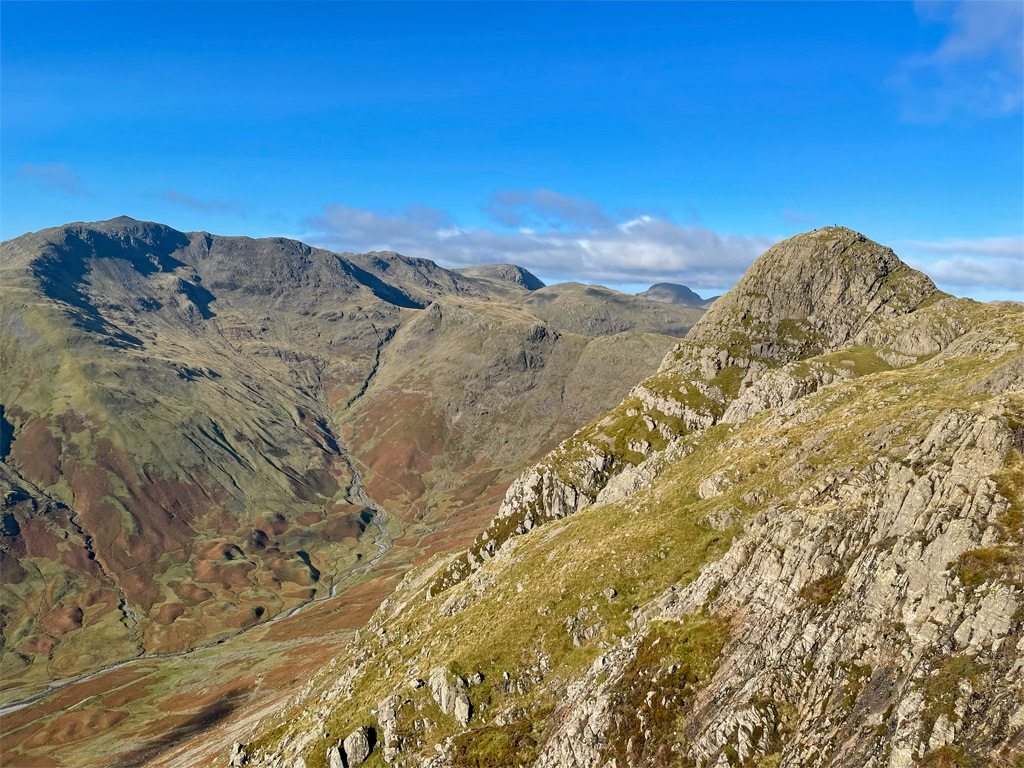
Whichever way the walker attains the summit eyrie will usually involve an easy scramble as befits the rocky nature of the top. This is a uplifting place to be, lording over the plunging canyon of Mickleden, while admiring the powerful presence of Bowfell above the head of the valley. Loft Crag blocks the lower Langdale valley, concentrating attention of the verticalities of Gimmer Crag.
In my youth, the quickest and most thrilling descent was to launch into the south scree shoot, surfing the river of stones that carried the scree runner rapidly down into Mickleden. Those times are past and through overuse the screes are now considered a hazardous place to be. A small part of culpability for this outcome must be laid at my door, as I was one of those giddy young men that knew no better and relished the evil art of scree running.
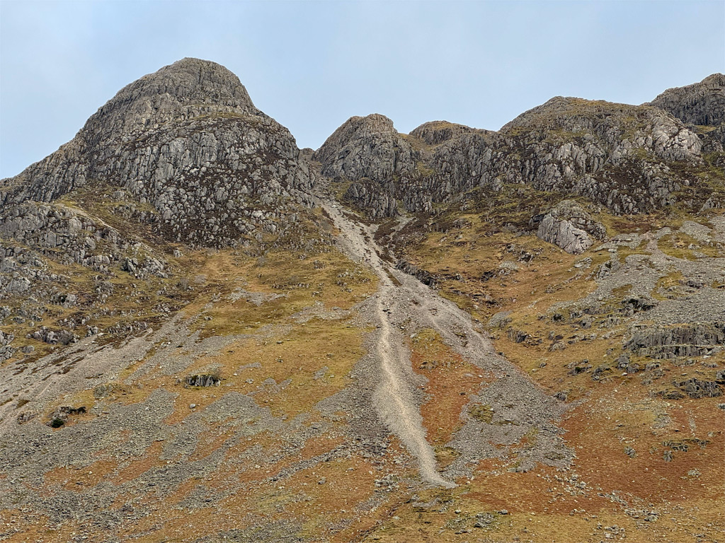
Towards the top of the scree gully is a small cave, probably created some six-thousand years ago as a shelter for Neolithic workers fashioning stone axe heads. These higher reaches of Pike o’ Stickle were the site of an axe ‘factory’, where Greenstone was extracted and chipped into shape in this immensely isolated location, even though flint was much easier to find elsewhere. Greenstone was presumably considered superior to warrant production on a large scale for such a long time. Langdale axes have been discovered countrywide and it is thought the chipping site was in operation for around one thousand years. Inferior axe heads were discarded, although the first recorded discovery here was not until 1947, perhaps by one of those early, excitable scree runners.
There were several other smaller chipping sites in the Lake District. The screes traversed above the upper part of Dungeon Ghyll on the Pike Howe path was a nearby one, with Glaramara and Scafell amongst others exhibiting activity.
At that ancient time of axe production the landscape was heavily wooded and hostile. The axes fashioned here were thought to be refined and polished nearer the coast, some returning to Mickleden to cut down the trees for agricultural activity. Evidence of prehistoric farming, field boundaries and stock enclosures can be discovered for those who choose to take the ‘back door’ approach to Pike o’ Stickle via Mickleden, Stake Pass and Martcrag Moor. There is a shorter, steeper alternative climbing beside Troughton Gill. The latter part of these routes cross moorland, feeling a world away from the glamour of the ascents from the New DG, yet they serve to broaden the diversity of the pikes, whether or not this is only appreciated by the sheep!
Worthy Rating: 75
Aesthetic – 24
Complexity – 14
Views – 15
Route Satisfaction – 14
Special Qualities – 8