Chrome Hill and Parkhouse Hill: Dragons of the Peak
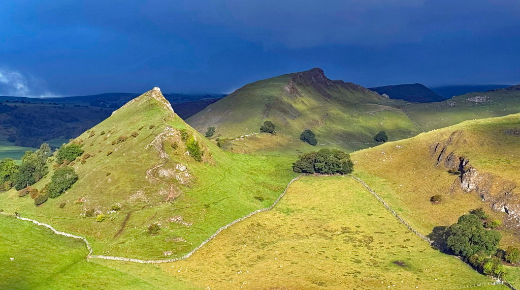
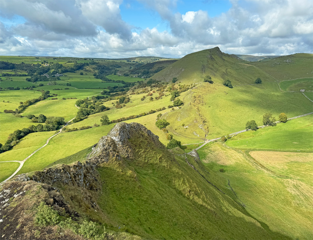
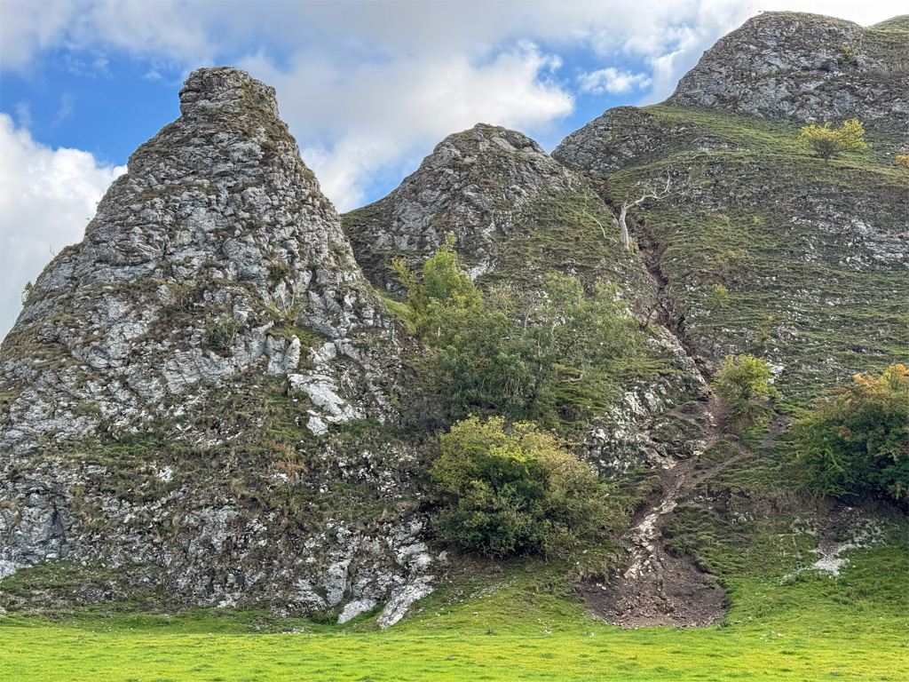
There are few hills worthy of the name ‘peak’ in the Peak District, with two very distinct exceptions. Geographically secreted in the upper Dove Valley, Chrome Hill and Parkhouse Hill are spectacular craggy etchings on the skyline of the limestone landscape.
Figuratively titled the Dragon’s Back, these peaks are not the only examples of the name, which occurs most famously in Hong Kong, where it is employed for a verdant mountain trail with stunning coastal views. In Wales there are two dragons; one a knobbly ridge ascending the Black Mountains and the other is the title of an endurance race traversing the heraldic spine of the country. However, the Peak District dragon is perhaps the most visually stimulating, the humped and scaley ridges of the hills capturing the essence of giant, petrified mythical reptiles.
But there’s a puzzle. What possible connection could there be with these two jagged Derbyshire peaks, the Great Barrier Reef, the phenomenon of a Double Sunset and a fixation for Norwegian musicians?
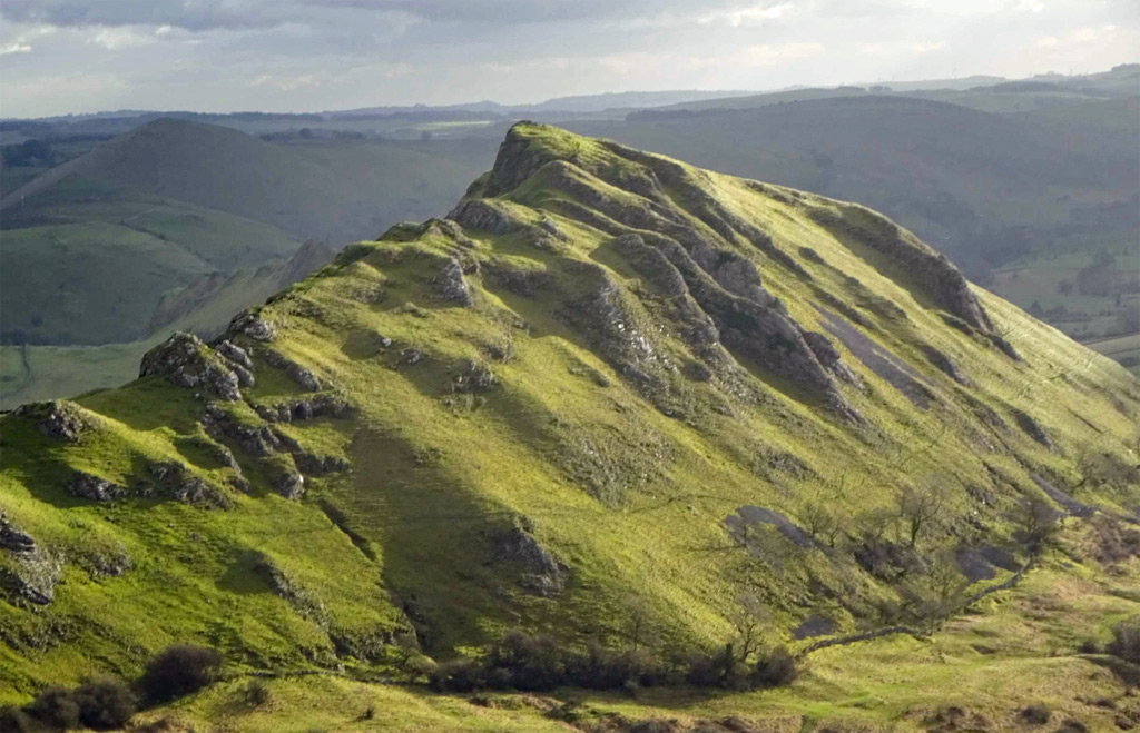
If you were standing on Chrome Hill three hundred and fifty million years ago, your feet would be wet, paddling in a warm, shallow sea not unlike the conditions that currently prevail off the eastern coast of Australia at the Great Barrier Reef, the world’s largest coral reef system. Incidentally, it’s called ‘Barrier’ for good reason, being a major hindrance to shipping as Captain Cook accidentally discovered when he ploughed into it when mapping this part of Australia. The formation of Chrome Hill and Parkhouse Hill was similar, these being reef knolls, composed of formerly living structures creating islands in the ocean.
In the case of our reefs these organisms are now fossilised, with the fossils being protected under law from the hammers of hunters, through the designation of the area as a Site of Special Scientific Interest. So, in addition to contemplating the striking views from the hills, take time whilst exploring to examine the rocks for the abundant fossil specimens.
The dramatic profile of these hills is further ennobled by their steep sides conspiring to create a rare astro-geographical phenomenon known as a Double Sunset. Basically, this is where, late in the day, the sun sinks behind a large object as though setting, only to remerge on the other side before setting for a second time on the lower horizon. This paradox is very much dependent on the precise location of the observer although, with precise geometrical planning amongst all the pointy mountains of the world, I would suggest the phenomenon is not quite so uncommon.
The double sunset at Chrome Hill was first observed in 1997 by writer and ecological campaigner Jeff Kent, who wrote a book about the subject. The sun initially sets behind the hill for around twenty minutes prior to its reappearance. From Jeff’s website he advises “the Chrome Hill double sunset can be most conveniently seen from the B5053 immediately north of the phone box in Glutton Bridge (grid reference SK 08346 66570) from 8.35 p.m. onwards on the summer solstice”.
Sightings can also be achieved at Thorpe Cloud also in Dovedale (another reef knoll) and in the town of Leek, where in Victorian times the double sunset behind Bosley Cloud was a celebrated attraction from St. Edwards churchyard. However, due to the microscopically changing tilt in the earth’s axis the best vantage point for Leek is no longer the churchyard.
And finally, before examining the hills in more detail let us address the bizarre Norwegian association alluded to earlier. There is a Jazz band in Norway actually called Chrome Hill, having changed their name from ‘Damp’ (also unconventional, although maybe there is something lost in the translation!). Previously, band members had collaborated on a piano instrumental entitled Chrome Hill and later a song called ‘Up on Chrome Hill’ and, having listened to the lyrics, I can confirm it is undisputedly inspired by it. Why, with all those astonishing mountains in Norway, they chose to adopt this little spiky upstart is a wonderful testament to the hill’s character.
The map can be zoomed in or out to change the scale
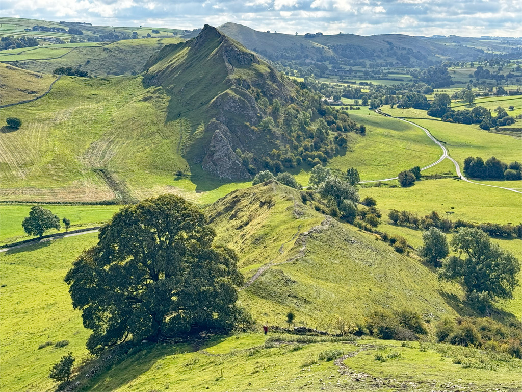
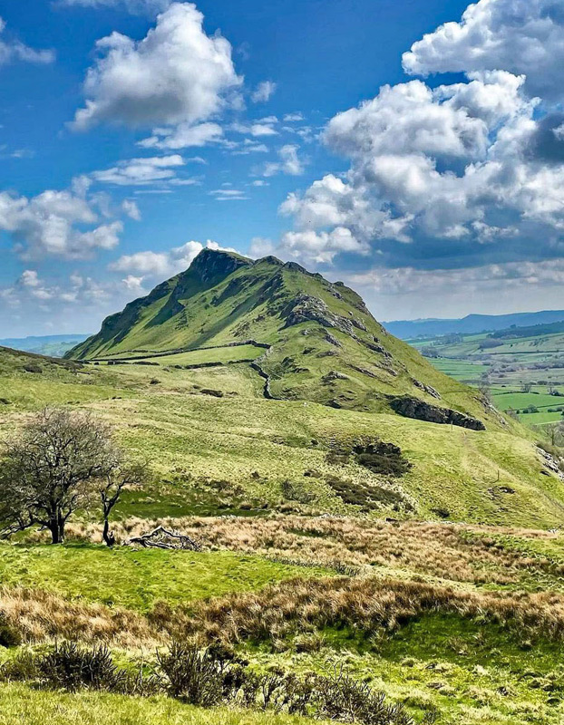
Neither hill is especially high, even nearby roads attain comparable altitude, although rising in isolation enhances their impact over the taller neighbouring summits of Hollins Hill and High Edge. Chrome Hill reaches 1441ft (439m) and Parkhouse Hill a lowly 1230ft (375m) and whilst Chrome is the bulkier of the two, Parkhouse is the more ostentatious and together the unique qualities of these miniature aiguilles are sufficient to warrant Worthy status.
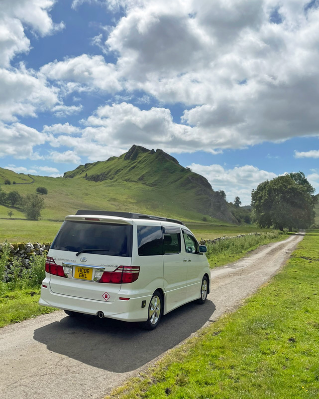
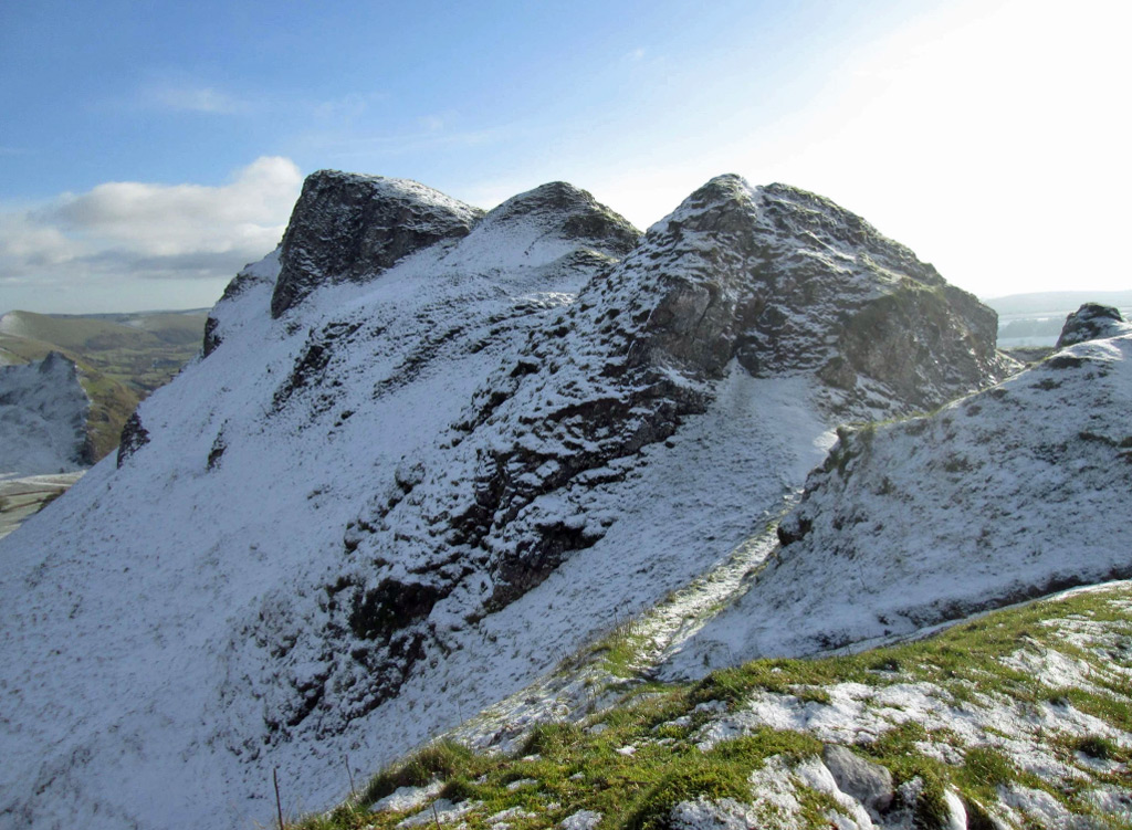
The peaks are generally climbed as a pair on a circular outing that commences at either Hollinsclough or Earl Sterndale, as there is no parking available close to the hills, which helps to contain the onslaught of visitors. There is no preferred way round, although Parkhouse Hill is the most testing part of the walk and ascending its western ridge is easier than descending it. Those who are hesitant on exposed ground may prefer to avoid this ridge. Technically there is no difficulty, except when wet or icy as limestone is particularly slippery in these conditions.
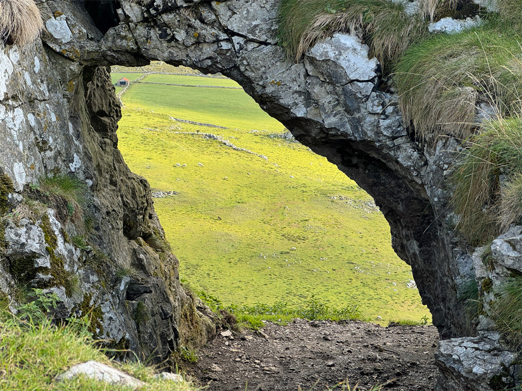
The walk from Hollinsclough, if taken in a clockwise direction, encircles Hollins Hill, involving a relatively long approach before the excitement of Chrome Hill is gained. Hollins Hill summit is less often incorporated, although can be traversed by permissive paths (not marked on OS maps), from near Hollins Farm (off the main path then up a zig-zag path to the wall leading up the ridge), or from the west via a steep waymarked path from Booth Farm. Climbing the hill adds effort but is preferable to simply following the track across the shoulder, which lacks the excellent views of Chrome Hill seen from the top. As a bonus, the summit displays a large Bronze Age round barrow, where Victorian excavations revealed human bones, indicating its use as a burial site. Incidentally, the connecting north top to Parkhouse Hill also exhibits a similar ‘Tumulus’ on its summit.
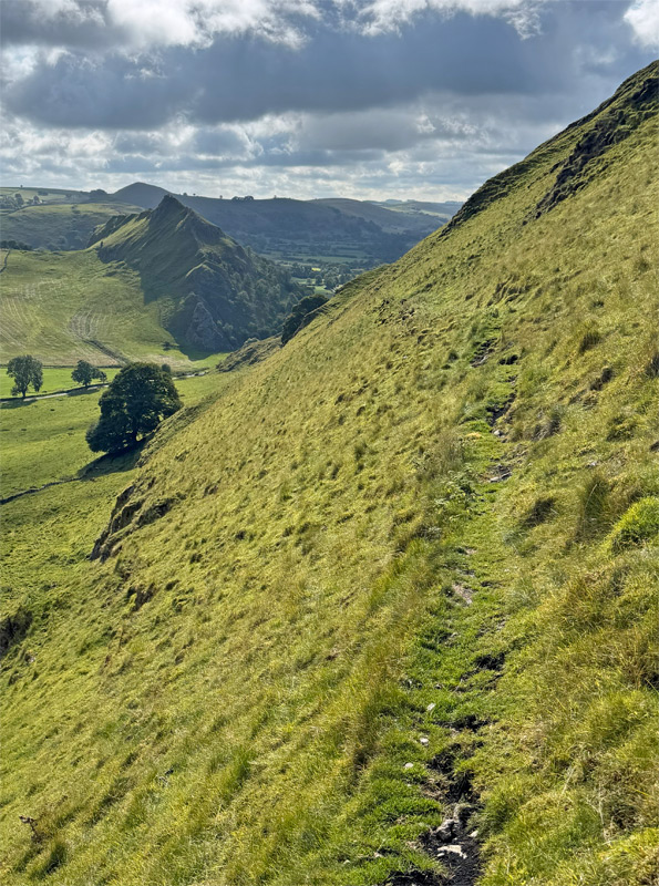
Continuing on to Stoop Farm, it is a lofty approach to Chrome Hill, nonetheless, an intervening descent of 50m does ensure Chrome Hill ranks as a separate summit, not merely a point on a connecting ridge. The views to the hill on this approach are superb.
At some point on the walk you will doubtless begin to ponder over the name Chrome Hill. Mining of Chromium never took place here as there is no ore (there is very little in Britain with just a small presence in the Highlands). The name did not therefore derive from Chrome, although sources suggest that Chrome is a corruption of Crumb or Crump, both being Old English words for curved or crooked, which certainly fits the topography. Furthermore, the natural pronunciation of ‘chrome’ is claimed to be inaccurate, with ‘croom’ being the original form, although it has been spelt as Chrome for a long time, appearing as such on the earliest OS map of the area surveyed in 1837.
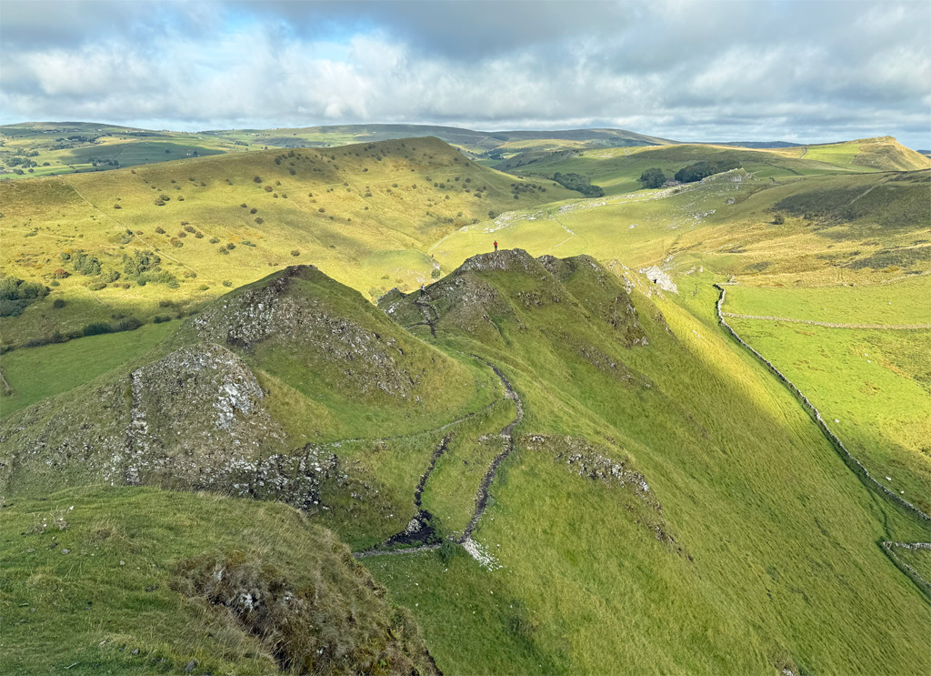
There is no major difficulty with the traverse of Chrome Hill, although you can look for scrambling if you wish amidst the interesting rock formations. The descent to the east is a relatively straightforward grassy path, all the while contemplating the ascent of Parkhouse Hill to come. Having said that, until the Millennium, this was as far as most people went, Parkhouse Hill being out of bounds on private land. How frustrating was that! The ascent wasn’t freely available until the Open Access Countryside Act in 2000.

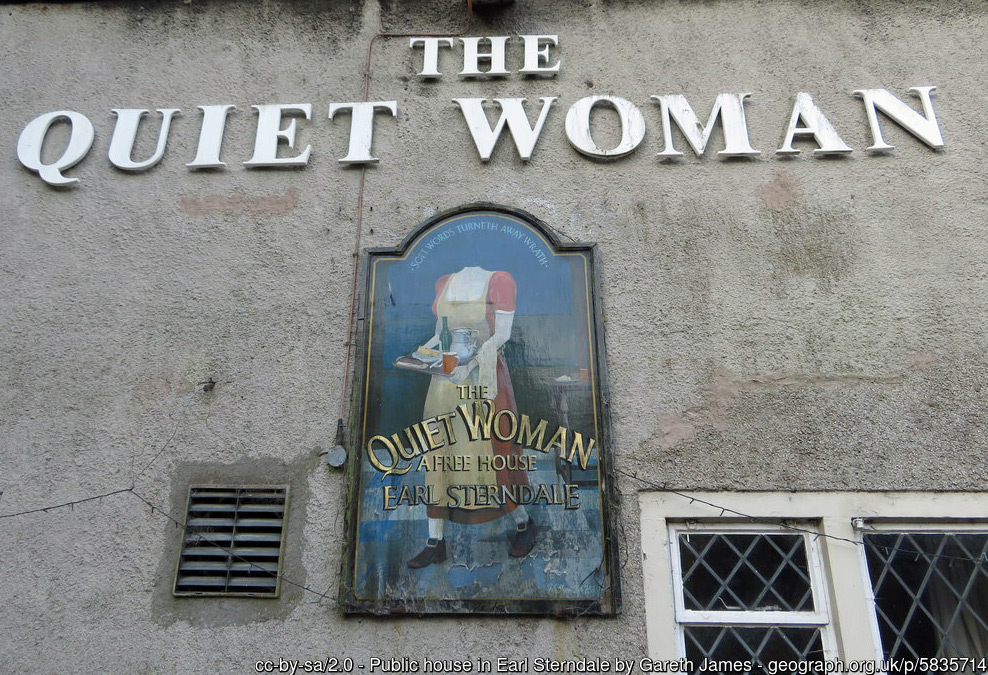
The alternative customary route to the Dragon’s Back involves crossing Hitter Hill from Earl Sterndale, commencing on a newly redirected path from the former 400-year old Quiet Woman pub, recently converted into holiday apartments. This is a splendid approach with both hills suddenly revealed in spectacular fashion. Parkhouse Hill comes first with a short, sharp climb onto the summit ridge. Use of hands is not required from this side but may be if continuing on and descending towards Chrome Hill. Employing one’s rear quarters as an additional point of contact is also often a useful technique!
Once again adhering to the crest provides the greatest thrill, although most walkers will be sufficiently occupied by the side paths, which are obvious and no problem in dry weather. Wet and icy adds a degree of fear factor, although in such conditions there are escape options. You can return a short way from the summit to a grassy slope that leads steeply to the north where, in many places, ‘footholds’ have been kicked into the grass to assist with secure passage. Otherwise, part way down the western ridge there are a choice of paths which also cut down to the north side. The lower part of the western ridge is barred by a limestone pinnacle. An obvious path cuts back right here and you may also be tempted by a gully going left. I would not advise this gully in descent as it can be slippery.
Parkhouse Hill can be circumvented entirely by paths around both sides, as indeed can Chrome Hill, which opens up possibilities for an out and back traverse, without the extra circuitous walking. Regarding Chrome Hill, the path on the south side is less easy to follow and the north side path, whilst never a problem, does cross a steep grassy slope at one point, which again may be slightly disconcerting if wet.
The longer return to Earl Sterndale, after crossing Chrome Hill, is to meet the single-track road near Stoop Farm and follow it into Dowel Dale, before quitting this for field paths. Dowel Dale is a dry valley, although not formed in the usual way by a river cutting it then disappearing underground. Instead it is a natural feature as old as the hills, being part of the original coral reef as an undersea channel. Nevertheless, it was likely deepened by glacial meltwater taking advantage of the existing valley. There is a river underground whose resurgence is close to Dowel Hall Farm. If you proceed beyond where the path leaves the road you will discover Dowel Cave at south end of valley, which was used as neolithic burial chamber.
From all of the above it becomes clear that there are many possibilities of routes to traverse the Dragon’s Back and to fully appreciate the qualities of these hills, you need to experience them all. And don’t forget to return on Midsummer’s Day for the double sunset!
Worthy Rating: 70
Aesthetic – 24
Complexity – 11
Views – 14
Route Satisfaction – 13
Special Qualities – 8