Blencathra – Lakeland’s North Star
Blencathra is amongst the Lake District’s finest mountains, its public face dominated by a battalion of fell tops spread along the extensive summit ridge, whose imperious presence descends dramatically in a riot of rocky ridges, down to the buzz of vehicles on the A66 trunk road at its foot. For the motorist on this highway, it is a spectacle that provides one of England’s finest driving views.
The mountain displays all its treasures in one vast shop window, which creates a magnet for visitors, who are otherwise oblivious to the unrevealed northern flanks that most would consider visually unstimulating. Nevertheless, Wainwright devoted more pages to Blencathra than any other Lakeland fell, although it must be said that where most regions are brimming with superstars competing for space, excepting Skiddaw the Northern Fells are customarily considered to be a backwater of less noteworthy hills.
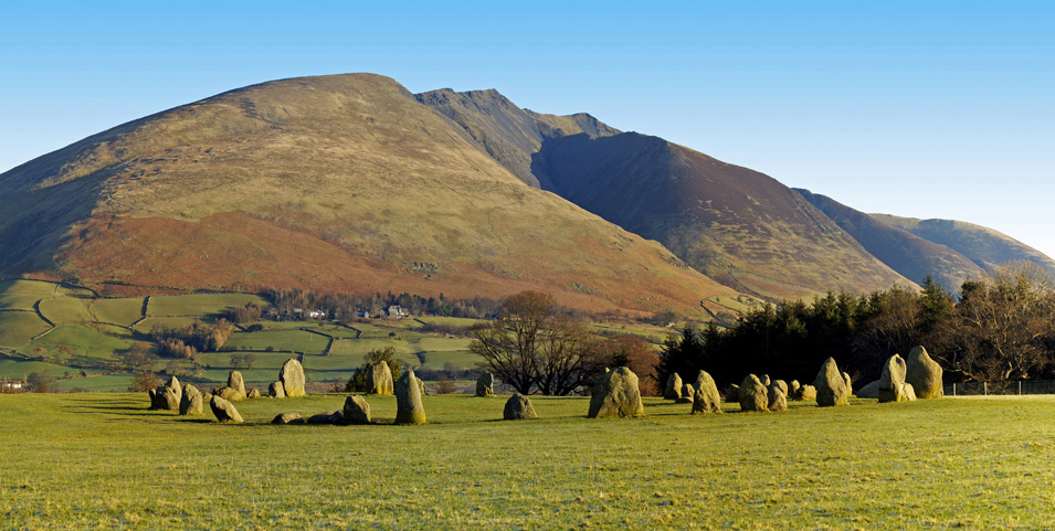
Featured Image above from Castlerigg Stone Circle: “Blencathra” by Alex Southward, CC BY-ND 2.0
The map can be zoomed in or out to change the scale
Blencathra has for centuries belonged to the Lowther Estates, although in 2014 it was put up for sale for £1.75 million by the Earl of Lonsdale to raise funds towards settling death duties. A group called the Friends of Blencathra was formed to purchase the mountain but failed to raise sufficient funds and the only other mystery buyer pulled out, so the debts were cleared by the sale of artwork and other possessions. Blencathra emerged unscathed.
Blencathra is also known as Saddleback, due to the distinctive shallow dip between the main summit and Atkinson’s Pike (Wainwright ignored this name and simply used Foule Crag instead). Saddleback was already employed interchangeably by Wordsworth (and on OS maps of the 1830’s) and apparently much promoted during Victorian times, perhaps as this distinctive angle was most frequently observed by the majority travelling from Penrith by train. The venerable Wainwright preferred to use the original more lyrical Cumbric name, which some sources claim also derives from this seat-like feature on the mountain.
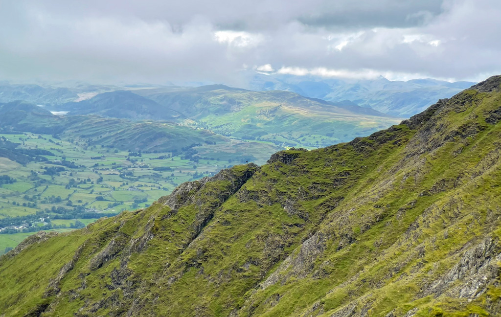
As a single, complex massif standing in relative isolation, Blencathra offers a dozen separate routes of ascent, many with variants and, with such a multitude of routes, we suggest you view the comprehensive coverage in the guidebooks rather than document each in detail here. Our purpose is to relay distinction and noteworthy features and the vast south face is undoubtedly the place to begin.
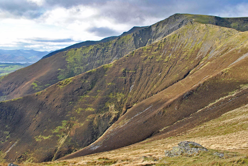
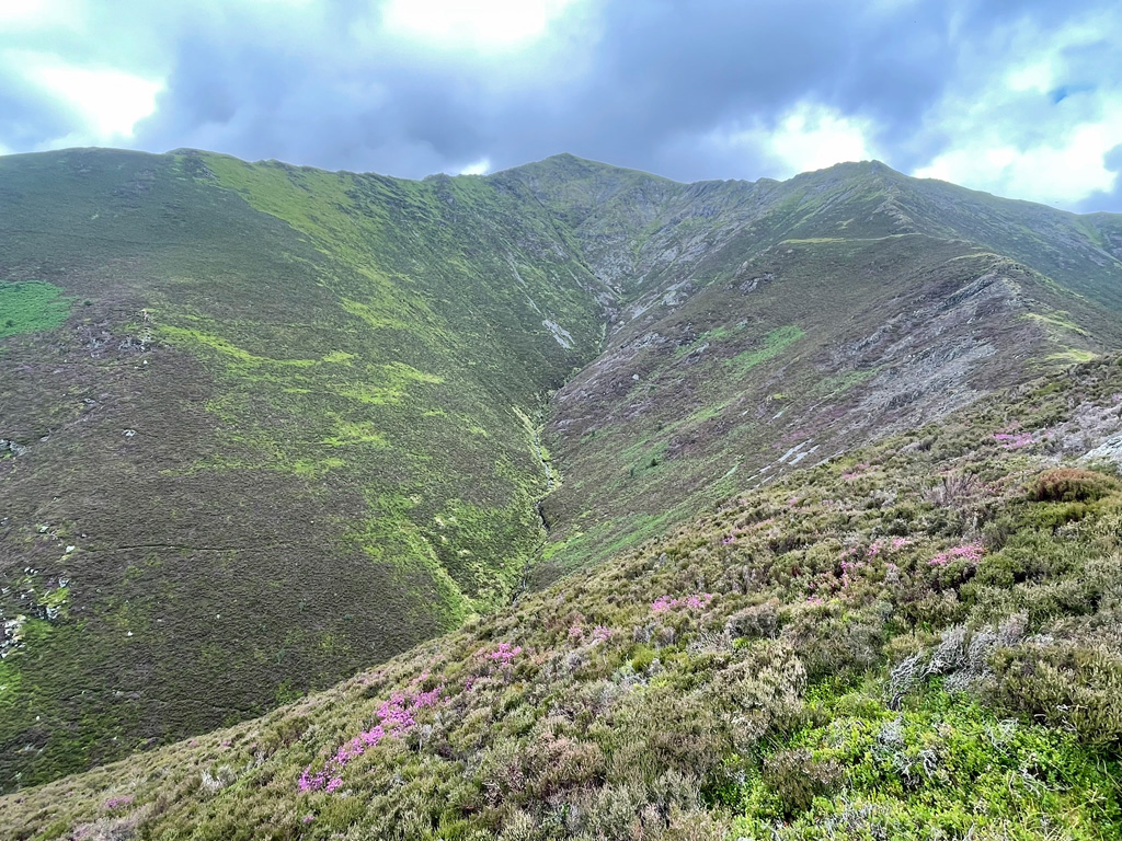
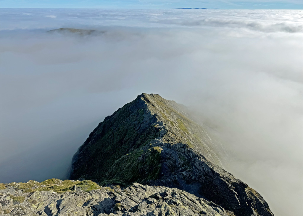
There are five major buttresses, rooted by wide snouts, that rise steeply, tapering into aretes as they approach the summit ridge. Each is a named fell, although none warrant separate mountain status, being intrinsic components of the whole. Those at either terminus, Blease Fell and Scales Fell, form rounded shoulders enclosing the three showstopping bastions of Gategill Fell, Hall’s Fell and Doddick Fell. All are hard won due to the prolonged acute angle of ascent, until the high connecting ridges are gained. The buttresses are separated by gills that are deep, stony rifts, each providing a means of access although few adventurers explore their savage and sterile worlds.
At the foot of Blencathra is the village of Threlkeld, a long established farming community that further grew with lead and zinc mining and later a granite quarry. Above the village, was established one of the earliest sanatoriums in the country, the pure mountain air being considered therapeutic for Tuberculosis sufferers. People could spend years there. The building now serves as the Blencathra Field Centre and a car park beyond provides a high starting point for the Blease Fell ascent, the convenience of the initial altitude providing more popularity than the route would otherwise warrant.
The three main frontal attacks commonly launch from Threlkeld. Gategill Fell is perhaps the most arduous of the trio due to its relatively short ridge not forming until after 1300ft of heather bashing up the hillside. In Wainwright’s day there was no path, being a ‘desperate struggle… with no semblance of pleasure’, but it’s a bit easier these days. Once the height is gained, the splendid lookout of Knott Halloo is a welcome place to recover, its curious name deriving from the fox hunting call, which formerly resounded amongst these hills. The Blencathra Foxhounds pack are still kennelled at Gategill, although since the ban on hunting they now follow scent trails, itself a practice soon to be outlawed by the present government.
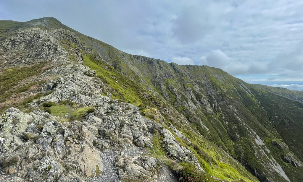
Hall’s Fell is the pre-eminent ridge on the south face, being a touch more consistently hands on and leading directly, with triumphant satisfaction, to the highest point of Blencathra, marked on the map as Hallsfell Top, because that is exactly what it is. Make no mistake, you still need to work hard to gain this reward, the initial pull up the hillside being only a little less than Gategill, at 1200ft. Above this the angle eases, the ridge narrows to an arete (it’s known as Narrow Edge) and the thrill of the finale begins. Scrambling is available for those who seek it, although none is necessary, the ordinary walker being amply rewarded by the airy location dividing rocky amphitheatres to either side.
Like all the ridges, Hall’s Fell is named after a farm at its foot, although for this fell, Threlkeld Hall Farm is situated lower down in the valley across the A66, and having now diversified into a caravan touring site.
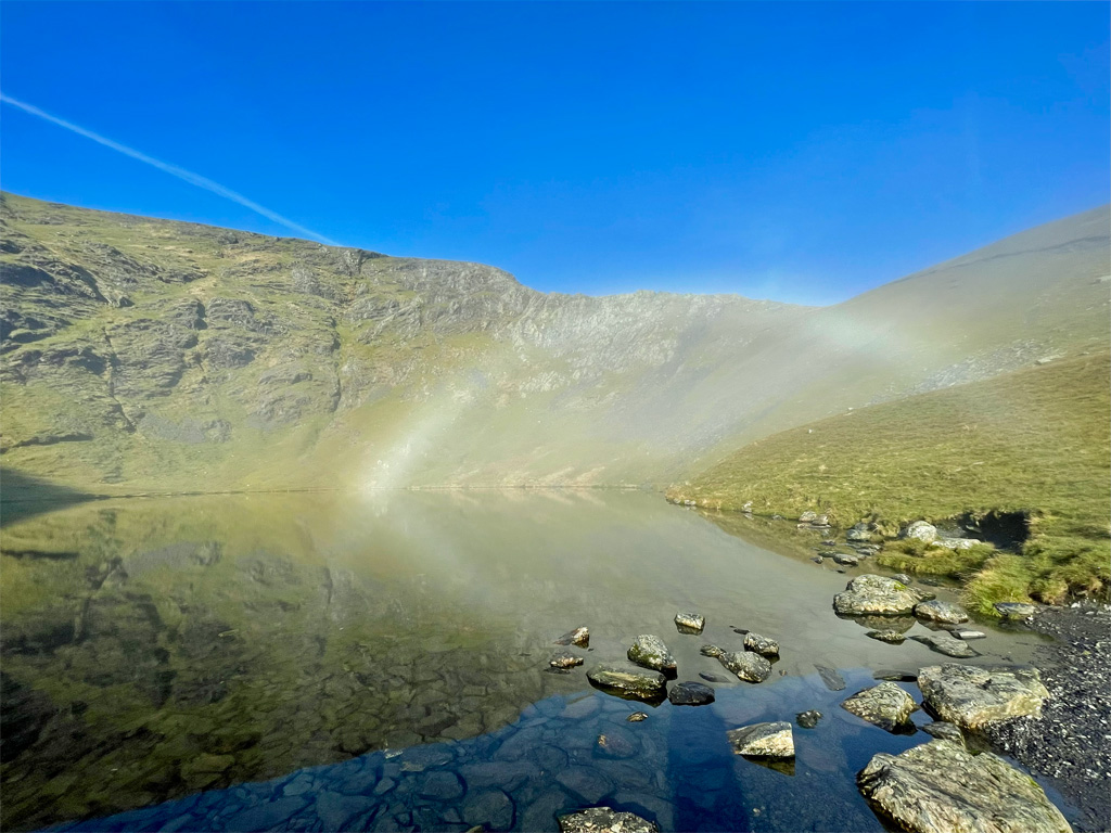
Doddick Fell is furnished with the longest of the ridges and with the least ascent to reach it, nevertheless, it’s just as steep. Once on the ridge, it is an absorbingly delightful walk to attain Doddick Fell Top, which is a high point on the shoulder leading up from Scales Fell, although you are not there yet, as there is still a stiff five hundred-foot climb to the summit, an exertion soothed by both the views of the southern ridges and the powerful prospect across Scales Tarn to Sharp Edge.
For the ascent via Scales Fell (and for Sharp Edge), walkers usually begin from Scales Farm or Mousthwaite Comb. Recent path work has made this a much more pleasurable ascent than it was, although it is perhaps most highly recommended (like its counterpart Blease Fell) in descent. Interestingly, the gill to its left, Scaley Beck, is actually the least scaly of them all being a rather drab route that once again Wainwright diligently researched and included for completeness, but the Fellranger guide – ‘all the fells, all the routes’ – once more chose to exclude. That may indicate something…
In olden days, it was the Scales Fell path that attracted the majority, many of the ascendants during Victorian times carried on hired ponies as a final flourish of the ‘Picturesque’ ideal, which had gained popularity a century before. What a strange world that was, although doubtless did not seem so at the time. You, however, will have to expend your own energy.
In my youth I remember not being overly impressed by Sharp Edge, believing it to be a long approach for a short rush of stimulation. Having walked the route recently in my more advanced years, I have changed my opinion; the approach was rather enjoyable and the challenge of the edge closer to my limits!
In dry conditions any agile walker with a head for heights will cope admirably. In the wet, the Skiddaw Slates take on the properties of verglas and the crossing becomes a more intense proposition. The initial arete is airy but straightforward, or can be bypassed almost entirely by a path on the right, although if followed to its end, some hands on work is required to regain the ridge. The well-documented Bad Step cannot be avoided in any event, although once again when dry underfoot you will barely notice it. The final ascent up the edge of Foule Crag is steeper slab climbing, not overly technical, but exposed if taken direct and many choose to step right and scramble up a more enclosed gully.
A popular outing is to climb Hall’s Fell then drop down on a walkers’ path to Scales Tarn before reclimbing to the summit via Sharp Edge. Descent is usually by Doddick Ridge (although there is less reascent if Doddick is climbed first and Hall’s Fell descended). This excursion thereby includes the three finest ridges on the mountain. There is no rock climbing on Blencathra, nor mighty crags, although the the Tarn Crags face above Scales Tarn, and Foule Crag (interestingly named Fool’s Crag on older OS maps), are nonetheless formidable.
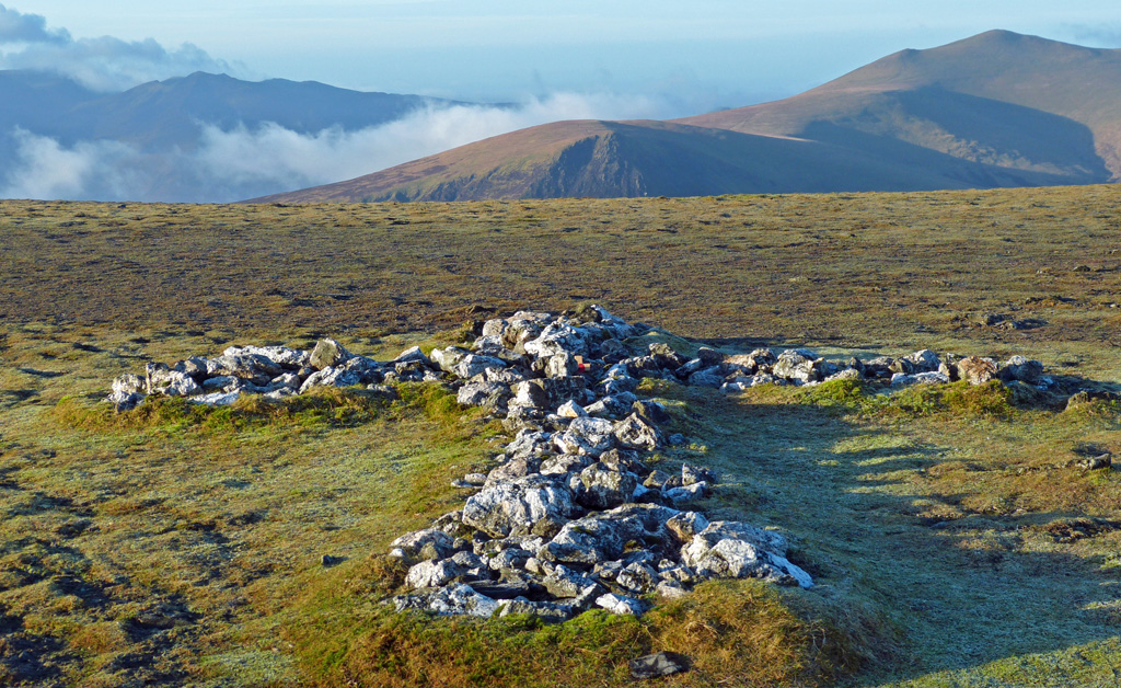
Sharp Edge, if followed directly to its conclusion, levels out at the summit of Atkinson Pike, from where an easy stroll across the saddle leads to the top of Blencathra. In the central seat of the saddle is found an intriguing white cross composed of quartzite stones. This was thought to have originated as a memorial to a deceased walker but, from 1945, it was neatly extended by Threlkeld man Harold Robinson on his regular ascents of the mountain. There is a smaller cross nearby and apparently a third that is all but lost in the grass.
The summit of Blencathra (Hall’s Fell Top, below) is surprising in that it exhibits no grand cairn. All it ever managed was a pile of small, unruly stones that are now spread around the bare, gravelly earth.
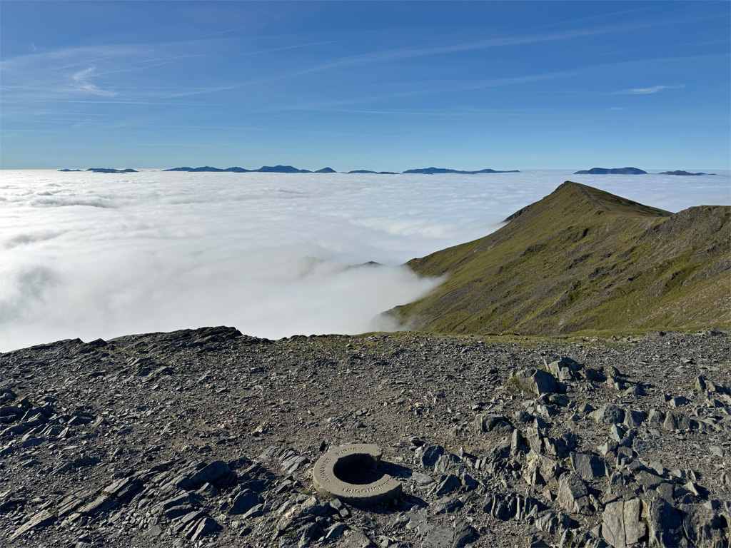
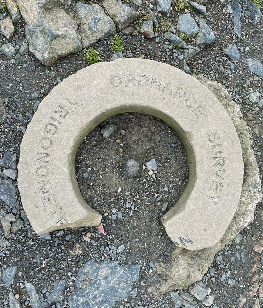
There is no triangulation pillar either, merely a curious stone polo mint with a substantial bite taken out of it. This structure is called a Concrete Detector Ring, or Emplacement Ring and was installed above a buried block. From the late 1940’s they were developed for lower order Triangulation Stations as a less obtrusive (being particularly designed for urban locations) and less expensive alternative to pillars. The Blencathra ring was installed in 1953 but went missing in 2018, presumably stolen. An online campaign raised £1000 to replace the ring, which was reinstalled in March 2019. It measures around 21 inches in diameter. Sadly just a year later it began to display signs of damage and now there is a substantial chunk missing.
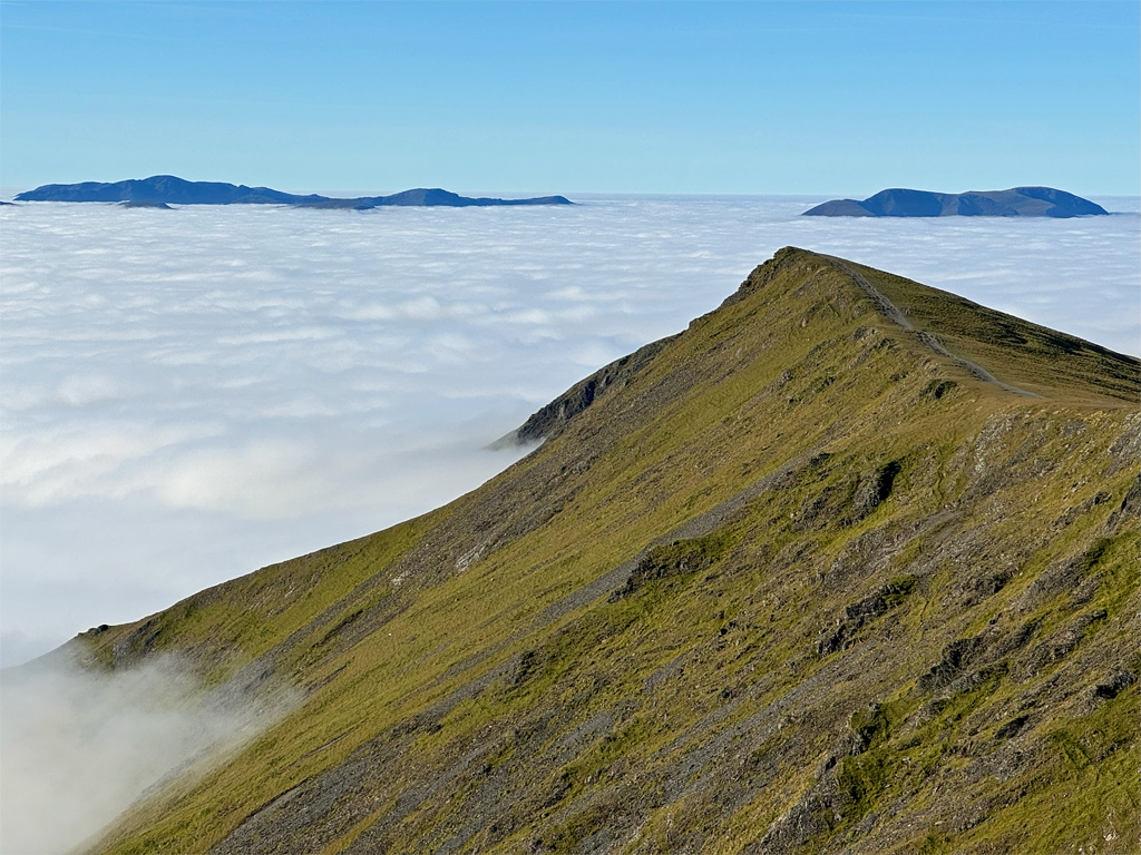
From the top the view is stunning with much of Lakeland and the Pennines at one’s feet. Turning to the north the contrast is striking, with the grassy northern fells underlining what a threshold mountain Blencathra is. Beyond its summit the landscape softens in character with moorland taking control as it slides into the upper Caldew Valley.
And yet this moorland was bizarrely designated by Wainwright as an independent fell, Mungrisdale Common, despite his affirmation that ‘strictly this is not a top that could be accepted as a separate summit’. Was AW simply designating the fell to ensure sufficient pages in his Northern Fells guide? His comments (whilst clearly tongue in cheek) abuse the hill atrociously and he doesn’t even bother to describe ascents ‘that will never be used’.
In Wainwright’s day Mungrisdale Common exhibited no summit cairn (there isn’t really an obvious summit), nor any stone to build one, although AW didn’t envisage that thousands of people would choose to ‘do the Wainwrights’, and in the intervening years some public spirited walkers have carried stones to the top to build a low cairn. Their footfall has also created paths across ‘a summit that holds indefinitely all the water that falls upon it’. Whatever were AW’s intentions, he certainly created a talking point!
Worthy Rating: 83.5
Aesthetic – 25.5
Complexity – 17
Views – 17
Route Satisfaction – 16
Special Qualities – 8