Black Mountains: The Whales of Wales
The Black Mountains comprise the most extensive upland range within the Brecon Beacons National Park, casting broad, grassy ridges projecting like the fingers of an arthritic hand. Collectively, the ridges stretch for fifty miles, with thirty miles of this above the 2,000ft contour.
The culmination of these whale-backed elevations is at Waun Fach, an unpretentious mass amidst the whole, yet second only in altitude to the celebrated twin tops of Pen y Fan and Corn Du. However, unlike those voguish honeypots, the walker will not be required to queue at its summit cairn to take a selfie – not that there is much of a cairn anyway.
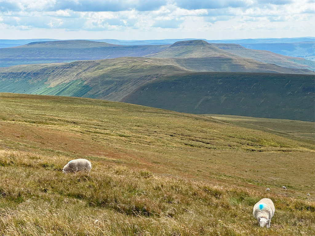
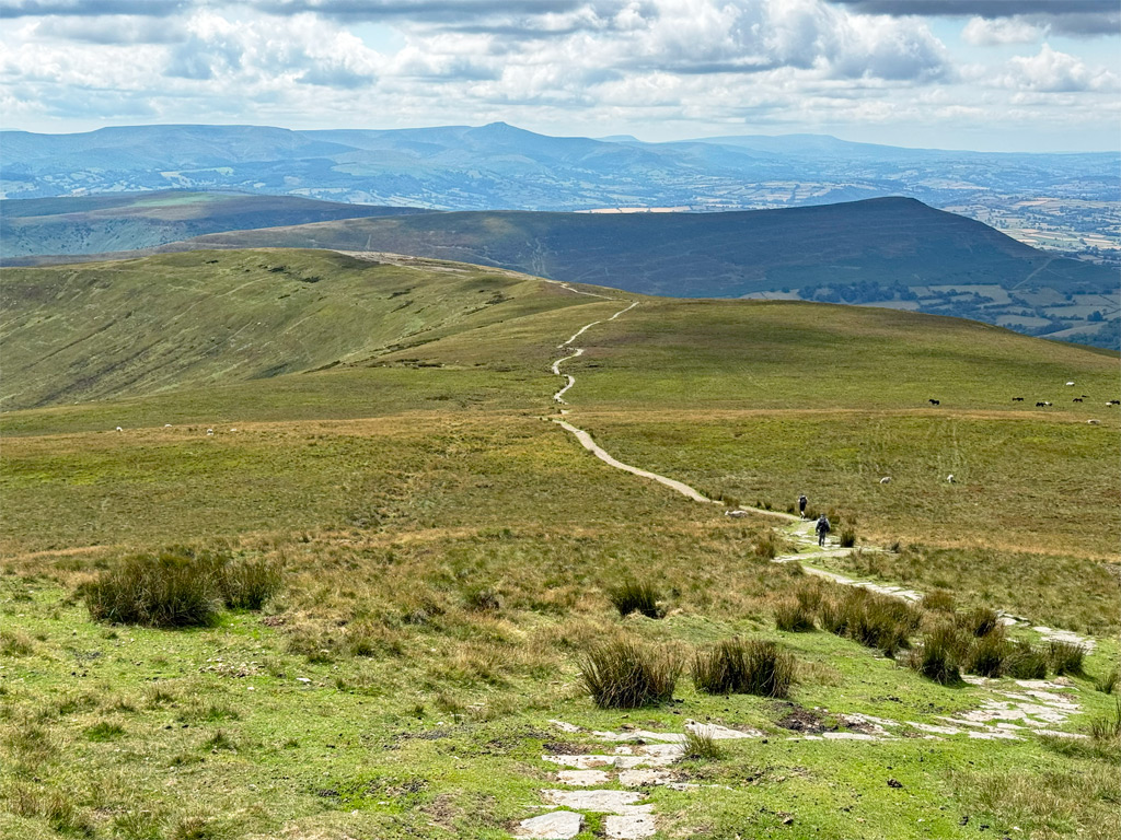
The Black Mountains are an undisturbed hinterland, the plump ridges concealing the adjacent valleys, promoting a pervading solitude and an intimate appreciation of the vast sky above. Undeniably, some may consider this landscape of exposed moorland to be bleak and inhospitable, while for others, it affords an unbounded freedom rarely encountered, the general uniformity encouraging immersion in perpetual contemplation.

The distinctive characteristics of the national park are evident here, albeit muted; the dramatic, steep scarp slopes of the high Beacons and Carmarthen Fans are extant, just moderated, although the Black Mountains do exhibit engaging topographical features to disrupt the moorland monotony. For example, here two of the most entertaining ridge ascents in the national park can be discovered.
Waun Fach may be the highest point of the massif, although it cannot be recognised as a Worthy in isolation; this accolade must be applied to a wider compass and, considering the immense extent of interconnecting ridgelines, the major difficulty arises more from limiting the boundaries.
The main body of the Black Mountains is roughly triangular, the summit of Hay Bluff being the northern apex. Three major ridges drift south from here, one diverging at Waun Fach to form an additional finger, with the nails of each finger broadening at their ends. Two short ridges with pointed tips are also evident, which complicate the scene and foster a sense of bewilderment when attempting to navigate around a map of the terrain.
Another point of confusion is that the Black Mountains are not wholly in Wales; in fact the highest point of Herefordshire shares the Welsh border at the summit of the confoundingly named Black Mountain. If we refer to the hills in Welsh, the Black Mountains would be Y Mynydd Du; however, this is also the name of the Black Mountain (range) in the west of the national park. Therefore, our eastern massif is usually translated as Y Mynyddoedd Duon. Incidentally, there is no definitive explanation of why the mountains are called ‘black’ in the first place.
The map below can be zoomed in and out to change the scale
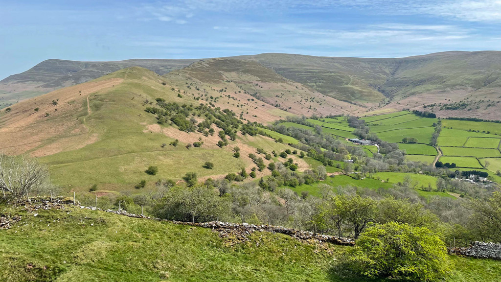
For the purposes of this Worthy, we are concentrating on the most westerly ridge as encompassing the overall atmosphere of the Black Mountains. This is the little finger of a palm-down, right hand, running from the nail of Crug Hywel (Table Mountain) above Crickhowell to Waun Fach and then rounding the knuckles on the back of the hand north and east to Hay Bluff, even though the latter stage of this route is interrupted by a minor road crossing our path, albeit one of the most scenic driving roads in the country. For good measure, offshoot ridges are described briefly to complete the picture, as each could conceivably provide a means of ascent to Waun Fach.
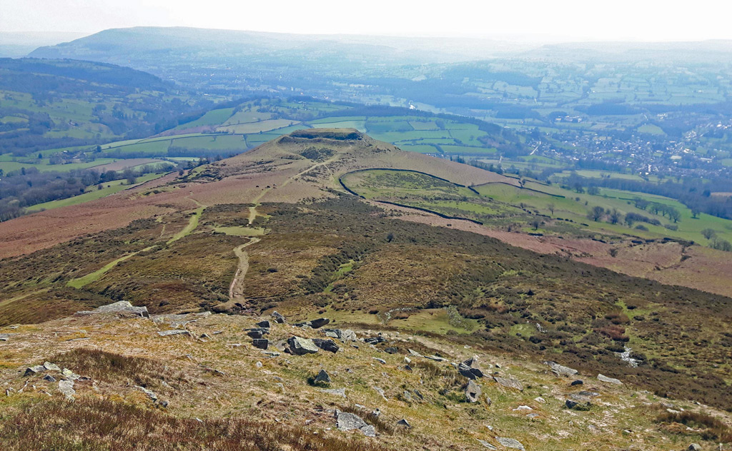
Crug Hywel is the Welsh name for Crickhowell, a splendidly historic little town at the foot of the Black Mountains, but it is also the name of a natural spur on Pen Cerrig-calch, whose slopes were sharpened to provide defence as an Iron Age hillfort standing at 1500ft above sea level. It’s also known, descriptively, as Table Mountain and provides a thrilling stepping stone to explore on the ascent to the first summit of Pen Cerrig-calch at 2302ft (701m), itself boasting even older constructions in the form of two sprawling Bronze Age cairns, along with a twentieth century OS trig pillar.
The views are sumptuous, particularly of the Usk Valley and south to the dainty profile of the Sugar Loaf. The path we are presently following is also utilised by the ambitious Cambrian Way, a magnificently plotted mountain walk through the heart of Wales, which takes a deliberate loop at the Black Mountains to include its own representative sample of these ridgelines.
It’s an easy stroll along to the next peak, Pen Allt-mawr, which gives its name to this ridge, the Allt Mawr, running up to Waun Fach. Once again, piles of stones along the route denote ancient cairns, possibly burial mounds, as this high land was thought to have provided temporary habitation for summer grazing in the Bronze Age period.
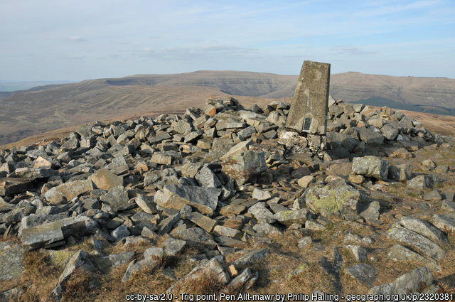
The summit of Pen Allt-mawr at 2361ft (711m) is the highest point of the ridge until Waun Fach is reached and also features an OS trig pillar, which became detached from its base over time and was listing badly for many years until it finally toppled in 2021. The trig was subsequently re-erected, although it is still not set into any foundations.
With four miles walked to Pen Allt-mawr, there remain another four and a half to Waun Fach, over the gently undulating ridge. Distances are considerable in the Black Mountains, although the going is often sprightly, with many sections of path much improved. Much of this has been the work of the Black Mountain Land Use Partnership, established to protect the fragile environment of this internationally important upland heath, and to further protect it from footfall, stone-flagged pathways are being laid in sensitive areas. Nonetheless, the Black Mountains still have areas that are shockingly boggy.
Waun Fach itself was once an extensive peat moor, its summit distinguished by one of the earliest OS trig pillars in the country, erected in April 1936. Through serious peat erosion the pillar was lost; however, during peat restoration in 2015 the surrounding paths were improved and the pillar was replaced by a rather unexciting block.
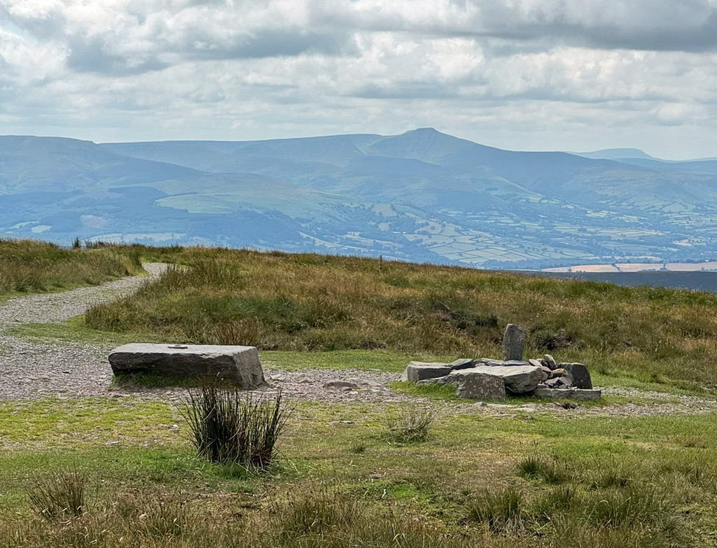
Another finger heads off southeast from Waun Fach; this is the Gader Ridge, which maintains high ground over the top of Pen y Gadair Fawr, the site of yet another round barrow formed of a grassy mound crowned by stones. From a distance the summit appears as a noticeable pimple and makes Pen y Gadair Fawr far more eye-catching than Waun Fach. It would be easy to mistake it for the dominant top.
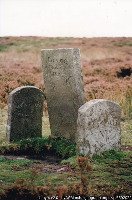
The Gader Ridge forms one half of a Waun Fach horseshoe walk, involving a seventeen-mile loop from Llanbedr. From Pen y Gadair Fawr, that route descends gradually to meet the Mynydd Du forest, cloaking the sheltered eastern slopes and comprising the highest tree-line in Wales, up to 700m. At the southern corner of the plantation, just as the ground begins to rise to the low hill of Crug Mawr, is the Dysgwlfa cairn, which by now will be clearly recognised as another round barrow. Close by are curious boundary marker stones, erected by the local estates. There are numerous boundary stones on neighbouring hills dating from around two hundred years ago.
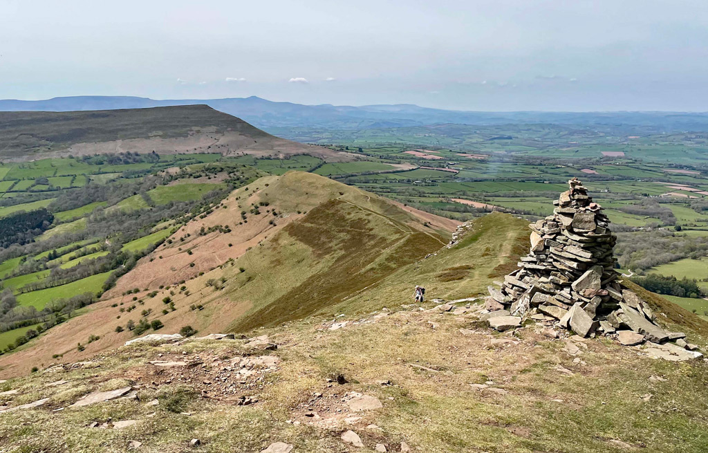
Returning to the summit of Waun Fach, the shortest ascent of the mountain approaches from the west, a route that benefits from a high point of the A479 near Pengenffordd. Again, this can be made into a fine circular walk to include the entertaining Y Grib, more popularly known as The Dragon’s Back. Commonly, the ridge is climbed from the Castle Inn, named after Castell Dinas, another Iron Age hillfort that is usually visited before tackling the ridge proper. This is one of the narrower ridges in the Black Mountains, although at no point is it especially airy. It’s relatively short too, fizzling out as the spur widens above 2000ft. It’s great while it lasts though.
Y Grib joins the main ridge at Pen y Manllwyn, where the back of the hand begins to take shape, being broad and featureless. However, as we progress north, the accompanying escarpment starts to take more dramatic form, dropping quite steeply for around one thousand feet. The path rarely approaches the edge with purpose, the sections around the summit of Rhos Dirion providing the most intimate views.
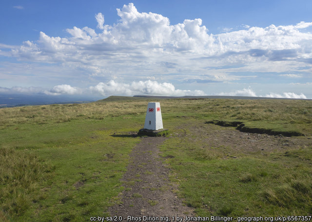
The Black Mountains are well-furnished with OS trig pillars and one provides the focal point for the featureless Rhos Dirion summit plateau. It is fortunate that the trig pillar is here, as the top would otherwise be easy to miss. Another major finger of the Black Mountain hand departs from the knuckle of Rhos Dirion, although it doesn’t narrow into finger form for a kilometre or so. This is the Ffawydog Ridge, central to the range and itself some fifteen kilometres long, being terminated once again by a hillfort, Twyn y Gaer. Along the way, the path alternates from hostile bogland to paved monotony, feeling all the time that it is at the hub of a wilder wilderness.
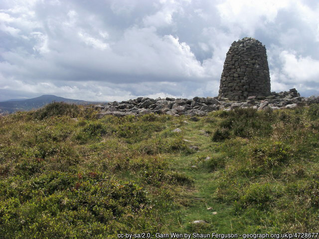
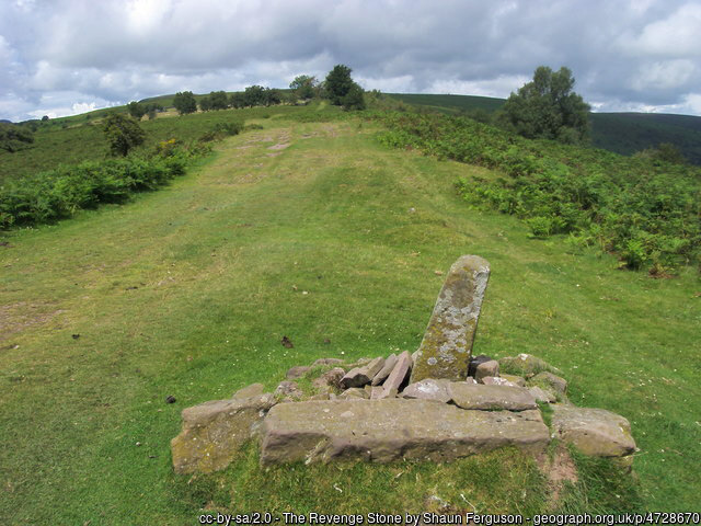
There is much to see apart from the views, including a stone-built OS trig for the baggers on Bal Mawr, and a substantial beehive cairn on Garn Wen. By now, with your growing field archaeologist experience, you will instantly know this cairn to be a modern creation; nonetheless, on what does it stand? Indeed, another Bronze Age foundation. And, if the antiquarian is not yet fully sated, there are many more mysteries marked on the map, including the Dial Garreg or Revenge Stone, to be found a mile further down the ridge, before the ridge begins to rise to its final flourish at Twyn y Gaer.
Heading northeast from Rhos Dirion, the final knuckles of Twmpa and Hay Bluff strive for individuality, being separated by pronounced cols, something atypical for the Black Mountains. Indeed, it is this prospect of these twin peaks that makes the Black Mountains so recognisable from Mid Wales and the English Midlands. The walk from Rhos Dirion is also enhanced by the grandeur of the escarpment and the sense of altitude, fostered by the view, which pans around the lower hills to the north.

Twmpa is commonly called by its English toponym, Lord Hereford’s Knob, at which not only school parties titter. ‘Knob’ is of course a geographical term for a distinctive protuberance of any size, from a minor hill feature to the whole hill itself, such as Twmpa, which is basically the Welsh translation of ‘knob’. Lord Hereford is the title of the Viscounts Devereux, the historic landowning family of the region.
The analogy of a topographical hand falters here, as a short ridge heads south from Twmpa, creating an additional stumpy digit. Nevertheless, this projection makes for a fine approach from Capel-y-ffin, the ridge being called Darren Lwyd and introduces a geological peculiarity of the Black Mountains in the shape of isolated rocky escarpments, known as Darrens (or Darens). These are late Ice Age landslips, which formed most prominently on the east faces of ridges.
Of all the valleys that drain southeast between the fingers of the Black Mountains, it is the Vale of Eywas that is dominant. The valley reaches its head at the Gospel Pass between Twmpa and Hay Bluff, carrying the only road to cross the range. And what a road its, the highest in Wales, the pass reaching 1801ft (549m). Were the two summits either side not so similar in appearance, the pass would form a major divide, although for the walker it remains simply a natural link between the hills.

Hay Bluff, or Penybegwn, to employ its lesser spoken Welsh name is the most climbed of any of the higher tops. Much of this is due to the ease of access via the high road from Hay-on-Wye to the Gospel Pass, affording one of Wales’ most scenic parking places by the Pen-y-Beacon stone circle, on delightful green common land. A charming short ascent from here joins the Offa’s Dyke path to reach the ridge, then cuts back to the summit, where once again an OS column is found, often surrounded by a moat, except during dry spells.
Running south is the twelve-mile-long index finger, Hatterall Ridge, the longest in the Black Mountains and accompanied for the majority of its length by two important features; Offa’s Dyke National Trail and the Wales/England border. The highest point of the whole 177-mile length of Offa’s Dyke path occurs on the ridge at a spot height marked on the maps at 703m (2308ft). What the map doesn’t record is its name, which in Welsh is Twyn Llech. For the Welsh, this isn’t of much consequence as there are plenty of higher tops in the Black Mountains.
However, the lack of a printed name on the maps is rather disrespectful to the English because this spot height is right on the border and represents the highest summit in Herefordshire. In English, it is named Black Mountain, for perhaps no other reason than it is the loftiest point in the English part of the Black Mountains.

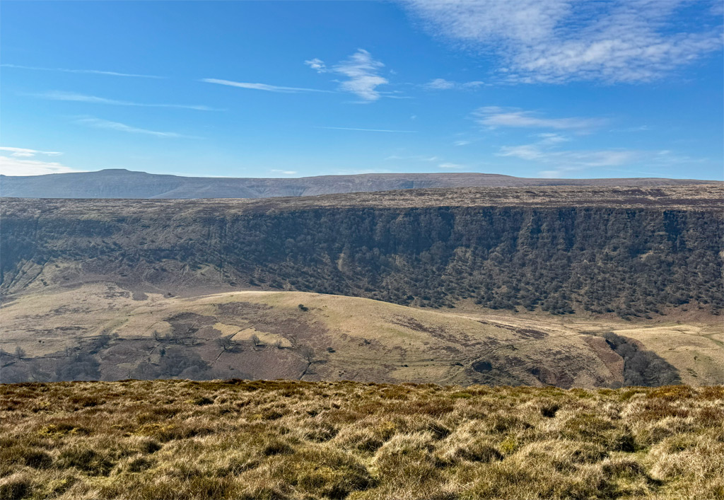
Nevertheless, do not confuse this Black Mountain with Black Hill, the most easterly summit of the Black Mountains, also nearby and wholly in England. The walk up Black Hill is also one of the most rousing in the entire range, taking a short, exhilarating ridge known as the Cat’s Back. There are echoes of its dragon counterpart on Waun Fach, although the feline version is slightly more slender. The inspiring views are mostly of the pastoral Herefordshire landscapes, with the aspect to the west being dominated by the Hatterall Ridge, which exhibits the finest of the local Darrens, Black Darren being the most celebrated and documented.

When climbing Black Hill, Waun Fach feels like a distant hill, such is the scale of the Black Mountains. Nonetheless, to complete a traverse of the full ridge from Black Hill to Crickhowell is actually just eighteen miles, within the capacity of fit walkers. Or, with so many ridges to provide circular walks, it is easily split into sections. In my view, this expedition represents the essence of what amounts to around fifty miles of connecting ridges in the Black Mountains. The foundation of Worthy exploration is panoptic and the Black Mountains truly exemplify this ethos.
Summits included for the Black Mountains Worthy:
Waun Fach, Pen Allt-mawr, Rhos Dirion, Pen Cerrig-calch, Twmpa, Hay Bluff, Pen Twyn Glas
Worthy Rating: 72.5
Aesthetic – 22.5
Complexity – 14
Views – 15
Route Satisfaction – 14
Special Qualities – 7