Beacons of the Chiltern Ridgeway – A Downland Sanctuary
Small in stature yet abounding with character, the eastern fringes of the Chiltern Ridge emerge from the woodlands that cloak the main body of the hills, forming a shapely swathe of open, chalky grassland.
But how can a tiny compass of rolling downs command Worthy status when compared to the giant mountains of the north? Realistically, these are small hills and only just make the grade, principally through isolation from any rival, which ensures their unique appeal can be measured by a completely different yardstick.
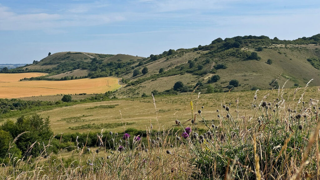
Nonetheless, this feature serves to highlight the landscape of just a tiny portion of the Chilterns, whose overall significance is recognised as a designated Area of Outstanding Beauty. It is hills that we are concerned with and in this case, crucially, these are the only morsels of upland that resemble or present the atmosphere of distinctive hills, albeit small ones. Here the chalk escarpment rises abruptly above the Vale of Aylesbury and the contrast of scarp slope and vale is one of the principal attractions of exploring this region.
Two long distance paths cross the Chilterns, the Ridgeway and the Icknield Way, both amongst Britain’s oldest roads, dating back 5,000 years, indeed the Ridgeway is a designated National Trail, which terminates at Ivinghoe Beacon, one of the three hills in our area of study. The other two are Steps Hill and Pitstone Hill.
The map can be moved and the scale altered by zooming in or out
A linear walk from the conservation village of Aldbury (frequently employed as a film set) to Gallows Hill is an excellent option for those with suitable transport, although making your return through the woodlands of the National Trust’s Ashridge Estate is a popular circuit. However, while pleasant the woodlands are simply not hilly enough for inclusion here, although ironically this is the place where you will encounter the most people, especially in the vicinity of the Bridgwater Monument, mainly due the availability of car parks and family attraction visitor centres. In fact, the pressure of visitor numbers (we are barely more than ten miles from the M25) is currently causing the National Trust to rethink their visitor strategy. You will never be alone on the hills either, although by avoiding busy times they may well still be more quiet than Snowdon or Catbells!
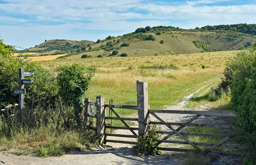
There are free car parks on the two roads that cross the hills, Beacon Road and Stocks Lane, both already around the 200m contour and, when starting from the ‘Ivinghoe Beacon Circular Walk’ car park, we actually commence by heading downhill. This car park benefits from the finest scenic view, so is the first to fill up.
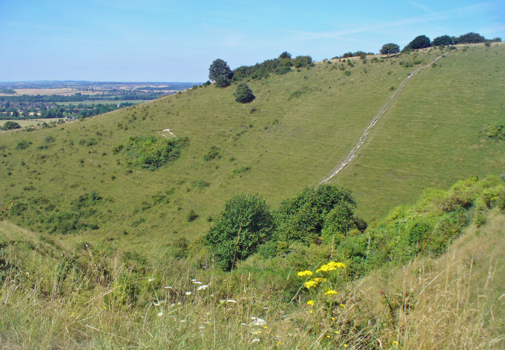
Let us start that way now, by walking south briefly then crossing the road to the Steps Hill car park to enter the woods. Emerging from the trees just 200m later continue straight down with views of Incombe Hole to the right. This ‘hole’ is a combe or dry valley, of which there are many in the district with Incombe boasting the steepest sides. Such combes, locally spelt coombe, are an Ice Age feature although, unlike corries and coves in the mountains, were not created by glaciers but freeze-thaw action fracturing the chalk, which subsequently slipped downhill. It’s a process called Nivation.
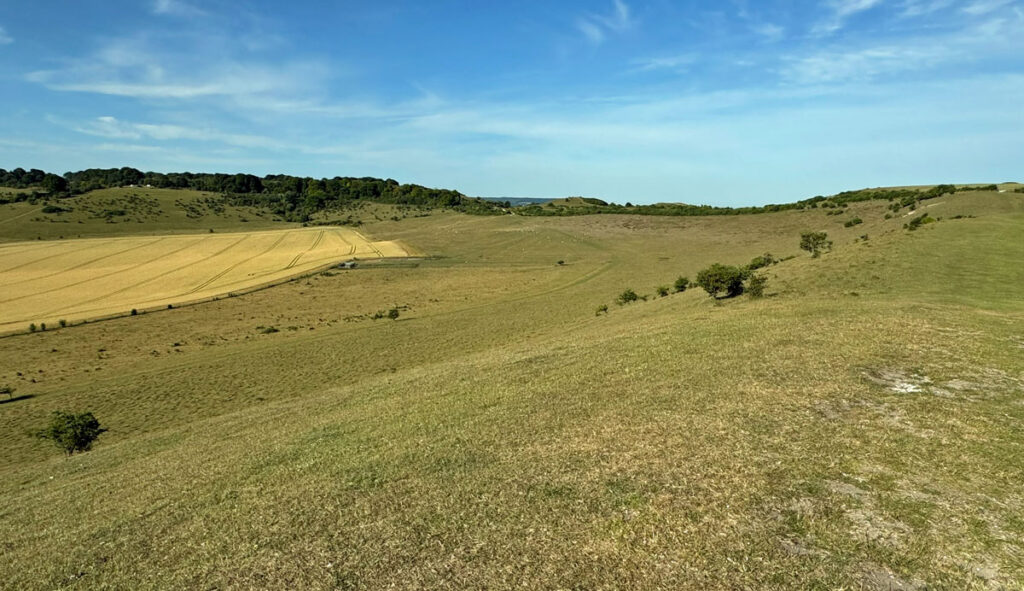
After initial steepness a lovely green path leads gently to Stocks Lane, crossing into the Pitstone car park, with Pitstone Hill rising attractively ahead. Firstly there is a small hill (more like a mound) to negotiate, which is called Paul’s Knob. It is not named on OS maps, just marked with a spot height of 202m (656ft).
A ten-minute stroll leads to the summit of Pitstone Hill, which features no cairn and doesn’t even warrant a spot height on the map. The reason is that the hill actually continues to climb imperceptibly for a further five metres or so into the woods ahead to its highest point at Aldbury Nowers (around 220m). Altitude is really of no importance on this walk. What is of interest on this hill are wildflowers, butterflies and nesting birds – the whole area of our walk is bursting with nature reserves and Sites of Special Scientific Interest (SSSI), created as a result of the chalk grassland ecology.
On the top of Pitstone Hill we encounter Grim’s Ditch, a mysterious prehistoric linear earthwork that actually crops up in many of the southern counties, although each section may not have been necessarily connected. Basically, it’s a ditch with a bank alongside and considered too small to have been defensive, so was perhaps a boundary.
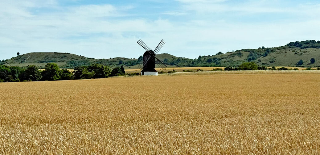
The view from Pitstone Hill includes the four Tring Reservoirs, built in the early 1800’s to supply water to the Grand Union Canal. They now form an important wildlife reserve. Closer at hand, in the quarry at the foot of the hill are flooded chalk pits. Significant geological features were discovered, such as Ice Age river channels, which led to SSSI designation, although quarrying continued, with respect for the protected areas. The quarry formerly served the largest cement works in Britain, notably having supplied the cement for the construction of Heathrow Airport. The works closed in 1991 and were demolished in 1999. Had it still been here the affect on the view from these hills would have undoubtedly been sufficient to remove their Worthy status!
Chalk is still extracted on a small scale for agricultural use, however, the long term plans are to return the site to nature, restoring the natural habitat. This will be achieved in stages over the next fifteen years and the land given to the National Trust, who intend to use the site as a new visitor hub to reduce pressure on the Bridgwater Monument area.
Let us get back to the hills. You may follow a lower path as described in the route link at the end of this feature or wander back along the Ridgeway towards Incombe Hole, where again you have the choice to take an alternative route to the summit of Steps Hill to rejoin the Ridgeway. Steps Hill has no obvious summit, in fact the land surreptitiously rises to the south for half a mile to the trig pillar on Clipper Down at 249m, which is classified as a Hump, a Tump and a Clem in hill bagging circles. Not one of the hills we climb today achieve any form of recognition amongst the 20,000 or more hills in the Database of British and Irish Hills (DoBIH). This only goes to underline the fact that Worthies have no basis in height or prominence – just quality!
Steps Hill may have no real top but it does have the steep, scrubby scarp slope plunging down to the Aylesbury Vale, which is common to our three hills. It’s a fine walk around the rim of the escarpment, followed by a brief descent to a col where we cross the road. On the way a flight of steps is spied on an alternative, direct path that will tempt those coming the other way. These are not the steps that give the name to the hill, which derives from deep gullies caused by cattle droving centuries ago.
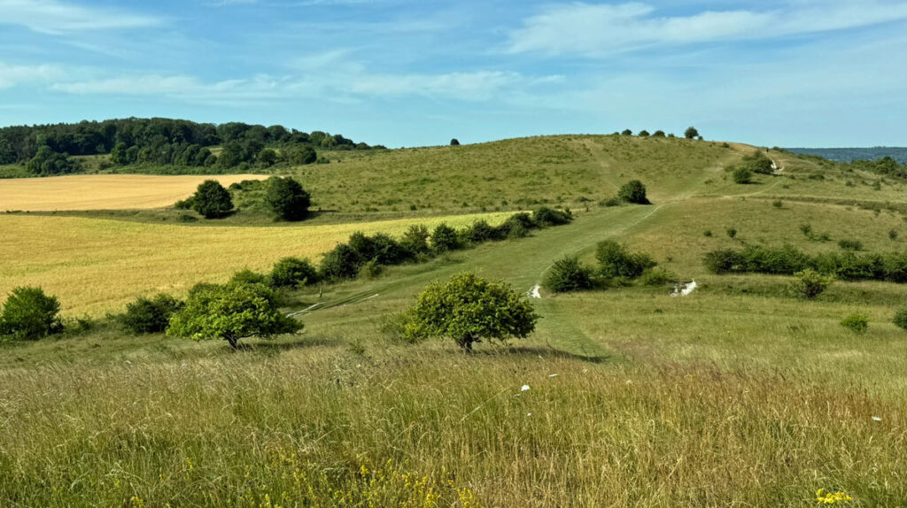
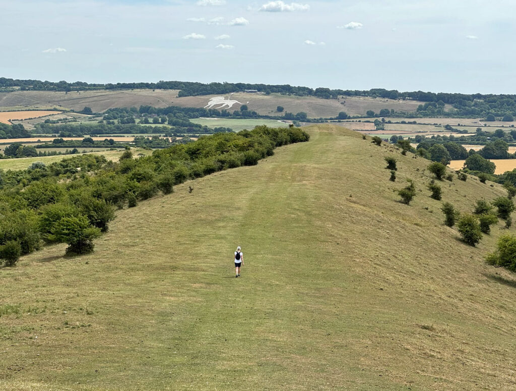
Ahead lies the beautifully open, curving ridge of the Beacon stretching around to its terminus at Gallows Hill. Ivinghoe Beacon is more correctly called Beacon Hill, of which there are many in the country, therefore the Ivinghoe prefix is commonly used, except by locals. This is the final and finest part of our walk, crossing delectable chalk downland on small, but perfectly formed hills. The main path ambles on ahead, something of an exposed white scar on the landscape and clearly far more trodden than the rest of the routes we have taken. No matter, as I suggest you don’t follow it but instead head left to the perky little top that is crowned by Bronze Age round barrows. From here make your way along the ridge meeting the main path enroute.
Undoubtedly, the 360-degree panorama enhances the joy of treading the ridge on the Beacon, with no woodland or nearby higher ground to restrict the perspective. The emphasis here is less on the immediacy of the escarpment, as the ridge is broad and the path central to it. Little effort is required for the slopes are shallow, nevertheless, there is a sense of mounting anticipation as a small intermediary mound is crossed before the final grassy top, which arrives with an undertone of finality. The summit feels like a terminus, an understated vantage point peering above the pastoral landscape.
For those few who have walked the eighty-seven miles of the Ridgeway from Avebury, they will experience a feeling of homecoming, the open chalk downs bearing many similarities to the earlier parts of their journey and unlike anything else since before they crossed the River Thames and into the Chilterns. The sister hills to the east are the Dunstable Downs, marginally taller but less imposing, they form the eastern boundary of the Chiltern AONB.
Ivinghoe Beacon is the only one of our trinity to be marked with summit furniture, including an OS trig pillar and a stone column with plaque commemorating the Ridgeway path. Curiously there are two spot heights on the map, one at 230m for the trig point and the other at 233m (764ft) presumably taken from the adjacent raised mound, one of the multiple Neolithic tumuli on Beacon Hill. The name of the hill derives from a fire beacon that was established here in Elizabethan times to warn of Spanish invasion. The perimeter of the summit is large, roughly triangular and was the site of a very early hillfort, the oldest parts possibly dating back to 1,000 BC. This makes it late Bronze Age rather than the customary Iron Age. It is surrounded at the 200m contour by a bank about 2m tall, so not an overly defensive rampart, the fort more likely having been utilised for livestock control. This type of fort is known as a Slight Univallate and is quite rare.
On the top you may observe radio controlled model gliders, silently taking advantage of the escarpment and engaged in flight evocatively called ‘slope soaring’. The local Ivinghoe Soaring Association has over 140 members. In 2001 a glider flew continuously for thirty-six hours at this spot setting a world record that stood for the next nine years.
This may be the end of the Ridgeway but to proceed no further would be to miss more glorious walking country. Turn to the east and the ridge dips leisurely towards Gallows Hill, a kilometre distant. Beyond it are the Dunstable Downs, with a white splodge on the hillside. It may require a double-take to recognise this as a chalk figure of a lion. It was cut in 1933 as an advertising board for Whipsnade Zoo, located just above the lion. During the Second World War the lion was concealed with bracken to prevent its use as a navigational aid by enemy aircraft.
Gallows Hill is named after gallows erected for executions centuries ago, although there is little documented evidence of this. What does remain is the most substantial of all the round barrows, this one crowning the top of the grassy knoll. From this point, the usual return to the car park is to drop down at the first fence back from the barrow into the dry valley, then follow the direct track, as described in the linked description below. However, I prefer to return to the second fence and not descend quite so far, turning right to follow a lovely curving and gently ascending grassy path back under the ridge. This eventually comes close to the Ridgeway, but turns left to follow a dedicated path, which is hedged off from the road.
A useful route description for the walk is Dan Bailey’s ‘Ivinghoe Hills’ feature found here: https://www.ukhillwalking.com/logbook/r/?i=1403
Worthy Rating: 61
Aesthetic – 18
Complexity – 10
Views – 14
Route Satisfaction -13
Special Qualities – 6