The Nantlle Ridge is frequently recommended as an alternative to Snowdon without the crowds, although this is to undersell an entirely independent massif that warrants recognition, not as a quieter surrogate, but because it is one of the finest standalone ridge walks in Wales.
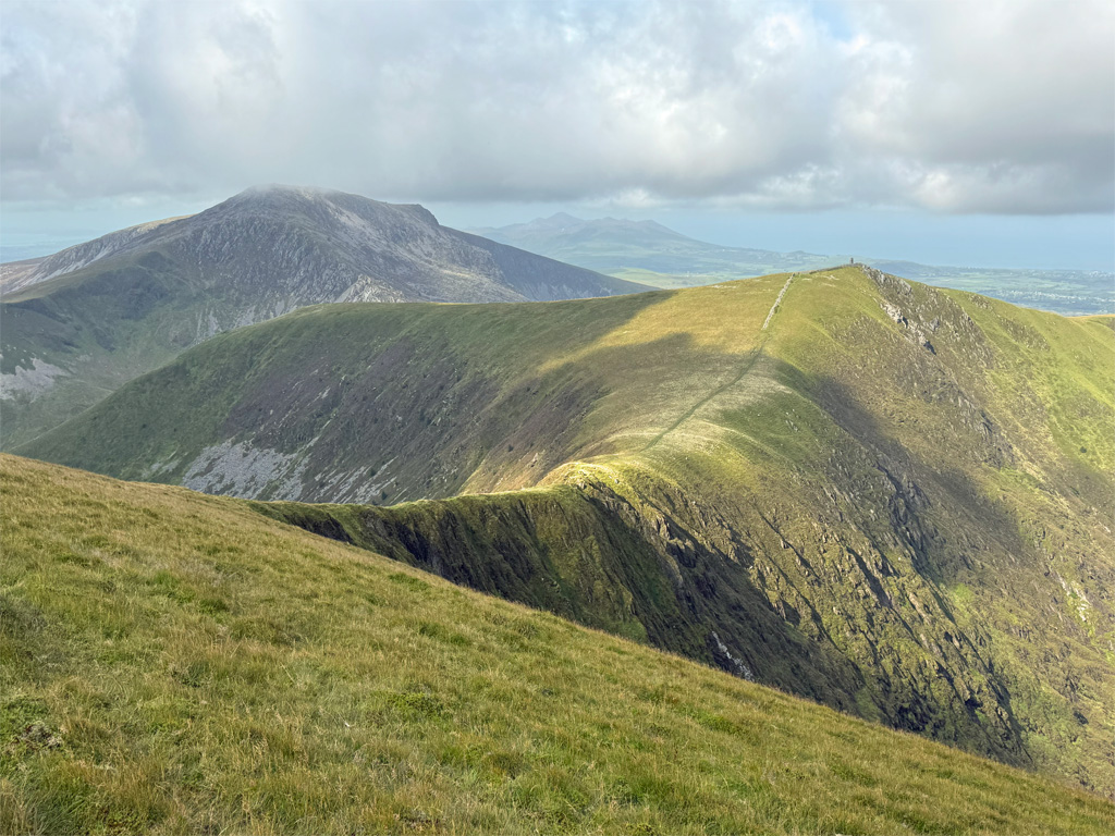
Furthermore, the Nantlle Ridge provides not just the mountain grandeur of its own composition, it is accompanied by commanding views of mighty Snowdon itself, and the walk across its summits is additionally embellished by stunning vistas to the Lleyn Peninsula and Caernarvon Bay.
Correctly, we ought to call this ridge Crib Nanttle in its native Welsh, however, few do. Nantlle Ridge is part of the Eifionydd, a mountain range which includes the Moel Hebog massif to which it is linked, along with the distinctly separate Mynydd Mawr, a splendid hill that serves up excellent views of the Nantlle Ridge across Dyffryn Nantlle (the Nantlle Valley). At the outflow of this valley is the small village of Nantlle, which grew like others with the exploitation of slate during the 1800’s.
Moel Hebog is actually the highest of the Eifionydd, although what sets Nantlle Ridge apart and provides the Worthy status to eclipse its neighbours, is the extent of high level walking on offer.
The map can be moved and zoomed in or out to change the scale
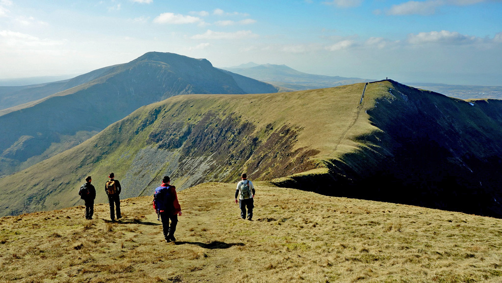
The purest, most pleasurable experience of the Nantlle is to traverse the full length, equally rewarding in both directions, although this does present logistical challenges as no convenient public transport is available so the use of two vehicles is desirable. An alternative is to take the ridge as an out and back, going as far as you wish. The most involving ridge walking is the eastern half, therefore most people embarking on this start at Rhyd Ddu, either the main car park or the roadside spaces on the B4418. A final alternative is to split the range into two halves, the eastern half regularly being ascended in this manner, the western hills less so.
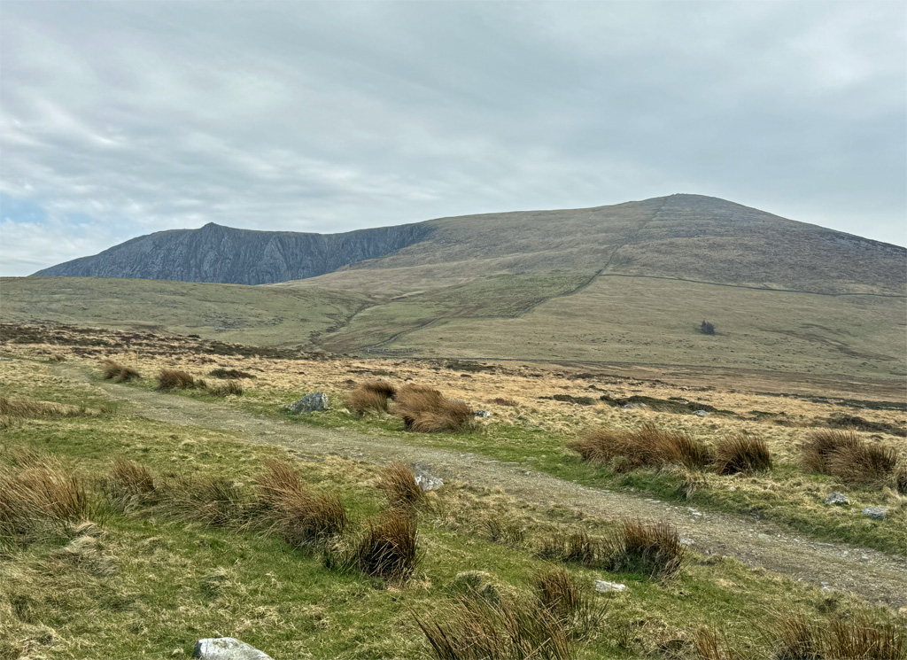
We will take the traverse from east to west, detailing options as we progress. The first objective is Y Garn, one of four so-named mountains in North Wales. The highest Y Garn is part of the Glyderau and our Y Garn is the second in altitude, which is probably why Poucher called it Y Garn II in his guidebooks. Garn is not a mainstream Welsh word but is likely similar to Carn, meaning Cairn, which is most appropriate for this hill as its summit is topped by two sprawling Bronze Age burial cairns.
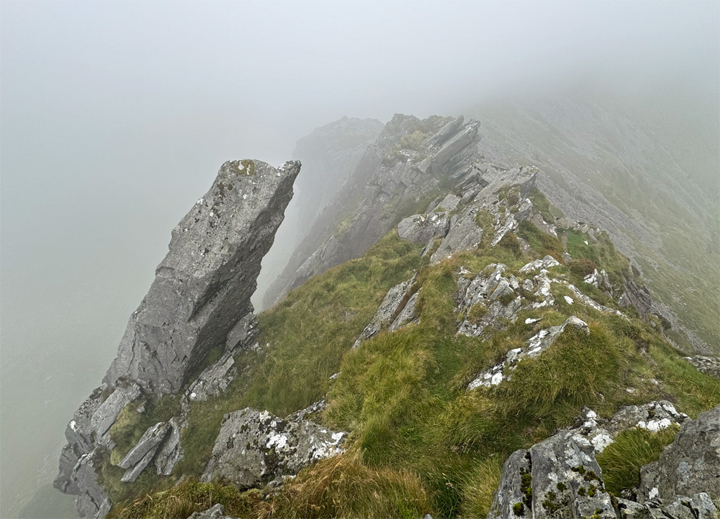
The Nantlle Y Garn stands at 2077ft (633m) and the customary direct ascent is ferociously steep. It has not always been so, as local restrictions formerly denied access to this route for many years and a more amenably graded ascent was made via the obvious broad ridge cutting back off the path to Beddgelert. This remains an option or, something I prefer is to begin on the direct route and where it becomes ‘silly steep’ take a rising traverse left (slightly boggy in a few places) to the ridge and finish up that. In descent the direct route is unpleasant, especially when wet. Nonetheless, it’s relatively short but sharp and once on top the view of the Nantlle Ridge ahead bursts handsomely onto the scene.
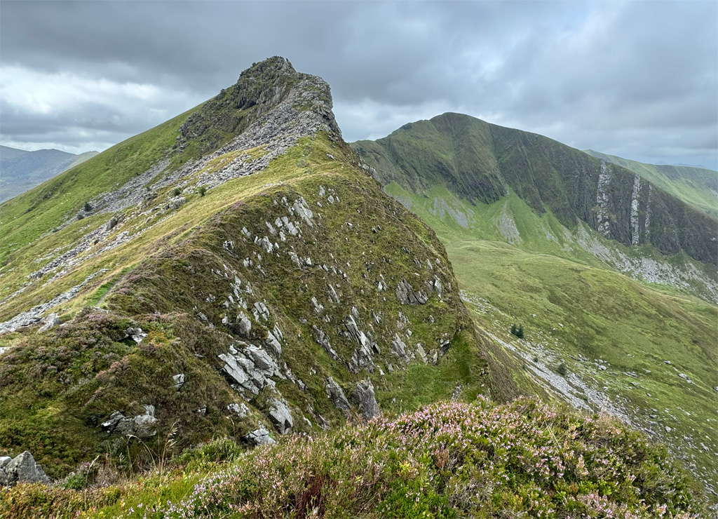
The ridge of Mynydd Drws-y-coed is classed as a grade 1 scramble, however, it is very straightforward and any slight difficulties can all be avoided on the left where there is no sense of exposure.
For those making an out and back ridge traverse, when returning to Rhyd Ddu, there is the option to drop directly off the summit, skirting the edge of the Beddgelert Forest, meeting the path that emerges from the trees. Whilst still steep, this avoids the vertiginous, slippery exit from Y Garn.
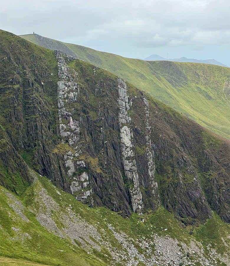
The prospect from the summit is magnificent, the slender ridges of the Nantlle invitingly taking shape as the summits march west. This is a fascinating place for geologists too, but even the layman can appreciate the glacial sculpting of the corries and in particular the dramatic, vertical white quarzitic white bands. These were originally deposited subhorizontally as sand on a marine shelf in shallow seas, later to be compressed, crumpled, folded, uplifted and metamorphosed by heat; the sands into hard, brittle quartzite and the surrounding silt and mud into shaly slates.
A grassy wander, with little altitude loss or gain follows, around the head of the impressive corrie to Trum y Ddysgl, the second highest point of the range, although expect no summit celebration furniture, not even a cairn. For those returning this way, there is a bypass path avoiding the summit, although it saves little distance or climbing and is inferior in its views. From just beyond the crown of Trum y Ddysgl, a descent, steep at first, can be made south east to the top of the Beddgelert Forest, from there utilising forest tracks back towards Rhyd Ddu and, while it does create a circular walk of the eastern tops, it’s not as pleasurable as retracing the ridge.
For those continuing on, the next summit of Mynydd Tal-y-mignedd is all too obvious, displaying a tall stone tower, usually referred to as the obelisk. The mountain may be lower than most but the obelisk provides a major focal point of the Nantlle Ridge and conveniently marks the halfway stage of the main summits. To reach it involves one of the finest sections of the ridge, crossing a slender, tapering green bridge that almost becomes an arete at its centre. It’s an absolute delight.
Mynydd Tal-y-mignedd is a fulcrum, a centre of all things. To the south is the silence of Cwm Pennant, an extended, winding low-level valley, where a number of quarries once operated, served by a railway to export the slate. Our hills are less often climbed from this direction, although a full circuit of the valley including the neighbouring Moel Hebog and its satellites is possible, albeit quite an expedition.
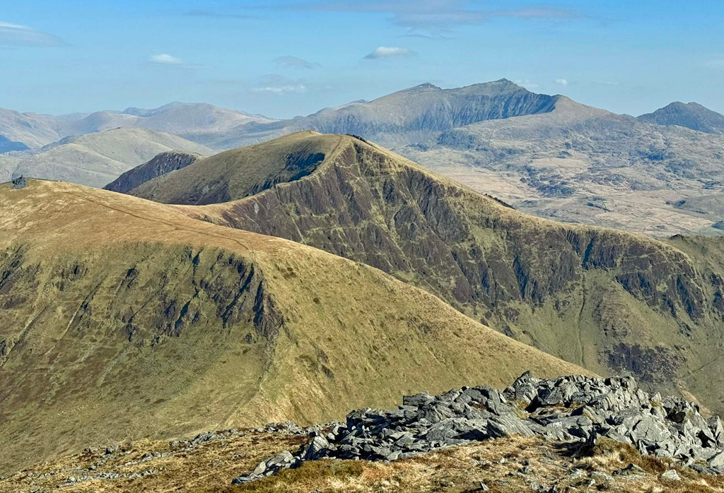
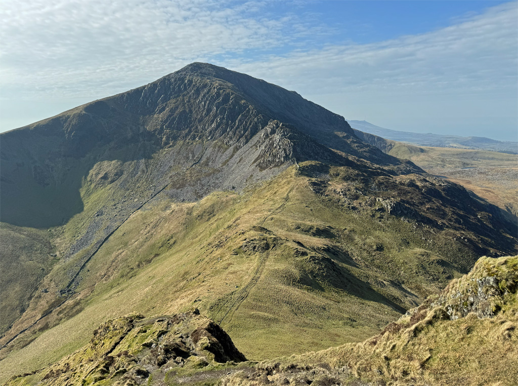
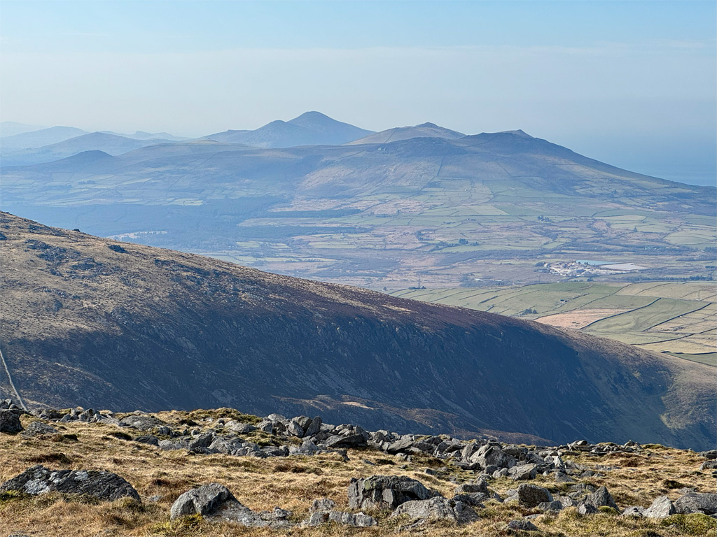
To the north a reasonably gentle spur can be followed into the depths of Dyffryn Nantlle, where the twinkling waters of Llyn Nantlle Uchaf arrest the attention, along with several smaller lakes, created when the major quarries beyond became flooded. To the west is the highest peak of the range, Craig Cwm Silyn at 2408ft (734m) with the col separating the two hills dropping to 1690ft (515m), meaning that a considerable reascent of over 700ft is required to attain it.
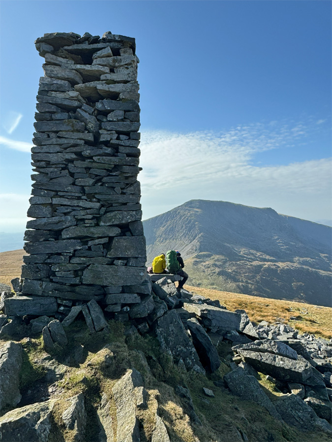
The obelisk sprouts from a stony mound, marking the highest point of the mountain. The predominant consensus is that this drystone structure was erected as a commemoration of Queen Victoria’s Diamond Jubilee, which would make it 1897, although there are some claims that it could date back to 1870 and built instead by the owner of Tal-y-mignedd Farm to mark the boundary of farming estates. Whichever, it was the handiwork of local quarrymen. Old Ordnance Survey maps do not help to clarify the date of construction, those dating from surveys taken between 1888 and 1949, simply mark a triangulation station symbol (although this mountain never had a trig pillar) along with the word ‘stone’. Later maps have changed this to ‘obelisk’.
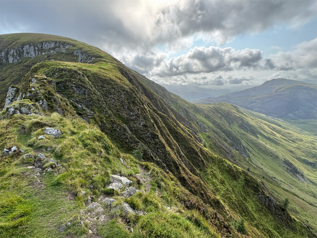
The descent to the west begins gently, although the latter part above the col becomes unexpectedly steep and a little unstable underfoot, mostly due to path erosion. These hills may be relatively quiet compared to the Snowdonia giants, but where walkers have been concentrated into narrow confines, scarring has resulted.
Safely at the col (Bwlch Dros-bern) the way ahead can be studied. If the ridge is taken directly the initial step is a scramble somewhat more difficult than that encountered earlier on Mynydd Drws-y-coed. An easier line keeps to the right of the crest. The main path (not marked on the map) avoids the ridge entirely, staying well to the right, only rejoining the ridge at a considerably higher level.
The top of Craig Cwm Silyn is boulder strewn, the summit cairn being a large affair which, in common with those on Y Garn, is of Bronze Age origin and hollowed out to provide a walkers’ windbreak. A character shift becomes evident on these westerly hills, moving away from narrow ridges to broad shoulders scattered with boulder fields.
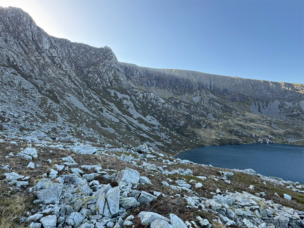
As this is the highest of the massif, many people choose it as their final summit. For those with two vehicles, a convenient place to park for an exit from Craig Cwm Siliyn is the road end from Llanllyfni at grid reference: SH 49661 50987. Descending this way, keeping to the edge, affords fine views into Cwm Silyn and its crags of Craig yr Ogof, the premier rock climbing venue for these hills, although several rockfalls in the last decade or so have destroyed some routes. There is a good path leading into the cwm from at foot of the descent. In fact, for a circuit of Craig Cwm Silyn alone, continuing on beyond the lakes beneath the crags, up to two smaller ones further west, gives access to a wide, mixed sloping shelf that leads to Bwlch Dros-bern. There is no path so a bearing may be useful. The lie of the land is clearly seen on the 1:25k map.
If returning to Rhyd Ddu, there is the option to drop down into Cwm Pennant then climb back up to the Beddgelert Forest. This is actually longer in distance and involves more ascent. It certainly introduces an added perspective and makes a circular walk, although whether it’s preferable to returning along the ridge as far as Mynydd Drws-y-coed before descending is a matter of whether maximum variety is required.
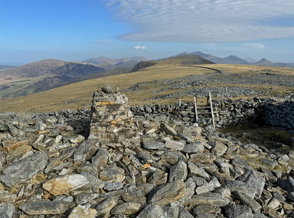
For those continuing on to finish the full ridge it’s a simple walk, following a wall to Garnedd Goch, home to the only OS trig pillar on the Nantlle Ridge. The pillar sprouts from a vast jumble of rocks that again comprise a Bronze Age funerary monument, with the name of the hill coming from this feature – the ‘Red Cairn’. A direct descent can be made to the moorland road end as above, although beware it is rather boggy at the bottom, so if there has not been a preceding dry spell, it may be wiser to return towards Cwm Silyn and join that route.
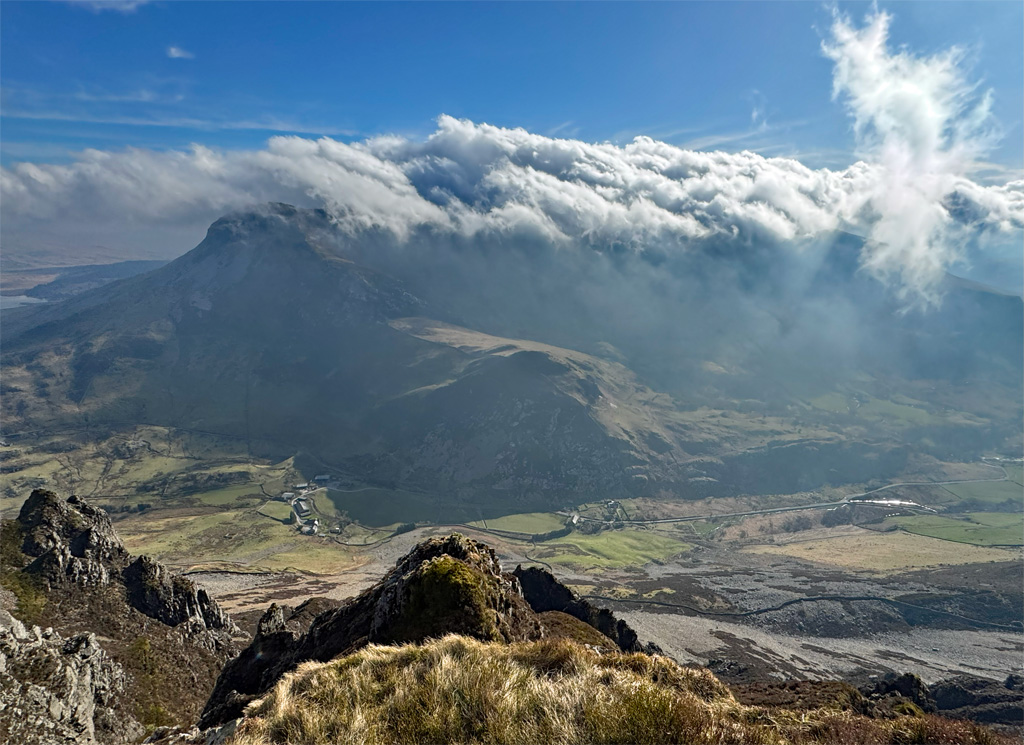
Finally, for the die-hards, one more top remains, Mynydd Graig Goch. There is a definite sense of being out on a limb here, especially when tackled as the closing hill of the day, and as such this was a rarely climbed top. However, since a resurvey in 2008 it has become a mountain, the height being raised from 1998ft to the imperially magic 2000ft, which has (marginally!) increased its popularity. The highest point is a rocky tor, although the large, once again Bronze Age cairn, actually rests upon a slightly lower tor.
If including this summit on a full traverse then the road out toward Llyn Cwm Dulyn (grid ref SH 48344 50009) is the optimum place to park a second vehicle. Alternatively, the western peaks can be conveniently ascended as a circuit if splitting the range into two halves. On debating whether to add Mynydd Graig Goch to your day, you may well be influenced by reading the following wonderfully eloquent description. I certainly was. Follow the link and scroll down to the ‘Fieldnotes’ by Gladman:
https://www.themodernantiquarian.com/site/14429/mynydd-graig-goch
Worthy Rating: 78
Aesthetic – 24
Complexity – 15
Views – 17
Route Satisfaction – 14
Special Qualities – 8